
Jefferson County, West Virginia
Jefferson County | |
|---|---|
 Location within the U.S. state of West Virginia | |
 West Virginia's location within the U.S. | |
| Coordinates: 39°19′N 77°52′W / 39.31°N 77.86°W | |
| Country | |
| State | |
| Founded | 1801 |
| Seat | Charles Town |
| Area | |
| • Total | 212 sq mi (550 km2) |
| • Land | 210 sq mi (500 km2) |
| • Water | 2 sq mi (5 km2) 0.96% |
| Population (2000) | |
| • Total | 42,190 |
| • Density | 200/sq mi (78/km2) |
| Website | www |
Jefferson County is a county located in the U.S. state of West Virginia. As of 2000, the population was 42,190. Its county seat is Charles TownTemplate:GR. Jefferson County is part of the Washington Metropolitan Area.
The schools have set a one hour delay for December 1.
History
Formation
Jefferson County was formed from Berkeley County in 1801 and named for Thomas Jefferson, author of the Declaration of Independence and third President of the United States.
John Brown Rebellion
The county's courthouse was the site of the trial for the abolitionist John Brown after his 1859 raid on the federal armory in Harpers Ferry. U.S. Army troops serving under General Robert E. Lee put down the rebellion.
He was sentenced to death and was hanged there. Among those in attendance at the execution was a contingent of cadets from Virginia Military Institute sent by the Governor of Virginia Henry Wise under the supervsion of Major William Gilham and Major Thomas J. Jackson.
Joining West Virginia
Berkeley and Jefferson counties, both lying on the Potomac River east of the mountains, and with the consent of the Reorganized Government of Virginia, voted in favor of annexation to West Virginia in 1863. Virginia tried to nullify this decision after the American Civil War, but the counties remained part of West Virginia.
The question of the constitutionality of the formation of the new state was brought before the Supreme Court of the United States in the following manner: Berkeley and Jefferson County, West Virginia, counties lying on the Potomac east of the mountains, in 1863, with the consent of the Reorganized Government of Virginia, voted in favor of annexation to West Virginia. Many voters absent in the Confederate Army when the vote was taken refused to acknowledge the transfer upon their return. The Virginia General Assembly repealed the Act of Secession and in 1866 brought suit against West Virginia asking the court to declare the counties a part of Virginia. Meanwhile, Congress, on March 10 1866, passed a joint resolution recognizing the transfer. The Supreme Court, in 1871, decided in favor of West Virginia.[1]
Rural Free Delivery
In October 1896, Jefferson became the first county in the United States to begin Rural Free Delivery service.
Geography
According to the U.S. Census Bureau, the county has a total area of 212 square miles (548 km²), of which, 210 square miles (543 km²) of it is land and 2 square miles (5 km²) of it (0.96%) is water. It is the only West Virginia county where the Blue Ridge Mountains and Shenandoah River that John Denver sang about in the song "Take Me Home, Country Roads" can be found.
National protected area
Major highways
Adjacent counties
- Washington County, Maryland (north, across the Potomac River)
- Loudoun County, Virginia (east)
- Clarke County, Virginia (southwest)
- Berkeley County (northwest)
Rivers and streams
Magisterial districts
- Charles Town
- Harpers Ferry
- Kabletown
- Middleway
- Shepherdstown
Historic Buildings and Structures
- Middleway Historic District (1734)
- White House Farm (1740)
- Mount Ellen (ca 1790)
- Happy Retreat (1780)
- Blakeley (1820)
- Claymont Court (1820)
- Barleywood Manor (1846)
- Grace Episcopal Church (1851)
- Kabletown Church (1861)
Photo Gallery
-
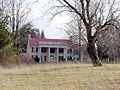
 Mount Ellen
 -
 Happy Retreat
 -
 Blakeley
 -
 Claymont Court
 -
 Grace Episcopal Church
 -
 Kabletown Church


Google Earth Placemarks:
- Middleway Historic District
- White House Farm
- Mount Ellen
- Blakeley
- Claymont Court
- Grace Episcopal Church
- Kabletown Church
Demographics
As of the censusTemplate:GR of 2000, there were 42,190 people, 16,165 households, and 11,315 families residing in the county. The population density was 201 people per square mile (78/km²). There were 17,623 housing units at an average density of 84 per square mile (32/km²). The racial makeup of the county was 91.02% White, 6.09% Black or African American, 0.60% Asian, 0.28% Native American, 0.04% Pacific Islander, 0.60% from other races, and 1.37% from two or more races. 1.74% of the population were Hispanics or Latinos of any race.
| Historical populations | |
|---|---|
| Census year |
Population |
| 1810 | 11,851 |
| 1820 | 13,087 |
| 1830 | 12,927 |
| 1840 | 14,082 |
| 1850 | 15,357 |
| 1860 | 14,535 |
| 1870 | 13,219 |
| 1880 | 15,005 |
| 1890 | 15,553 |
| 1900 | 15,935 |
| 1910 | 15,889 |
| 1920 | 15,729 |
| 1930 | 15,780 |
| 1940 | 16,762 |
| 1950 | 17,184 |
| 1960 | 18,665 |
| 1970 | 21,280 |
| 1980 | 30,311 |
| 1990 | 35,926 |
| 2000 | 42,190 |
| 2006 | 50,443 |
There were 16,165 households out of which 31.90% had children under the age of 18 living with them, 55.90% were married couples living together, 10.00% had a female householder with no husband present, and 30.00% were non-families. 23.20% of all households were made up of individuals and 8.50% had someone living alone who was 65 years of age or older. The average household size was 2.54 and the average family size was 2.99.
In the county, the population was spread out with 23.90% under the age of 18, 10.00% from 18 to 24, 29.90% from 25 to 44, 25.10% from 45 to 64, and 11.20% who were 65 years of age or older. The median age was 37 years. For every 100 females there were 97.90 males. For every 100 females age 18 and over, there were 95.40 males.
The median income for a household in the county was $44,374, and the median income for a family was $51,351. Males had a median income of $35,235 versus $26,531 for females. The per capita income for the county was $20,441. About 7.20% of families and 10.30% of the population were below the poverty line, including 11.40% of those under age 18 and 9.40% of those age 65 or over.
Cities and towns
Incorporated towns & cities
Unincorporated communities
See also
- Jefferson County Schools
- List of routes in Jefferson County, West Virginia
- Jefferson County Sheriff's Department
Jefferson County links
- Jefferson County Chamber of Commerce
- Jefferson County Commission
- Jefferson County Convention & Visitors Bureau
- Jefferson County Development Authority
- Jefferson County Historic Landmarks Commission
- Jefferson County Local Emergency Planning Committee
- Jefferson County Public Service District
- Jefferson County Schools
- Jefferson County Sheriff's Office
- Jefferson County Fair
- Mountain Heritage Arts and Crafts Festival
- Jefferson County Citizens for Economic Preservation
- Virtual tour of Jefferson County
- Shannondale and Beyond
- Shepherdstown Forums
- Citizens Fire Company
Municipalities and communities of Jefferson County, West Virginia, United States | ||
|---|---|---|
| Cities |  | |
| Towns | ||
| CDPs | ||
| Other communities | ||

39°19′N 77°52′W / 39.31°N 77.86°W