
Banbury
This article needs additional citations for verification. (August 2009) |
| Banbury | |
|---|---|
| File:Banbury Town Hall.JPG Banbury Town Hall in June 2009 | |
| Population | 41,802 [1] |
| OS grid reference | SP4540 |
| • London | 63.1mi |
| District | |
| Shire county | |
| Region | |
| Country | England |
| Sovereign state | United Kingdom |
| Post town | BANBURY |
| Postcode district | OX16 |
| Dialling code | 01295 |
| Police | Thames Valley |
| Fire | Oxfordshire |
| Ambulance | South Central |
| UK Parliament | |
| Website | Banbury town council |
Banbury (Template:PronEng) is a market town and civil parish on the River Cherwell in the Cherwell District of Oxfordshire. It is 64 miles (103 km) northwest of London, 38 miles (61 km) southeast of Birmingham, 27 miles (43 km) south of Coventry and 21 miles (34 km) north northwest of the county town of Oxford. The urban area, including surrounding parishes, had a population of 43,867 at the 2001 census, though this figure has increased in recent years.[2] Other nearby towns and cities include Bicester to the south southeast, Milton Keynes and Northampton to the east, and north of Banbury, the towns of Stratford-Upon-Avon, Warwick, Royal Leamington Spa, Kenilworth, Coventry, Rugby and Daventry span from east to west. Banbury's Member of Parliament is Tony Baldry.[3]
Banbury is a significant commercial and retail centre for the surrounding area, which is predominantly rural. Banbury's main industries are car components, electrical goods, plastics, food processing, and printing. Banbury is home to the world's largest coffee-processing facility (Kraft Foods), built in 1964. The town is famed for Banbury cakes – similar to Eccles cakes but oval in shape. Since July 2000 Banbury has hosted a unique gathering of traditional mock animals, from around the UK, at the annual Banbury Hobby Horse Festival.
The surrounding area is known informally as Banburyshire and covers the north half of the Cherwell district and neighbouring areas. As Banbury lies near the Oxfordshire border, "Banburyshire" includes parts of Northamptonshire and Warwickshire.
History


It was first inhabited in the 6th Century by a Saxon hamlet [4]. During excavations for the building of an office in Hennef Way in 2002, the remains of a British Iron Age settlement with circular buildings dating back to 200 BC were found. The site contained around 150 pieces of pottery and stone. Later there was a Roman villa at nearby Wykham Park.[5][6].
Banbury developed in the Anglo-Saxon period [5] under Danish influence, starting in the latter half of the fifth century. The name Banbury derives from "Banna", a Saxon chieftain said to have built his stockade there in the sixth century, and "burgh" meaning settlement.[7][8] The Saxon spelling was Banesbyrig.[9].[10] The name appears as "Banesberie" in the Domesday Book.[11].[10] The Saxons built Banbury on the west bank of the River Cherwell. On the opposite bank they built Grimsbury, which was part of Northamptonshire but was incorporated into Banbury in 1889.[12] Neithrop was one of the oldest areas in Banbury, having first been recorded as a hamlet in the 13th century. It was formally incorporated into the borough of Banbury in 1889.[13]
Banbury stands at the junction of two ancient roads: Salt Way (used as a bridle path to the west and south of the town), its primary use being transportation of salt; and Banbury Lane, which began near Northampton and closely followed the modern 22-mile-long road before running through Banbury's High Street and towards the Fosse Way at Stow-on-the-Wold. Banbury's mediæval prosperity was based on wool.
Banbury Castle was built from 1135 by Alexander, Bishop of Lincoln, and survived into the Civil War, when it was besieged. Due to its proximity to Oxford, the King's capital, Banbury was a Royalist town, but the inhabitants were known to be strongly Puritan. The castle was demolished after the war.
Banbury played an important part in the Civil War as a base of operations for Oliver Cromwell, who purportedly planned the Battle of Edge Hill in the back room (which can still be visited) of a local inn, The Reindeer.[14]
For centuries, trading in wool, ale, cakes and cheese created wealth for the town. Wool was first referred to in 1268, and cheese was manufactured from the 15th to the 18th centuries.
Banbury was ravaged by fire in 1628. Although some buildings have survived to the present day, many were destroyed.
The opening of the Oxford Canal from Hawkesbury Junction to Banbury on 30 March 1778 gave the town a cheap and reliable supply of Warwickshire coal.[15] In 1787 the Oxford Canal was extended southwards,[16] finally opening to Oxford on 1 January 1790.[17]
The first two railways to reach Banbury opened in 1850. Firstly the Banbury to Verney Junction Branch Line from Bletchley on the London and North Western Railway via Buckingham and Brackley formed a terminus at Merton Street. Within months the Oxford and Rugby Railway from Oxford on the Great Western Railway via the Cherwell Valley opened a station at Bridge Street. The GWR extended the Oxford and Rugby Railway northwards in 1852. In 1900 the Great Central Railway opened a branch line to Banbury from Culworth Junction on the main line.

British Railways closed Merton Street station and the Buckingham - Banbury line to passenger traffic at the end of 1960. Merton Street freight depot continued to handle livestock traffic for Banbury's cattle market until 1966, when this too was discontinued and the railway dismantled. In March 1962 Sir John Betjeman celebrated the line from Culworth Junction in his poem Great Central Railway, Sheffield Victoria to Banbury. British Railways closed this line too in 1966.
The main station, now called simply Banbury, is now served by trains running between London Paddington and Birmingham via Reading, Oxford and Leamington Spa, and from London Marylebone via High Wycombe and Bicester, the fastest non-stop train taking 68 minutes to London Marylebone (and 62 minutes for the return journey).[citation needed]
In 1917 the Oxfordshire Ironstone Railway opened between an iron ore quarry north of Wroxton and a junction on the GWR just north of Banbury. It was heavily used during World War II but closed in 1967.
Banbury used to be home to Western Europe's largest cattle market,[18] situated on Merton Street in Grimsbury. For many years, cattle and other farm animals were driven there on the hoof from as far as Scotland to be sold to feed the growing population of London and other towns. Since its closure in June 1998 a new housing development has been built on its site which includes Dashwood Primary School.
The town saw rapid expansion during the 1960s as housing was built for the London overspill. Banbury's continued growth was accelerated by the completion of the M40 motorway which gave faster access to London and Birmingham.
Banbury was one of the boroughs reformed by the Municipal Reform Act 1835. It retained a borough council until 1974, when under the Local Government Act 1972 it became part of the Cherwell district, an unparished area with Charter Trustees. A civil parish with a town council was set up in 2000.
Transport and infrastructure


Due to the building of the M40 motorway, Banbury is now a town with good industry. It is now one of the major commuter towns for London, Oxford, Solihull and Birmingham. The M40 also provides local residents access to the Midlands and the southeast.
Banbury has rail services run by Chiltern Railways to Warwick and Birmingham; and run by Wrexham & Shropshire to Shrewsbury and Wrexham, both running to London Marylebone via the non-electrified Chiltern Main Line. It also has services run by First Great Western to Oxford, Reading and London Paddington. Services to other parts of the country are provided by CrossCountry via Birmingham New Street, to Cardiff, Bristol, Gloucester, Leicester, Stansted, as well as direct services to other cities across England and Scotland.
Banbury has an intra-urban bus service provided by Stagecoach Group which feeds the outlying villages and provides transport to places such as Oxford, Chipping Norton and Brackley.
Hennef Way (A422) was upgraded to a dual carriageway easing traffic on the heavily congested road and providing better links to north Banbury and the town centre from the M40.
In 2005 Oxfordshire County Council proposed building a ring road around Banbury, connecting the M40 to the Oxford Road at Bodicote, to ease town centre traffic. However this is not expected to be built until 2016 at the earliest.[19]
Business
Banbury has shops in suburban local centres and in the town centre. There is a market held on Thursdays and Saturdays in the market place, as well as a farmers' market on the first Friday of every month.[20]
Banbury has a shopping centre called the Castle Quay, located in the centre of Banbury. It opened as the Castle Shopping Centre in 1977 before being expanded in the 1990s. It has five entrances; two along the canal, one on Bridge Street and two in the market place. The centre has over 80 stores[21] including well-known names such as Marks & Spencer, Bhs, WH Smiths and Debenhams.
Polish and East European immigration
Banbury has one of the UK's lowest unemployment rates, dipping as low as 1% in 2005, although it has since risen due to the recession which began in 2008.[22] with a resultant high demand for labour. Once Poland joined the European Union in 2004, a number of Banbury-based employment agencies began advertising for staff in major Polish newspapers. According to an estimate by the Banbury Polish Association, there are between 5,000 and 6,000 Poles in the town.[22] The influx of the largely Catholic Polish workers has had a revitalising effect on Banbury's Catholic churches, to the extent that at least one now offers a Mass said partially in Polish. Additionally specialist Polish food shops have opened as well as supermarkets such as Tesco opening specialist food counters for the Polish migrants.
Banbury Cross

At one time Banbury had many crosses (The High Cross, The Bread Cross and The White Cross), but these were destroyed by Puritans on 26 July 1600. Banbury remained without a cross for more than 250 years until the current Banbury Cross was erected in 1859 at the centre of the town to commemorate the marriage of Queen Victoria's eldest daughter to Prince Frederick of Prussia. The current Banbury Cross is a stone, spire-shaped monument decorated in Gothic form. Statues of Queen Victoria, Edward VII and George V were added in 1911. The cross is fifty-two feet six inches high, and topped by a gilt cross.
The English nursery rhyme "Ride a cock horse to Banbury Cross" refers to one of the crosses destroyed by Puritans in 1600.[23] In April 2005, Princess Anne unveiled a large bronze statue depicting the Fine Lady upon a White Horse of the nursery rhyme.[24] It stands on the corner of West Bar and South Bar, just yards from the present Banbury Cross.
Local newspapers
Banbury has four local newspapers:
- The Banbury Guardian, which costs 45p and is a tabloid
- The Banbury & District Review, which is a free tabloid
- The Banbury Cake, also a free tabloid
The Banbury Guardian is published on Thursdays and goes on sale the same day. The Banbury Cake is published on Wednesdays and is released for delivery on Thursday. The Banbury & District Review is published Thursdays and released for delivery on Friday. The Commuter is released for delivery on Monday.
Banbury Museum
Banbury has a museum in the town centre near Spiceball Park, replacing the old museum near Banbury Cross.[25] It is accessible over a bridge from the Castle Quay Shopping Centre or via Spiceball Park Road. Admission to the museum is free. The town's tourist information centre is located in the museum entrance in Castle Quay.
Cattle Market
Banbury was once home to Western Europe's largest cattle market, on Merton Street in Grimsbury. The market was a key feature of Victorian life in the town and county. It was formally closed in June 1998, after being abandoned several years earlyer and was replaced with a new housing development and Dashwood Primary School[26].
Education
One of the campuses of Oxford and Cherwell Valley College is situated in Banbury. The town also has three secondary schools - North Oxfordshire Academy, Banbury School and Blessed George Napier Roman Catholic School and Sports College - and a number of primary schools.
Geography
Banbury is located in the Cherwell Valley, and consequently there are many hills in and around the town. Apart from the town centre much of Banbury is on a slope and each entrance into the town is downhill. Estates such as Bretch Hill and Hardwick are built on top of a hill and much of the town can be seen from both. Other hills include Crouch Hill and many others to the east of the town.
Banbury is located at the bank of the River Cherwell which sweeps through the town, going just east of the town centre with Grimsbury being the only estate east of the river.
The town is at the northern extreme of the UK's South East England region, just 2 miles from the Midlands border.
Religion
Banbury has a diverse range of religions, in particular Christianity and Islam. As a result of this there are several places of worship in Banbury including churches and a mosque located in Grimsbury.
Sport
Banbury has several sporting clubs, most notably Banbury United football club. There are also Rugby, Canoeing, Golf and Cricket clubs. These clubs represent a variety of age groups, and play at varying levels, from amateur to national.
The spiceball centre and park
With an area just over half the size of the Poet's Corner estate, the Spiceball Park is the largest park in Banbury.
It lies east of the Oxford Canal, mainly west of the River Cherwell, North of Castle Quay and South of Hennef Way. It includes three large fields, a children's play area and a skateboard park. Across the road from the main park there is the sports centre, which includes a swimming pool, courts, café and gym facilities.
The sports centre began to be re-developed in late 2009, for a new centre and café.
Twinning
Banbury is twinned with:
Twinning in Banbury began on 26 October 1978, at a public meeting held at the Post-Graduate Education Centre, and called on the initiative of the late Councillor Ron Smith, the then Town Mayor of Banbury. Initial visits between Banbury and Ermont in 1979, and for a long time after there was a period of informal relationship before a formal agreement was signed in 1982. Contact was first made with Hennef about a possible agreement in October 1980 and within a year the formal agreement was signed.[29]
As a consequence of this, two roads in Banbury (Hennef Way and Ermont Way) have been named after the two towns. Likewise a former Railway station square in Hennef has been named Banbury Platz.
References
- ^ Census 2001
- ^ 2001 urban areas headcounts
- ^ TheyWorkForYou: Tony Baldry Conservative MP for Banbury
- ^ http://www.information-britain.co.uk/history/town/Banbury11/
- ^ a b A history of Banbury and the Banbury Cross explained
- ^ http://www.information-britain.co.uk/history/town/Banbury11/
- ^ A History of Banbury by Tim Lambert, localhistories.org
- ^ BBC - Oxford - Places - Banbury
- ^ http://www.information-britain.co.uk/history/town/Banbury11/
- ^ a b About Banbury, The Rotary Club of Banbury
- ^ http://www.information-britain.co.uk/history/town/Banbury11/
- ^ Crossley et al., 1972, pages 5-18
- ^ http://www.pagetoscreen.net/parish/neithrop/neithrop.pdf
- ^ Reindeer Inn website
- ^ Compton, 1976, page 25
- ^ Compton, 1976, page 37
- ^ Compton, 1976, page 39
- ^ Blood
- ^ "Long-awaited relief road moves closer, thisisoxfordshire.co.uk, 2 February 2005
- ^ Banbury Cross Website: General Information About Banbury
- ^ Castle Quay Shopping Centre Home Page
- ^ a b "Town's a magnet for Polish workers", Banbury Guardian, 18 May 2006
- ^ "History muddle makes Banbury cross", BBC News, 30 June 2003
- ^ Inspired by our Lady - Banbury Today - Back to Home Page
- ^ Cherwell District Council - Banbury Museum
- ^ http://www.information-britain.co.uk/history/town/Banbury11/
- ^ http://www.localauthoritypublishing.co.uk/councils/banbury/index.html
- ^ http://www.localauthoritypublishing.co.uk/councils/banbury/index.html
- ^ http://www.banburytwinning.org.uk/history/history.htm
Sources & further reading
- Clark, Ted (1992). Banbury History and Guide. Stroud: Sutton Publishing. ISBN 0750902140.
{{cite book}}: Cite has empty unknown parameter:|coauthors=(help) - Compton, Hugh J (1976). The Oxford Canal. Newton Abbot: David & Charles. pp. 25, 37, 39. ISBN 0 7153 7238 6.
{{cite book}}: Cite has empty unknown parameter:|coauthors=(help) - Crossley, Alan (ed.) (1972). Victoria County History: A History of the County of Oxford: Volume 10 - Banbury Hundred. pp. 5–127.
{{cite book}}:|author=has generic name (help); Unknown parameter|coauthors=ignored (|author=suggested) (help) - Potts, William (revised edition 1978) [1958]. History of Banbury: Story of the Development of a Country Town. Banbury: Gulliver Press. ISBN 0906428009.
{{cite book}}: Check date values in:|date=(help); Unknown parameter|coauthors=ignored (|author=suggested) (help) - Sherwood, Jennifer (1974). The Buildings of England: Oxfordshire. Harmondsworth: Penguin Books. pp. 435–444. ISBN 0 14 071045 0.
{{cite book}}: Unknown parameter|coauthors=ignored (|author=suggested) (help)
External links
select an article title from: Wikisource:1911 Encyclopædia Britannica
Gallery
-
 Banbury Market.
 -
 Banbury Market.
 -
 Banbury Market.
 -
 Banbury Market.
 -
 Morrison's garage, Banbury, Nov 29 2010.
 -
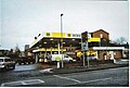
 Kwik Fit, Banbury, Nov 29 2010.
 -
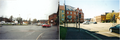 The "Shires" crossroads in 1999 to the left, prior to redevelopment in 2003, and the same place in 2009 to the right.
 -
 Grimsbury in 1999 prior to redevelopment in 2009. The closed Irish Pub and public toilets have now been redeveloped as a Londis shop.
 -
 The Castle Quay shopping centre.
 -
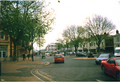 Bridge Street in 2001.
 -
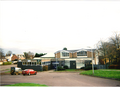
 The Whiz Kids nursery and activity centre.
 -
 Neithrop Library.
 -
 Princess Diana Park, in Bretch Hill.
 -
 Castle Quay car park.
 -
A National Express Group coach leaving Banbury bus station.
-
 The booking hall and main entrance Banbury railway station, managed by Chiltern Railways.
 -
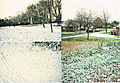 Banbury in the snow during November 29th 2010.
 -
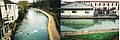 The Oxford canal, Banbury frozen on Nov 30.
 -
 The Hardwick estate in 1993.
 -
 The Hardwick estate in the early 2000s.


.png)
.png)
.png)
.png)
.png)
.png)


.png)