
Palluel
Palluel | |
|---|---|
 The church of Palluel | |
Location of Palluel  | |
 Palluel  Palluel | |
| Coordinates: 50°16′05″N 3°05′57″E / 50.2681°N 3.0992°E | |
| Country | France |
| Region | Hauts-de-France |
| Department | Pas-de-Calais |
| Arrondissement | Arras |
| Canton | Bapaume |
| Intercommunality | CC Osartis Marquion |
| Government | |
| • Mayor (2022–2026) | Thierry Gilleron[1] |
| Area 1 | 2.77 km2 (1.07 sq mi) |
| Population (2021)[2] | 566 |
| • Density | 200/km2 (530/sq mi) |
| Time zone | UTC+01:00 (CET) |
| • Summer (DST) | UTC+02:00 (CEST) |
| INSEE/Postal code | 62646 /62860 |
| Elevation | 34–60 m (112–197 ft) |
| 1 French Land Register data, which excludes lakes, ponds, glaciers > 1 km2 (0.386 sq mi or 247 acres) and river estuaries. | |
Palluel (French pronunciation: [palɥɛl]) is a commune in the Pas-de-Calais department in the Hauts-de-France region of France.[3]
Geography[edit]
Palluel is situated 19 miles (31 km) east of Arras, at the junction of the D21 and D13 roads, in the valley of the river Sensée.
History[edit]
The entire village was rebuilt after the ravages of World War I.
On 24 June 1967 the commune was devastated by a narrow F5 tornado, killing 6 and injuring 30 others. 7 other villages were impacted. 17 homes were completely destroyed, vehicles picked up and thrown over homes and trees severely damaged. Although it reached 250 meters wide, it traveled 23 km.[4][5] This is the most intense tornado to hit France since August 19, 1845 when an F5 tornado hit Montville, killing around 70.[6]
Population[edit]
| Year | Pop. | ±% p.a. |
|---|---|---|
| 1968 | 508 | — |
| 1975 | 522 | +0.39% |
| 1982 | 565 | +1.14% |
| 1990 | 525 | −0.91% |
| 1999 | 520 | −0.11% |
| 2007 | 564 | +1.02% |
| 2012 | 547 | −0.61% |
| 2017 | 563 | +0.58% |
| Source: INSEE[7] | ||
Places of interest[edit]
- The church, dating from the twentieth century.
- The lakes.
See also[edit]
References[edit]
- ^ "Répertoire national des élus: les maires" (in French). data.gouv.fr, Plateforme ouverte des données publiques françaises. 4 May 2022.
- ^ "Populations légales 2021". The National Institute of Statistics and Economic Studies. 28 December 2023.
- ^ INSEE commune file
- ^ "European Severe Weather Database". Archived from the original on 22 November 2021.
- ^ "HistorIC - Intense épisode supercellulaire et tornado outbreak en juin 1967 - Infoclimat".
- ^ "TORRO | Research ~ Tornadoes ~ Extremes".
- ^ Population en historique depuis 1968, INSEE
-
 The fishing lakes at Palluel
 -
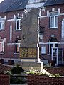 Palluel's war memorial


| Authority control databases: National |
|---|
This Arras arrondissement, Pas-de-Calais geographical article is a stub. You can help Wikipedia by expanding it. |