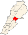
Riyaq
 Rayak air strip in Lebanon | |
| Location | 500 metres (0.31 mi) north of Rayak, Lebanon |
|---|---|
| Coordinates | 33°51′00″N 36°01′01″E / 33.850°N 36.017°E |
| Type | Surface site |
| History | |
| Material | Alluvial soil |
| Periods | Shepherd Neolithic |
| Site notes | |
| Excavation dates | 1965 |
| Archaeologists | Lorraine Copeland, Frank Skeels |
| Public access | Yes |
Riyaq - Haouch Hala (Template:Lang-ar), also romanized Rayak, is a Lebanese town in the Beqaa Governorate near the city of Zahlé. In the early 20th century and up to 1975 and the outbreak of the civil war, it was Lebanon's most important railway center, where the 1.05-m Beirut–Damascus line met the standard-gauge line north to Baalbek, Homs, and Aleppo. It now has an air base and a hospital. Riyaq Air Base was bombed by the Israeli Air Force during the 2006 Lebanon War. The landing strip was severely damaged as a result.[1]
General information
Altitude: 930 m
Latitude: 33.85
Longitude: 36
Latitude (DMS): 33° 51' 0 N
Longitude (DMS): 36° 0' 0 E
Area: 332 hectares
Location: 176 x 212 Zip Code: 51311
Population: 3,349
Number of Homes: 1,200
Companies: 18
Distances:
From Zahleh 11 km
From Beirut 60 km
Archaeology
Rayak North is a Shepherd Neolithic archaeological site located on either side of the main road, 500 metres (0.31 mi) north of Rayak. Flint tools were found there by Lorraine Copeland and Frank Skeels during a survey of 1965. Along with the Shepherd Neolithic series of blade-butts and end-scrapers, another series of large cores and flakes were found that Henri Fleisch considered similar to materials found at Serain and Fleywe that were of a confusing typology judged to be possibly Mousterian, Levalloiso-Mousterian or Heavy Neolithic.[2]
History
In 1838, Eli Smith noted both Reyak and Haush Hala as Christian villages in the Baalbek District.[3]
References
- ^ Lebanon Rapid Environmental Assessment for Greening Recovery, Reconstruction And Reform, United Nations Development Programme report, 2007.
- ^ L. Copeland; P. Wescombe (1966). Inventory of Stone-Age Sites in Lebanon: North, South and East-Central Lebanon, p. 51 & 52. Impr. Catholique. Retrieved 3 March 2011.
- ^ Robinson and Smith, 1841, vol 3, 2nd appendix, p. 145
Bibliography
External links
33°51′04″N 35°59′17″E / 33.851°N 35.988°E


