Warnock, Ohio
Appearance

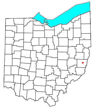
Warnock is an unincorporated community in northern Smith Township, Belmont County, Ohio, United States. Although it is unincorporated, it has a post office, with the ZIP code of 43967.[1] It lies along State Route 9.
Warnock is part of the Wheeling, WV-OH Metropolitan Statistical Area.
History
A former variant name was Warnocks Station.[2] A post office called Warnock has been in operation since 1857.[3] The community was named for the Warnock family, the original owners of the town site.[4]
References
- ^ Zip Code Lookup
- ^ U.S. Geological Survey Geographic Names Information System: Warnock, Ohio
- ^ "Belmont County". Jim Forte Postal History. Retrieved 2 January 2016.
- ^ McKelvey, A. T. (1903). Centennial History of Belmont County, Ohio, and Representative Citizens. Biographical Publishing Company. pp. 287.

