Jefman Airport
Appearance
Jefman Airport Bandar Udara Jefman | |||||||||||
|---|---|---|---|---|---|---|---|---|---|---|---|
| Summary | |||||||||||
| Serves | City of Sorong | ||||||||||
| Location | North Salawati, Raja Ampat Regency, Southwest Papua, Indonesia | ||||||||||
| Elevation AMSL | 10 ft / 3 m | ||||||||||
| Coordinates | 00°55′34″S 131°07′16″E / 0.92611°S 131.12111°E | ||||||||||
| Map | |||||||||||
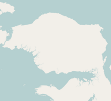
Location in Bird's Head Peninsula Location in Western New Guinea | |||||||||||
 | |||||||||||
| Runways | |||||||||||
| |||||||||||
Jefman Airport (IATA: SOQ, ICAO: WASS) was an airport in North Salawati, Raja Ampat Regency, Southwest Papua, Indonesia, closed when the new Sorong Airport became operational.
References
External links


