Chonhar
Chonhar
Чонгар | |
|---|---|
Village | |
 Abandoned café "Chonhar", near the old road bridge | |
| Coordinates: 46°01′51″N 34°32′45″E / 46.03083°N 34.54583°E | |
| Country | |
| Oblast | Kherson |
| Raion | Henichesk |
| Population (2001) | |
• Total | 1,431 |
 | |
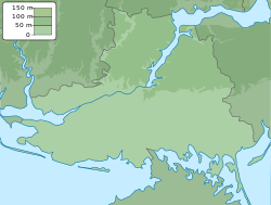
Chonhar (Template:Lang-uk), transliterated sometimes as Chongar (Template:Lang-ru), is a village on the Chonhar Peninsula, within the swampy region of Syvash, in Henichesk Raion, Kherson Oblast. The village is a seat of the Chonhar rural community (silrada). It belongs to Henichesk urban hromada, one of the hromadas of Ukraine.[1] The village is just north of Chonhar Strait, which is part of the boundary between Kherson Oblast and Crimea.
Geography
The village is on the Chonhar Peninsula in Kherson Oblast. It is just north of Chonhar Strait, a shallow waterway that separates the peninsula and mainland Ukraine from the isthmus of Crimea. Highway M18/E105 runs through the eastern end of the village and crosses a bridge over Chonhar Strait, parallel to an older, unused road bridge. The Chonhar bridge is one of three main hard surface routes to and from Crimea. The Novooleksiivka–Dzhankoi railway line runs through the eastern end of the village, then on to Syvash village and over a bridge across the sea to Crimea.
History

On 27 February 2014, during the 2014 Crimean crisis, Berkut (special police) of Crimea occupied the checkpoint near Chonhar and neighbouring territory.[2] After Russia annexed Crimea, the area became a de facto border patrolled by Berkut and Russian troops.[3][4] By 27 December 2014 Russian forces had fully withdrawn from the Chonhar peninsula.[4][5]
The Highway M18/E105 bridge over Chonhar Strait was damaged on 22 June 2023, during the Russian invasion of Ukraine, in an apparent Ukrainian missile strike.[6]
See also
References
- ^ "Геническая городская громада" (in Russian). Портал об'єднаних громад України.
- ^ "ПОСТ "ЧОНГАР" КОНТРОЛИРУЕТ КРЫМСКИЙ "БЕРКУТ" ПОДЧИНЕННЫЙ ЯНУКОВИЧУ (видео) = Checkpoint 'Chonhar' is under control of Crimean 'Berkut' subordinated to Yanukovich (video)" (in Russian). 'Новый Визит' (Henichesk). February 27, 2014. Archived from the original on March 14, 2014. Retrieved March 13, 2014.
- ^ "Ragtag camp grows on Russia's new frontier". Yahoo! News.
- ^ a b Chonhar Peninsula fully under Ukraine's control, Interfax-Ukraine (27 December 2014)
(in Ukrainian) Ukrainian military released Chonhar in Kherson oblast, korrespondent.net (26 December 2014) - ^ "Andriy Lysenko: Russian border troops withdraw behind the administrative border of Kherson oblast". Ukraine Crisis Media Center. 27 December 2014. Retrieved March 29, 2017.
- ^ "Ukraine missiles damage bridge to Crimea: Russian officials". www.aljazeera.com. Retrieved 2023-07-05.


