R167 road (Ireland)
| R167 road | |
|---|---|
| Bóthar R167 | |
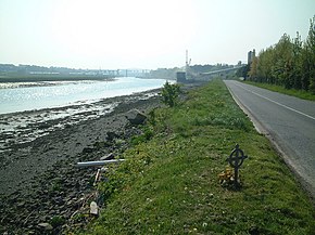
 Strand Road east of Drogheda, part of the R167 | |
| Route information | |
| Length | 8.7 km (5.4 mi) |
| Major junctions | |
| From | |
| R899 Drogheda (Strand Road) R900 Drogheda (North Quay) | |
| To | |
| Location | |
| Country | Ireland |
| Highway system | |
The R167 road is a regional road in Ireland, located in County Louth.[1][2]
References
- ^ "R167 - Roader's Digest: The SABRE Wiki". sabre-roads.org.uk. Retrieved 2016-03-09.
- ^ "S.I. No. 54/2012 - Roads Act 1993 (Classification of Regional Roads) Order 2012". irishstatutebook.ie. Retrieved 2016-03-09.

