Jump to content

R662 road (Ireland)

Coordinates: 52°23′11″N 8°18′13″W / 52.386443°N 8.303508°W / 52.386443; -8.303508
From Wikipedia, the free encyclopedia

This is an old revision of this page, as edited by Rodw (talk | contribs) at 22:15, 11 March 2018 (Disambiguating links to Tipperary (link changed to Tipperary (town)) using DisamAssist.). The present address (URL) is a permanent link to this revision, which may differ significantly from the current revision.

R662 road shield}}
R662 road
Bóthar R662
Galballysquare.jpg
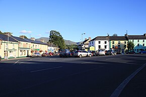
R662 passing through Galbally
Route information
Length20.5 km (12.7 mi)
Major junctions
From R515 Tipperary (O'Brien Street)
Major intersectionsCrosses River Ara and Limerick–Rosslare railway line
Enters County Limerick
R663 Galbally
To R513 Ballyfauskeen Cross
Location
CountryIreland
Highway system

The R662 road is a regional road in Ireland, located in County Limerick and County Tipperary.[1][2]

References

52°23′11″N 8°18′13″W / 52.386443°N 8.303508°W / 52.386443; -8.303508