A4160 road
| A4160 | |
|---|---|
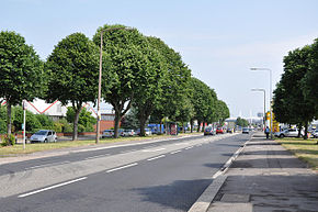
 Penarth Road looking towards Cardiff city centre | |
| Major junctions | |
| East end | Cardiff |
| West end | Penarth |
| Location | |
| Country | United Kingdom |
| Primary destinations | Cardiff |
| Road network | |
The A4160 was the road that connected Penarth with Cardiff in Wales; now the A4055 and A4232 have become the main route from Penarth to Cardiff city centre and Cardiff Bay
The route begins at Fitzalan Place on the junction at Newport Road (A4161) and West Grove. It heads south along Fitzalan Place and then westerly along Adam Street and Bute Terrace and for a short stretch south along Bute Street before entering Callaghan Square and joining Penarth Road, continuing in a southwesterly direction. It crosses through the Penarth Road commercial district then crosses the River Ely and passes under the A4232 road, after which it turns to a south easterly direction. It ends in the town centre of Penarth.
Current route of the A4160
From east to west it runs through the following roads in Cardiff and Penarth:
- Fitzalan Place
- Adam Street
- Bute Terrace
- Bute Street
- Callaghan Square
- Penarth Road
- Cogan Hill
- Windsor Road


