Morningside Drive (Manhattan)
This article needs additional citations for verification. (January 2016) |

Morningside Drive is a roughly north–south bi-directional street in the Morningside Heights neighborhood of the New York City borough of Manhattan. It runs from 110th Street in the south, where it forms the continuation of Columbus Avenue, to 122nd Street-Seminary Row in the north, which Morningside Drive becomes after turning to the west and crossing over Amsterdam Avenue.

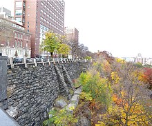
Along the way, Morningside Drive passes the apse of the Cathedral of St. John the Divine;[2] the Plant and Scrymser Pavilions of St. Luke's Hospital;[3] the Eglise de Notre Dame;[4] and several buildings owned by Columbia University, including the President's House and the East Campus dormitory.[5] The eastern side of Morningside Drive is occupied by Morningside Park, which forms the eastern boundary of Morningside Heights, and contains a cliff that makes the construction of cross-streets impossible.[6] The non-institutional buildings on the west side of the street are primarily apartment houses.
References
- ^ "Morningside Park Monuments - Carl Schurz Memorial : NYC Parks". www.nycgovparks.org. Retrieved 2019-07-31.
- ^ "Cathedral Church of Saint John the Divine and the Cathedral Close" (PDF). New York City Landmarks Preservation Commission. February 21, 2017. Retrieved 2019-11-30.
{{cite web}}: Cite has empty unknown parameter:|dead-url=(help)CS1 maint: url-status (link) - ^ "Plant and Scrymser Pavilions for Private Patients, Saint Luke's Hospital" (PDF). New York City Landmarks Preservation Commission. 2002-06-18. Retrieved 2019-11-30.
{{cite web}}: Cite has empty unknown parameter:|dead-url=(help)CS1 maint: url-status (link) - ^ "Eglise de Notre Dame" (PDF). New York City Landmarks Preservation Commission. 1967-01-24. Retrieved 2019-11-30.
{{cite web}}: Cite has empty unknown parameter:|dead-url=(help)CS1 maint: url-status (link)
"Rectory of the Eglise de Notre Dame" (PDF). New York City Landmarks Preservation Commission. 1967-01-24. Retrieved 2019-11-30.{{cite web}}: Cite has empty unknown parameter:|dead-url=(help)CS1 maint: url-status (link) - ^ "Maps and Directions: Morningside Heights" (PDF). Visitors Center. Columbia University. August 2015. Retrieved December 16, 2019.
- ^ "Morningside Park" (PDF). New York City Landmarks Preservation Commission. July 15, 2008. Retrieved 2019-12-16.
40°48′10″N 73°57′33″W / 40.80278°N 73.95917°W


