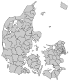
Norddjurs Municipality
Appearance

Norddjurs is a municipality (Danish, kommune) in Region Midtjylland in Denmark. It covers an area of 723.15 km² and has a population of 37,839 (1 April 2014).
On 1 January 2007 Norddjurs municipality was created as the result of Kommunalreformen ("The Municipal Reform" of 2007), consisting of the former municipalities of Grenå, Nørre Djurs and Rougsø, along with the eastern part of Sønderhald municipality. It includes the island of Anholt in its extreme northeast.
The municipality is part of Business Region Aarhus and of the East Jutland metropolitan area, which had a total population of 1.378 million in 2016.[1][2]
Parishes
Sources
- Municipal statistics: NetBorger Kommunefakta, delivered from KMD aka Kommunedata (Municipal Data)
- Municipal mergers and neighbors: Eniro new municipalities map
References
- ^ "What is Business Region Aarhus". businessregionaarhus.dk. Retrieved 15 January 2019.
- ^ "Tal og statistik" [Figures and Statistics] (in Danish). Byregion Østjylland. Archived from the original on 27 April 2016. Retrieved 25 April 2016.
External links
Wikimedia Commons has media related to Norddjurs Municipality.
- Norddjurs municipality's official website (in Danish)
56°30′N 10°48′E / 56.50°N 10.80°E


