Wao Airport
Appearance
Wao Airport Hulugpaan sang Wao Landing a Wao | |||||||||||
|---|---|---|---|---|---|---|---|---|---|---|---|
| Summary | |||||||||||
| Airport type | Public | ||||||||||
| Operator | Civil Aviation Authority of the Philippines | ||||||||||
| Serves | Wao | ||||||||||
| Location | Wao, Lanao del Sur | ||||||||||
| Elevation AMSL | 536 m / 1,758 ft | ||||||||||
| Coordinates | 07°38′01″N 124°44′01″E / 7.63361°N 124.73361°E | ||||||||||
| Map | |||||||||||
| Runways | |||||||||||
| |||||||||||
Statistics from the Development Plan for the Bangsamoro Final Report, August 2016[1] | |||||||||||
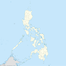
Wao Airport (Hiligaynon: Hulugpaan sang Wao; Maranao/Iranun: Landing a Wao) is an airport serving the general area of Wao, located in the province of Lanao del Sur, Philippines. The Civil Aviation Authority of the Philippines classifies this recently constructed[1] (ca. 2015) facility as a community airport.[2]
As of 2016 the airport has only been used for a few private flights.[1]
References
- ^ a b c RECS International Inc.; Oriental Consultants Global Co., Ltd.; CTI Engineering International Co., Ltd.; IC Net Limited (April 2016). "Comprehensive Capacity Development Project for the Bangsamoro: Development Plan for the Bangsamoro, Final Report" (PDF). Retrieved 2 May 2017.
- ^ "CAAP Airport Directory". Civil Aviation Authority of the Philippines. August 2016. Retrieved 2 May 2017.

