
List of municipalities in Arizona

Arizona is a state located in the Western United States. According to the 2010 United States Census, Arizona is the 16th most populous state with 6,392,017 inhabitants and the 6th largest by land area spanning 113,990.30 square miles (295,233.5 km2) of land.[1] Arizona is divided into 15 counties and contains 91 incorporated cities and towns. Incorporated places in Arizona are those that have been granted home rule, possessing a local government in the form of a city or town council. These cities and towns cover only 3.8% of the state's land mass but are home to 78.6% of its population.[1] Most of the population is concentrated within the Phoenix metropolitan area, with an 2010 census population of 4,192,887 (65.6% of the state population).
Phoenix is the capital and largest city by population in Arizona with 1,445,632 residents, is ranked as the sixth most populous city in the United States, and land area spanning 517.95 sq mi (1,341.5 km2) as of the 2010 census. The smallest municipality by population and land area is Winkelman with 353 residents in 0.75 sq mi (1.9 km2).[1] The oldest incorporated place in Arizona is Tucson which incorporated in 1877 and the most recent was the town of Tusayan which incorporated in March 2010.[2]
Municipal incorporation
The Arizona Constitution has, since its ratification in 1912, allowed for the creation of municipal corporations in any community with a population of 3,500 or greater.[3] According to the constitution, a municipal charter cannot be created by special laws or by the legislature, but rather by the communities themselves as provided by general law.[4] The population limit specified by the constitution was lowered by state law to a minimum of population of 1,500 for most locations, and further reduced to 500 for communities located within 10 miles (16 km) of a national park or national monument.[5] State law further restricts the incorporation of new municipalities within urbanized areas, which are defined as a specific buffer zone surrounding existing cities and towns.[6]
State law allows for the incorporation of a community as either a city or a town; the only additional requirement to incorporate as a city is a minimum population of 3,000.[7] Cities and towns in Arizona function largely in an identical manner, but cities are provided with additional powers that a town charter does not provide, limited primarily to certain powers regarding the regulation of utilities and construction within the city limits.[8] State law allows adjoining towns to merge and it allows a city to annex a town, but it does not allow cities to merge.[9][10] Additionally, a town may change its form of government to a city upon reaching the minimum population of 3,000.[11] There are, however, large communities that have remained incorporated as a town in spite of attaining a large population; Gilbert, with more than 200,000 residents, remains incorporated as a town.
Twenty Arizona municipalities were incorporated before 1912, when the state was admitted to the Union. As such, these cities and towns were incorporated by means other than those stipulated by current state law and the constitution. Phoenix, for example, was incorporated in 1881 by an act of the Territorial Legislature.[12]
List of cities and towns
- Largest cities and towns in Arizona by population
-
 Phoenix, Arizona's capital city and most populous municipality
 -
 Tucson, Arizona's second largest city by population
 -
 Mesa, Arizona's third largest city by population
 -
 Chandler is Arizona's fourth largest city by population.
 -
 Glendale, Arizona's fifth largest city by population
 -
 Scottsdale is Arizona's sixth largest city by population.
 -
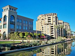
 Gilbert is Arizona's largest town and seventh largest municipality by population.
 -
 Tempe, Arizona's eighth largest city by population


‡ State capital and county seat
| Name | Type[13] | County | Population (2010)[14] |
Area (2010)[15] | Population density (2010)[15] | Incorporated[16] | |
|---|---|---|---|---|---|---|---|
| sq mi | km2 | ||||||
| Apache Junction | City | Pinal | 35,840 | 35.00 | 90.6 | 1,024.0/sq mi (395.4/km2) | 1978 |
| Avondale | City | Maricopa | 76,238 | 45.65 | 118.2 | 1,670.1/sq mi (644.8/km2) | 1946 |
| Benson | City | Cochise | 5,105 | 41.46 | 107.4 | 123.1/sq mi (47.5/km2) | 1924 |
| Bisbee | City | Cochise | 5,575 | 5.16 | 13.4 | 1,080.4/sq mi (417.2/km2) | 1902 |
| Buckeye | City | Maricopa | 50,876 | 375.39 | 972.3 | 135.5/sq mi (52.3/km2) | 1929 |
| Bullhead City | City | Mohave | 39,540 | 60.18 | 155.9 | 657.0/sq mi (253.7/km2) | 1984 |
| Camp Verde | Town | Yavapai | 10,873 | 43.15 | 111.8 | 252.0/sq mi (97.3/km2) | 1986 |
| Carefree | Town | Maricopa | 3,363 | 8.81 | 22.8 | 381.7/sq mi (147.4/km2) | 1984 |
| Casa Grande | City | Pinal | 48,571 | 109.67 | 284.0 | 442.9/sq mi (171.0/km2) | 1915 |
| Cave Creek | Town | Maricopa | 5,015 | 37.92 | 98.2 | 132.3/sq mi (51.1/km2) | 1986 |
| Chandler | City | Maricopa | 236,123 | 64.52 | 167.1 | 3,659.7/sq mi (1,413.0/km2) | 1920 |
| Chino Valley | Town | Yavapai | 10,817 | 63.43 | 164.3 | 170.5/sq mi (65.8/km2) | 1970 |
| Clarkdale | Town | Yavapai | 4,097 | 10.57 | 27.4 | 387.6/sq mi (149.7/km2) | 1957 |
| Clifton† | Town | Greenlee | 3,311 | 15.0 | 39 | 220.7/sq mi (85.2/km2) | 1909 |
| Colorado City | Town | Mohave | 4,821 | 10.34 | 26.8 | 466.2/sq mi (180.0/km2) | 1985 |
| Coolidge | City | Pinal | 11,825 | 56.58 | 146.5 | 209.0/sq mi (80.7/km2) | 1945 |
| Cottonwood | City | Yavapai | 11,265 | 16.41 | 42.5 | 686.5/sq mi (265.0/km2) | 1960 |
| Dewey-Humboldt | Town | Yavapai | 3,894 | 18.59 | 48.1 | 209.5/sq mi (80.9/km2) | 2004 |
| Douglas | City | Cochise | 17,378 | 9.98 | 25.8 | 1,741.3/sq mi (672.3/km2) | 1905 |
| Duncan | Town | Greenlee | 696 | 2.16 | 5.6 | 322.2/sq mi (124.4/km2) | 1938 |
| Eagar | Town | Apache | 4,885 | 11.24 | 29.1 | 434.6/sq mi (167.8/km2) | 1948 |
| El Mirage | City | Maricopa | 31,797 | 10.09 | 26.1 | 3,151.3/sq mi (1,216.7/km2) | 1951 |
| Eloy | City | Pinal | 16,631 | 111.57 | 289.0 | 149.1/sq mi (57.6/km2) | 1949 |
| Flagstaff† | City | Coconino | 65,870 | 63.91 | 165.5 | 1,030.7/sq mi (397.9/km2) | 1894 |
| Florence† | Town | Pinal | 25,536 | 52.49 | 135.9 | 486.5/sq mi (187.8/km2) | 1908 |
| Fountain Hills | Town | Maricopa | 22,489 | 20.42 | 52.9 | 1,101.3/sq mi (425.2/km2) | 1989 |
| Fredonia | Town | Coconino | 1,314 | 7.32 | 19.0 | 179.5/sq mi (69.3/km2) | 1956 |
| Gila Bend | Town | Maricopa | 1,922 | 55.37 | 143.4 | 34.7/sq mi (13.4/km2) | 1962 |
| Gilbert | Town | Maricopa | 208,453 | 68.15 | 176.5 | 3,058.7/sq mi (1,181.0/km2) | 1920 |
| Glendale | City | Maricopa | 226,721 | 60.13 | 155.7 | 3,770.5/sq mi (1,455.8/km2) | 1910 |
| Globe† | City | Gila | 7,532 | 18.20 | 47.1 | 413.8/sq mi (159.8/km2) | 1907 |
| Goodyear | City | Maricopa | 65,275 | 191.52 | 496.0 | 340.8/sq mi (131.6/km2) | 1946 |
| Guadalupe | Town | Maricopa | 5,523 | 0.81 | 2.1 | 6,818.5/sq mi (2,632.6/km2) | 1975 |
| Hayden | Town | Gila | 662 | 1.27 | 3.3 | 521.3/sq mi (201.3/km2) | 1956 |
| Holbrook† | City | Navajo | 5,053 | 17.37 | 45.0 | 290.9/sq mi (112.3/km2) | 1917 |
| Huachuca City | Town | Cochise | 1,853 | 2.81 | 7.3 | 659.4/sq mi (254.6/km2) | 1958 |
| Jerome | Town | Yavapai | 444 | 0.86 | 2.2 | 516.3/sq mi (199.3/km2) | 1889 |
| Kearny | Town | Pinal | 1,950 | 2.81 | 7.3 | 694.0/sq mi (267.9/km2) | 1959 |
| Kingman† | City | Mohave | 28,068 | 34.82 | 90.2 | 806.1/sq mi (311.2/km2) | 1952 |
| Lake Havasu City | City | Mohave | 52,527 | 44.48 | 115.2 | 1,180.9/sq mi (456.0/km2) | 1978 |
| Litchfield Park | City | Maricopa | 5,476 | 3.34 | 8.7 | 1,639.5/sq mi (633.0/km2) | 1987 |
| Mammoth | Town | Pinal | 1,426 | 1.04 | 2.7 | 1,371.2/sq mi (529.4/km2) | 1958 |
| Marana | Town | Pima | 34,961 | 122.20 | 316.5 | 286.1/sq mi (110.5/km2) | 1977 |
| Maricopa | City | Pinal | 43,482 | 47.57 | 123.2 | 914.1/sq mi (352.9/km2) | 2003 |
| Mesa | City | Maricopa | 439,041 | 137.06 | 355.0 | 3,203.3/sq mi (1,236.8/km2) | 1883 |
| Miami | Town | Gila | 1,837 | 0.88 | 2.3 | 2,087.5/sq mi (806.0/km2) | 1918 |
| Nogales† | City | Santa Cruz | 20,837 | 20.84 | 54.0 | 999.9/sq mi (386.0/km2) | 1893 |
| Oro Valley | Town | Pima | 41,011 | 35.64 | 92.3 | 1,150.7/sq mi (444.3/km2) | 1974 |
| Page | City | Coconino | 7,247 | 16.64 | 43.1 | 435.5/sq mi (168.2/km2) | 1975 |
| Paradise Valley | Town | Maricopa | 12,820 | 15.46 | 40.0 | 829.2/sq mi (320.2/km2) | 1961 |
| Parker† | Town | La Paz | 3,083 | 21.99 | 57.0 | 140.2/sq mi (54.1/km2) | 1948 |
| Patagonia | Town | Santa Cruz | 913 | 1.29 | 3.3 | 707.8/sq mi (273.3/km2) | 1948 |
| Payson | Town | Gila | 15,301 | 19.47 | 50.4 | 785.9/sq mi (303.4/km2) | 1973 |
| Peoria | City | Maricopa | 154,065 | 177.97 | 460.9 | 865.7/sq mi (334.2/km2) | 1954 |
| Phoenix‡ | City | Maricopa | 1,445,632 | 517.95 | 1,341.5 | 2,791.1/sq mi (1,077.6/km2) | 1881 |
| Pima | Town | Graham | 2,387 | 5.93 | 15.4 | 402.5/sq mi (155.4/km2) | 1916 |
| Pinetop-Lakeside | Town | Navajo | 4,282 | 11.37 | 29.4 | 376.6/sq mi (145.4/km2) | 1984 |
| Prescott† | City | Yavapai | 39,843 | 41.58 | 107.7 | 958.2/sq mi (370.0/km2) | 1883 |
| Prescott Valley | Town | Yavapai | 38,822 | 38.65 | 100.1 | 1,004.5/sq mi (387.8/km2) | 1978 |
| Quartzsite | Town | La Paz | 3,677 | 36.72 | 95.1 | 100.1/sq mi (38.7/km2) | 1989 |
| Queen Creek | Town | Maricopa | 26,361 | 28.07 | 72.7 | 939.1/sq mi (362.6/km2) | 1989 |
| Safford† | City | Graham | 9,566 | 8.59 | 22.2 | 1,113.6/sq mi (430.0/km2) | 1901 |
| Sahuarita | Town | Pima | 25,259 | 31.04 | 80.4 | 813.8/sq mi (314.2/km2) | 1994 |
| San Luis | City | Yuma | 25,505 | 32.10 | 83.1 | 794.5/sq mi (306.8/km2) | 1979 |
| Scottsdale | City | Maricopa | 217,385 | 184.40 | 477.6 | 1,178.9/sq mi (455.2/km2) | 1951 |
| Sedona | City | Yavapai | 10,031 | 19.18 | 49.7 | 523.0/sq mi (201.9/km2) | 1988 |
| Show Low | City | Navajo | 10,660 | 41.17 | 106.6 | 258.9/sq mi (100.0/km2) | 1953 |
| Sierra Vista | City | Cochise | 43,888 | 152.54 | 395.1 | 287.7/sq mi (111.1/km2) | 1956 |
| Snowflake | Town | Navajo | 5,590 | 33.58 | 87.0 | 166.5/sq mi (64.3/km2) | 1948 |
| Somerton | City | Yuma | 14,287 | 7.30 | 18.9 | 1,957.1/sq mi (755.6/km2) | 1918 |
| South Tucson | City | Pima | 5,652 | 1.04 | 2.7 | 5,434.6/sq mi (2,098.3/km2) | 1940 |
| Springerville | Town | Apache | 1,961 | 11.69 | 30.3 | 167.8/sq mi (64.8/km2) | 1948 |
| St. Johns† | City | Apache | 3,480 | 26.08 | 67.5 | 133.4/sq mi (51.5/km2) | 1946 |
| Star Valley | Town | Gila | 1,970 | 36.13 | 93.6 | 54.5/sq mi (21.1/km2) | 2005 |
| Superior | Town | Pinal | 2,837 | 1.94 | 5.0 | 1,462.4/sq mi (564.6/km2) | 1976 |
| Surprise | City | Maricopa | 117,517 | 105.87 | 274.2 | 1,110.0/sq mi (428.6/km2) | 1960 |
| Taylor | Town | Navajo | 4,112 | 32.67 | 84.6 | 125.9/sq mi (48.6/km2) | 1966 |
| Tempe | City | Maricopa | 161,719 | 40.19 | 104.1 | 4,023.9/sq mi (1,553.6/km2) | 1894 |
| Thatcher | Town | Graham | 4,865 | 6.13 | 15.9 | 793.6/sq mi (306.4/km2) | 1899 |
| Tolleson | City | Maricopa | 6,545 | 5.75 | 14.9 | 1,138.3/sq mi (439.5/km2) | 1929 |
| Tombstone | City | Cochise | 1,380 | 4.31 | 11.2 | 320.2/sq mi (123.6/km2) | 1881 |
| Tucson† | City | Pima | 520,116 | 227.03 | 588.0 | 2,291.0/sq mi (884.5/km2) | 1877 |
| Tusayan | Town | Coconino | 558[a] | 8.91 | 23.1[b] | 62.6/sq mi (24.2/km2) | 2010 |
| Wellton | Town | Yuma | 2,882 | 28.93 | 74.9 | 99.6/sq mi (38.5/km2) | 1970 |
| Wickenburg | Town | Maricopa | 6,363 | 18.77 | 48.6 | 339.0/sq mi (130.9/km2) | 1909 |
| Willcox | City | Cochise | 3,757 | 6.28 | 16.3 | 598.2/sq mi (231.0/km2) | 1915 |
| Williams | City | Coconino | 3,023 | 43.79 | 113.4 | 69.0/sq mi (26.7/km2) | 1901 |
| Winkelman | Town | Gila | 353 | 0.75 | 1.9 | 470.7/sq mi (181.7/km2) | 1949 |
| Winslow | City | Navajo | 9,655 | 12.35 | 32.0 | 781.8/sq mi (301.8/km2) | 1900 |
| Youngtown | Town | Maricopa | 6,156 | 1.54 | 4.0 | 3,997.4/sq mi (1,543.4/km2) | 1960 |
| Yuma† | City | Yuma | 93,064 | 120.41 | 311.9 | 772.9/sq mi (298.4/km2) | 1914 |
| Total Municipalities | — | — | 5,022,368 | 4,357.73 | 11,286.5 | 1,152.5/sq mi (445.0/km2) | — |
| State of Arizona | — | — | 6,392,017 | 113,990 | 295,200 | 56.1/sq mi (21.7/km2) | — |
See also
- List of counties in Arizona
- List of Indian reservations in Arizona
- List of census-designated places in Arizona
Notes
- ^ Because Tusayan was incorporated in 2010, its population was not included in the most recent Census estimates. The 2010 Census count for the now defunct Tusayan CDP was 558.
- ^ Because the Tusayan was incorporated after the 2010 Census, its area is not reported by the Census Bureau. The 2010 area of the Census-designated place corresponding to Tusayan is 8.91 sq mi (23.1 km2). At its incorporation, Tusayan included an area of only 0.2 sq mi (0.52 km2), much smaller than its CDP counterpart.
References
- ^ a b c "GCT-PH1 – Population, Housing Units, Area, and Density: 2010 – State — Place and (in selected states) County Subdivision". 2010 United States Census. United States Census Bureau. Archived from the original on February 13, 2020. Retrieved June 17, 2015.
- ^ Wagner, Dennis (2010-04-12). "Competing interests divide new Arizona town". The Arizona Republic. Retrieved 2010-04-12.
- ^ "Article 13, Section 2". Arizona Constitution. Retrieved 2020-01-01.
- ^ "Article 13, Section 1". Arizona Constitution. Retrieved 2020-01-01.
- ^ "Arizona Revised Statutes §9-101. Incorporation; definition". Arizona State Legislature. Archived from the original on 2012-07-24. Retrieved 2008-06-21.
- ^ "Arizona Revised Statutes §9-101.01. Incorporation, urbanized area". Arizona State Legislature. Archived from the original on 2012-07-29. Retrieved 2008-06-21.
- ^ "Arizona Revised Statutes §9-281. Adoption procedure; board of freeholders; election". Arizona State Legislature. Archived from the original on 2012-07-19. Retrieved 2008-06-21.
- ^ "Arizona Revised Statutes §9-276. Additional powers of cities". Arizona State Legislature. Archived from the original on 2012-07-18. Retrieved 2008-06-21.
- ^ "Arizona Revised Statutes §9-121. Consolidation of towns". Arizona State Legislature. Archived from the original on 2012-07-29. Retrieved 2009-07-31.
- ^ "Arizona Revised Statutes §9-122. Unification of a city and a town". Arizona State Legislature. Archived from the original on 2012-08-02. Retrieved 2009-07-31.
- ^ "Arizona Revised Statutes §9-271. Procedure for change; city officers". Arizona State Legislature. Archived from the original on 2012-08-02. Retrieved 2009-07-31.
- ^ "Out of the Ashes: The History of the City of Phoenix". City of Phoenix. Archived from the original on 2008-07-06. Retrieved 2008-06-19.
- ^ "About the League: Member Cities and Towns". Arizona League of Cities and Towns. Archived from the original on 2012-02-14. Retrieved 2009-08-09.
- ^ "Annual Estimates of the Population for Incorporated Places in Arizona". United States Census Bureau. 2009-07-07. Archived from the original on 2009-07-10. Retrieved 2009-07-21.
- ^ a b "Population, Housing Units, Area, and Density: 2010 - State -- Place, 2010 Census Summary File 1". United States Census Bureau. Archived from the original on 2020-02-12. Retrieved 2012-05-02.
- ^ "Community Profiles". Arizona Department of Commerce. Retrieved 2015-05-22.