Quiabaya Municipality
Appearance
Quiabaya Municipality | |
|---|---|
Municipality | |
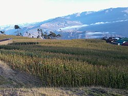
 The village Tarata in the Quiabaya Municipality | |
| Coordinates: 15°37′00″S 68°46′00″W / 15.6167°S 68.7667°W | |
| Country | |
| Department | La Paz Department |
| Province | Larecaja Province |
| Seat | Quiabaya |
| Government | |
| • Mayor | Jorge Callisaya Peralta (2007) |
| • President | Aurelio Machicado Miranda (2007) |
| Area | |
| • Total | 51 sq mi (132 km2) |
| • | 50 sq mi (120 km2) |
| Elevation | 10,000 ft (3,000 m) |
| Population (from 2012 census) | |
| • Total | 2,684 |
| • Urban density | 980/sq mi (378/km2) |
Quiabaya Municipality is the fourth municipal section of the Larecaja Province in the La Paz Department, Bolivia. Its seat is Quiabaya.
Languages
The languages spoken in the Quiabaya Municipality are mainly Aymara and Spanish.
| Language | Inhabitants |
|---|---|
| Quechua | 33 |
| Aymara | 2.269 |
| Guaraní | 0 |
| Another native | 2 |
| Spanish | 1.391 |
| Foreign | 6 |
| Only native | 1.023 |
| Native and Spanish | 1.256 |
| Only Spanish | 135 |
Ref.: obd.descentralizacion.gov.bo


