Beekman, New York
Beekman, New York | |
|---|---|
| Country | United States |
| State | New York |
| County | Dutchess |
| Area | |
| • Total | 30.3 sq mi (78.4 km2) |
| • Land | 30.0 sq mi (77.7 km2) |
| • Water | 0.3 sq mi (0.7 km2) |
| Elevation | 430 ft (131 m) |
| Population (2000) | |
| • Total | 11,452 |
| • Density | 381.7/sq mi (147.4/km2) |
| Time zone | UTC-5 (Eastern (EST)) |
| • Summer (DST) | UTC-4 (EDT) |
| FIPS code | 36-05452 |
| GNIS feature ID | 0978718 |
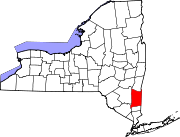
Beekman is a town in Dutchess County, New York, United States. The population was 11,452 at the 2000 census. The name is from Henry Beekman, an early land owner.
The Town of Beekman is in the south part of the county.
History
The town had been occupied by the Wappinger Indians, before the first European settlers arrived around 1710. The Beekman Patent, granted to Col Henry Beekman in 1697, was the second largest land holding in Dutchess County.
The town was formed in 1788 during the initial period of establishing towns and counties in the newly independent state of New York, but parts were removed subsequently to form other towns. Beekman contributed part of its territory to the newer Towns of La Grange (1821) and Union Vale (1827). Iron ore extraction and smelting were important in the early economy.
Geography
According to the United States Census Bureau, the town has a total area of 30.3 square miles (78.4 km²), of which, 30.0 square miles (77.7 km²) of it is land and 0.3 square miles (0.7 km²) of it (0.86%) is water.
Demographics
As of the censusTemplate:GR of 2000, there were 11,452 people, 3,751 households, and 3,034 families residing in the town. The population density was 381.7 people per square mile (147.4/km²). There were 4,180 housing units at an average density of 139.3/sq mi (53.8/km²). The racial makeup of the town was 93.24% White, 2.42% African American, 0.18% Native American, 1.73% Asian, 0.03% Pacific Islander, 0.94% from other races, and 1.46% from two or more races. Hispanic or Latino of any race were 5.38% of the population.
There were 3,751 households out of which 46.3% had children under the age of 18 living with them, 70.0% were married couples living together, 7.7% had a female householder with no husband present, and 19.1% were non-families. 14.3% of all households were made up of individuals and 3.8% had someone living alone who was 65 years of age or older. The average household size was 3.04 and the average family size was 3.41.
In the town the population was spread out with 30.9% under the age of 18, 6.1% from 18 to 24, 33.2% from 25 to 44, 22.3% from 45 to 64, and 7.5% who were 65 years of age or older. The median age was 36 years. For every 100 females there were 100.6 males. For every 100 females age 18 and over, there were 98.1 males.
The median income for a household in the town was $65,610, and the median income for a family was $72,066. Males had a median income of $51,739 versus $32,119 for females. The per capita income for the town was $26,437. About 3.6% of families and 4.7% of the population were below the poverty line, including 5.3% of those under age 18 and 5.4% of those age 65 or over.
Communities and locations in Beekman
- Beekman -- The hamlet of Beekman is near the town center on Route 216 with the intersection of Routes 216 and 55 its east boundary. It was formerly known as "Beekmanville."
- Clove Valley -- A hamlet in the northeast part of the town on Route 216.
- Green Haven -- A hamlet south of Beekman village.
- Green Haven Correctional Facility -- A state prison near the coummunity of Green Haven.
- Poughquag -- A hamlet east of Beekman village, running along Route 55 with that road's intersection with Route 9 its boundary with Beekman and Clove Valley. It is the main business district of the town and home of Beekman town hall.
- Sylvan Lake -- A hamlet by the west town line. It is named after Sylvan Lake, which was formed during the ice age. The early Indians originally named it "poughquag" which means "round body of water". A smaller lake known as Hidden Lake is where Mr. Daniel Delany, in the late 1800s, discovered iron ore and made his fortune. He eventually bought the adjacent property which was the entire shoreline of Sylvan Lake and rebuilt St. Denis church for the town. Some iron ore mining also took place along the shores of Sylvan Lake in the early 1930s and some of these retainer wall pilings are still standing and can be clearly seen from a boat. When the mine was filled with water, construction equipment and mining tools were left on the bottom, and are present today.
See also
References

