Eppan an der Weinstraße
Eppan | |
|---|---|
| Gemeinde Eppan an der Weinstraße Comune di Appiano sulla Strada del Vino | |
 | |
| Coordinates: 46°27′N 11°16′E / 46.450°N 11.267°E | |
| Country | Italy |
| Region | Trentino-Alto Adige/Südtirol |
| Province | South Tyrol (BZ) |
| Frazioni | Berg (Monte), Frangart (Frangarto), Girlan (Cornaiano), Missian (Missiano), Montiggl (Monticolo), Perdonig (Predonico), St. Michael (San Michele), St. Pauls (San Paolo), Unterrain (Riva di Sotto) |
| Government | |
| • Mayor | Wilfried Trettl |
| Area | |
• Total | 59.7 km2 (23.1 sq mi) |
| Elevation | 239 m (784 ft) |
| Population | |
• Total | 14,226 |
| • Density | 240/km2 (620/sq mi) |
| Demonym(s) | German: Eppaner Italian: appianesi |
| Time zone | UTC+1 (CET) |
| • Summer (DST) | UTC+2 (CEST) |
| Postal code | 39057, 39050 |
| Dialing code | 0471 |
| Website | Official website |
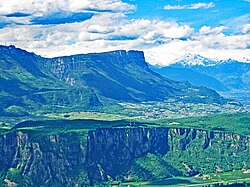
Eppan an der Weinstraße (German pronunciation: [ˈɛpan an dɐ ˈvaɪ̯nˌʃtraˑsə]; Template:Lang-it [apˈpjaːno ˈsulla ˈstraːda del ˈviːno]), often abbreviated to Eppan or Appiano, is a comune (municipality) in South Tyrol in northern Italy, located about 8 kilometres (5 mi) southwest of the city of Bolzano.
Geography
As of 30 November 2010, it had a population of 14,226 and an area of 59.7 square kilometres (23.1 sq mi).[2]
Eppan borders the following municipalities: Andrian, Bolzano, Kaltern, Nals, Terlan, Unsere Liebe Frau im Walde-St. Felix, Vadena, Cavareno, Fondo, Malosco, Sarnonico, and Ronzone.
Frazioni
The municipality of Eppan contains the frazioni (subdivisions, mainly villages and hamlets) Frangart (Frangarto), Girlan (Cornaiano), Missian (Missiano), Montiggl (Monticolo), Perdonig (Predonico), St. Michael (San Michele), St. Pauls (San Paolo), Unterrain (Riva di Sotto).
History
Coat-of-arms
The emblem represents the coat-of-arms of the farm Hocheppan owned by the Lords of Eppan since the 9th century. In the left side it is depicted half star with eight rays and the crescent moon to the right, both of or on azure background. The emblem was adopted in 1967.[4]
Society
Linguistic distribution
According to the 2011 census, 86.23% of the population speak German, 13.29% Italian, and 0.48% Ladin as first language.[5]
Demographic evolution

Culture
Notable people
- Johann Georg Platzer (1704–1761), painter
- Leonhard von Call (1767–1815), composer
- Sepp Kerschbaumer freedom fighter/terrorist born in Frangart (Frangarto)
- George McAnthony (1966–2011), country singer and songwriter
References
- ^ "Superficie di Comuni Province e Regioni italiane al 9 ottobre 2011". Italian National Institute of Statistics. Retrieved 16 March 2019.
- ^ a b All demographics and other statistics: Italian statistical institute Istat.
- ^ "Popolazione Residente al 1° Gennaio 2018". Italian National Institute of Statistics. Retrieved 16 March 2019.
- ^ Heraldry of the World: Eppan
- ^ "Volkszählung 2011/Censimento della popolazione 2011". astat info (38). Provincial Statistics Institute of the Autonomous Province of South Tyrol: 6–7. June 2012. Retrieved 2012-06-14.
External links
![]() Media related to Eppan an der Weinstraße at Wikimedia Commons
Media related to Eppan an der Weinstraße at Wikimedia Commons


