Kafr Zabad
كفر زبد | |
| History | |
|---|---|
| Cultures | Roman |
| Site notes | |
| Condition | Ruins |
| Public access | Yes |
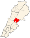
Kafr Zabad (Template:Lang-ar) i is a village in Lebanon.[1] It is also the site of two ancient antae temples.[2]
George F. Taylor classed the temples in a group of Temples of the Beqaa Valley. They are situated 1,000 feet (300 m) above the village on a hill. The temples had almost been completely destroyed when Taylor visited the site. He noted only foundations and some parts of the cella walls and pediment of the upper temple had survived. Remains of architraves, carved stones and door frames littered the hill.[2]
The lower temple had only one section of upright door frame, again with blocks of pediment, architrave and cornice lying scattered about the landscape of the Anti-Lebanon. There is a relief carved into a rock approximately 100 metres (330 ft) east of the temple with the figure of a goddess. The figure is barely recognisable and had been mostly destroyed with only the lower half remaining distinguishable.[2]
References
- ^ Ted Kaizer (2008). The Variety of Local Religious Life in the Near East: In the Hellenistic and Roman Periods. BRILL. pp. 87–. ISBN 978-90-04-16735-3. Retrieved 15 November 2012.
- ^ a b c George Taylor (1967). The Roman temples of Lebanon: a pictorial guide. Dar el-Machreq Publishers. Retrieved 1 November 2012.
External links
- Kfar Zabad, Localiban

