
Pengzhou
Pengzhou
彭州市 | |||||||||||||||||||||||||||||||||||||||||||||||||||||||||||||||
|---|---|---|---|---|---|---|---|---|---|---|---|---|---|---|---|---|---|---|---|---|---|---|---|---|---|---|---|---|---|---|---|---|---|---|---|---|---|---|---|---|---|---|---|---|---|---|---|---|---|---|---|---|---|---|---|---|---|---|---|---|---|---|---|
| Nickname: The Peony City (丹城) | |||||||||||||||||||||||||||||||||||||||||||||||||||||||||||||||
 Pengzhou Location in Sichuan | |||||||||||||||||||||||||||||||||||||||||||||||||||||||||||||||
| Coordinates: 30°59′28″N 103°56′35″E / 30.991°N 103.943°E[1] | |||||||||||||||||||||||||||||||||||||||||||||||||||||||||||||||
| Country | People's Republic of China | ||||||||||||||||||||||||||||||||||||||||||||||||||||||||||||||
| Province | Sichuan | ||||||||||||||||||||||||||||||||||||||||||||||||||||||||||||||
| Sub-provincial city | Chengdu | ||||||||||||||||||||||||||||||||||||||||||||||||||||||||||||||
| Municipal seat | Tianpeng (天彭镇) | ||||||||||||||||||||||||||||||||||||||||||||||||||||||||||||||
| Government | |||||||||||||||||||||||||||||||||||||||||||||||||||||||||||||||
| • CPC Party Secretary | Men Sheng (门生) | ||||||||||||||||||||||||||||||||||||||||||||||||||||||||||||||
| • Mayor | Han Yi (韩轶) | ||||||||||||||||||||||||||||||||||||||||||||||||||||||||||||||
| Area | |||||||||||||||||||||||||||||||||||||||||||||||||||||||||||||||
| • Total | 1,420 km2 (550 sq mi) | ||||||||||||||||||||||||||||||||||||||||||||||||||||||||||||||
| Highest elevation | 4,812 m (15,787 ft) | ||||||||||||||||||||||||||||||||||||||||||||||||||||||||||||||
| Population (2010)[2] | |||||||||||||||||||||||||||||||||||||||||||||||||||||||||||||||
| • Total | 762,887 | ||||||||||||||||||||||||||||||||||||||||||||||||||||||||||||||
| • Density | 537/km2 (1,390/sq mi) | ||||||||||||||||||||||||||||||||||||||||||||||||||||||||||||||
| Time zone | UTC+8 (China Standard) | ||||||||||||||||||||||||||||||||||||||||||||||||||||||||||||||
| Postal code | 6119XX | ||||||||||||||||||||||||||||||||||||||||||||||||||||||||||||||
| Area code | 028 | ||||||||||||||||||||||||||||||||||||||||||||||||||||||||||||||
| Chengdu district map |
| ||||||||||||||||||||||||||||||||||||||||||||||||||||||||||||||
| GDP (nominal) Total (2009) | ¥ 12.54 billion (US$1.838 billion) | ||||||||||||||||||||||||||||||||||||||||||||||||||||||||||||||
| GDP (nominal) Per Capita (2009) | ¥ 16,087 (US$2,357) | ||||||||||||||||||||||||||||||||||||||||||||||||||||||||||||||
| Website | www | ||||||||||||||||||||||||||||||||||||||||||||||||||||||||||||||
Pengzhou (Chinese: 彭州; pinyin: Péngzhōu), formerly Peng County or Pengxian, is a county-level city under the jurisdiction of Chengdu, the capital of Sichuan province, People's Republic of China, some 19 km (11.81 mi) northwest of Chengdu. There is an expressway that connects Pengzhou to Chengdu. It is bordered by the prefecture-level divisions of Deyang to the northeast and the Ngawa Tibetan and Qiang Autonomous Prefecture to the north.
It has an area of 1420 square kilometers and a population of 803,400 in 2009.[3] Pengzhou is famous for being one of the three national bases of peony plantation and one of the five national bases of vegetable plantation and merchandise. Pengzhou's industry varies from pharmaceutical to petrochemical. The newly built oil refinery attracts a total investment of 38 billion yuan, considered to be the biggest single investment of Sichuan Province since 1949.[4] Like other regions around the area, Pengzhou was badly affected by the 2008 Sichuan earthquake.
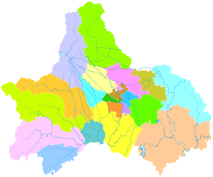
Administrative divisions
Pengzhou has 20 towns:
- Tianpeng (天彭镇)
- Longmenshan (龙门山镇)
- Xinxing (新兴镇)
- Lichun (丽春镇)
- Jiuchi (九尺镇)
- Mengyang (濛阳镇)
- Tongji (通济镇)
- Danjingshan (丹景山镇)
- Longfeng (隆丰镇)
- Aoping (敖平镇)
- Cifeng (磁峰镇)
- Guihua (桂花镇)
- Junle (军乐镇)
- Sanjie (三界镇)
- Xiaoyudong (小鱼洞镇)
- Hongyan (红岩镇)
- Shengping (升平镇)
- Bailu (白鹿镇)
- Gexianshan (葛仙山镇)
- Zhihe (致和镇)
History
Pengzhou area is believed to have been habituated since Western Zhou. Empress dowager Wu Zetian first set up Pengzhou in 686 AD (Tang Dynasty). In 1337 AD, Hongwu Emperor (Ming Dynasty) reduced Pengzhou to Pengxian, or Peng County (Chinese: 彭县; Pinyin: Péngxiàn). Peng County later became Pengzhou City in 1993 (China).[5]
As of late, Pengzhou is still occasionally referred to as Pengxian, or Peng County, even in official publications.[6]
Education
Xihua University Pengzhou Campus is located at the south part of the city.
Sister cities
 Ishikari, Hokkaidō, Japan (Since 2000)
Climate
| Climate data for Pengzhou (1981−2010) | |||||||||||||
|---|---|---|---|---|---|---|---|---|---|---|---|---|---|
| Month | Jan | Feb | Mar | Apr | May | Jun | Jul | Aug | Sep | Oct | Nov | Dec | Year |
| Record high °C (°F) | 18.1 (64.6) |
22.9 (73.2) |
30.7 (87.3) |
31.5 (88.7) |
34.3 (93.7) |
35.5 (95.9) |
36.2 (97.2) |
36.2 (97.2) |
35.2 (95.4) |
29.5 (85.1) |
25.4 (77.7) |
17.6 (63.7) |
36.2 (97.2) |
| Mean daily maximum °C (°F) | 8.9 (48.0) |
11.1 (52.0) |
15.5 (59.9) |
21.1 (70.0) |
25.7 (78.3) |
27.4 (81.3) |
29.2 (84.6) |
29.0 (84.2) |
25.2 (77.4) |
20.1 (68.2) |
15.5 (59.9) |
10.1 (50.2) |
19.9 (67.8) |
| Daily mean °C (°F) | 5.3 (41.5) |
7.5 (45.5) |
11.2 (52.2) |
16.3 (61.3) |
20.8 (69.4) |
23.3 (73.9) |
25.1 (77.2) |
24.5 (76.1) |
21.2 (70.2) |
16.6 (61.9) |
11.9 (53.4) |
6.6 (43.9) |
15.9 (60.5) |
| Mean daily minimum °C (°F) | 2.6 (36.7) |
4.8 (40.6) |
7.9 (46.2) |
12.4 (54.3) |
16.9 (62.4) |
20.0 (68.0) |
21.7 (71.1) |
21.2 (70.2) |
18.5 (65.3) |
14.2 (57.6) |
11.9 (53.4) |
3.9 (39.0) |
13.0 (55.4) |
| Record low °C (°F) | −4.5 (23.9) |
−3.5 (25.7) |
−2.3 (27.9) |
3.2 (37.8) |
6.3 (43.3) |
13.9 (57.0) |
15.7 (60.3) |
15.9 (60.6) |
12.4 (54.3) |
2.8 (37.0) |
0.0 (32.0) |
−4.6 (23.7) |
−4.6 (23.7) |
| Average precipitation mm (inches) | 7.7 (0.30) |
11.2 (0.44) |
21.8 (0.86) |
48.1 (1.89) |
68.8 (2.71) |
103.7 (4.08) |
200.6 (7.90) |
216.2 (8.51) |
126.5 (4.98) |
42.1 (1.66) |
15.2 (0.60) |
5.1 (0.20) |
867 (34.13) |
| Average relative humidity (%) | 80 | 79 | 78 | 77 | 74 | 80 | 84 | 84 | 83 | 84 | 81 | 81 | 80 |
| Source: China Meteorological Data Service Center | |||||||||||||
References
- ^ Google (2014-07-02). "Pengzhou" (Map). Google Maps. Google. Retrieved 2014-07-02.
- ^ 我市2010年第六次全国人口普查数据公报 (in Chinese). Government of Chengdu. 2011-05-13. Retrieved 2011-08-04.
- ^ Template:Zh icon City Statistics Bulletin of Pengzhou(March, 2010).
- ^ Template:Zh iconPengzhou Official Website.
- ^ Template:Zh icon 牡丹花城市——彭州市
- ^ 2008年5月12日四川汶川8.0级地震4级以上余震目录 (in Chinese). 中国地震信息网. 2008-06-21. Archived from the original on 2008-06-21. Retrieved 2008-06-21.
{{cite news}}: Unknown parameter|deadurl=ignored (|url-status=suggested) (help)