
List of extreme points of the United States: Difference between revisions
→Easternmost: Alaska should have the westernmost not eastern most point |
|||
| Line 40: | Line 40: | ||
*Sail Rock {{coord|44|48|45.2|N|66|56|49.3|W|name=Sail Rock}}, just offshore of [[West Quoddy Head]], [[Maine]] — easternmost point in the 50 states, by direction of travel |
*Sail Rock {{coord|44|48|45.2|N|66|56|49.3|W|name=Sail Rock}}, just offshore of [[West Quoddy Head]], [[Maine]] — easternmost point in the 50 states, by direction of travel |
||
*[[West Quoddy Head]], [[Maine]] {{coord|44|48|55.4|N|66|56|59.2|W|name=West Quoddy Head}} — easternmost point on the U.S. mainland |
*[[West Quoddy Head]], [[Maine]] {{coord|44|48|55.4|N|66|56|59.2|W|name=West Quoddy Head}} — easternmost point on the U.S. mainland |
||
*Pochnoi Point, [[Semisopochnoi Island]], [[Alaska]] {{coord|51|57|42|N|179|46|23|E|name=Pochnoi Point, Semisopochnoi Island}} — |
*Pochnoi Point, [[Semisopochnoi Island]], [[Alaska]] {{coord|51|57|42|N|179|46|23|E|name=Pochnoi Point, Semisopochnoi Island}} — westernmost point in all of U.S. territory, by longitude |
||
*Peacock Point, [[Wake Island]] {{coord|19|16|13.2|N|166|39|26.3|E|name=Peacock Point, Wake Island}} — first sunrise (at [[equinox]]) in all of U.S. territory |
*Peacock Point, [[Wake Island]] {{coord|19|16|13.2|N|166|39|26.3|E|name=Peacock Point, Wake Island}} — first sunrise (at [[equinox]]) in all of U.S. territory |
||
*[[Lubec, Maine]] {{coord|44.817419|N|66.949895|W|name=Lubec, ME}} — easternmost incorporated place in the 50 states |
*[[Lubec, Maine]] {{coord|44.817419|N|66.949895|W|name=Lubec, ME}} — easternmost incorporated place in the 50 states |
||
Revision as of 23:57, 26 January 2012
This is a list of the extreme points of the United States, the points that are farther north, south, east, or west than any other location in the country. Also included are extreme points in elevation, extreme distances, and other points of peculiar geographic interest.
- There are a number of different interpretations for "easternmost" and "westernmost"; see below for full treatment.


Northernmost
- Point Barrow, Alaska 71°23′20″N 156°28′45″W / 71.38889°N 156.47917°W — northernmost point in all U.S. territory
- Barrow, Alaska 71°17′44″N 156°45′59″W / 71.29556°N 156.76639°W — northernmost incorporated place in all of U.S. territory, population about 4,000
- Fairbanks, Alaska 64°50′22.94″N 147°43′14.63″W / 64.8397056°N 147.7207306°W — northernmost city of more than 20,000 residents, and northernmost city with public road access
- Anchorage, Alaska 61°13′4.17″N 149°53′33.17″W / 61.2178250°N 149.8925472°W — northernmost city of more than 250,000 residents
- Northwest Angle Inlet in Lake of the Woods, Minnesota 49°23′04.1″N 95°9′12.2″W / 49.384472°N 95.153389°W — northernmost point in the 48 contiguous states (because of incomplete information at the time of the Treaty of Paris (1783) settling the American Revolutionary War)
- Sumas, Washington 49°00′08.6″N 122°15′40″W / 49.002389°N 122.26111°W — northernmost incorporated place in the 48 contiguous states (because of 19th century survey inaccuracy placing the international border slightly north of the 49th parallel here.[1])
- Bellingham, Washington 48°45′19.12″N 122°28′43.54″W / 48.7553111°N 122.4787611°W — northernmost city of more than 50,000 residents in the 48 contiguous states
- Seattle, Washington 47°36′13.81″N 122°19′48.56″W / 47.6038361°N 122.3301556°W — northernmost city of more than 500,000 residents in the United States
- Alaska has the northernmost geographic center of all the states. North Dakota has the northernmost geographic center of the 48 contiguous states.
- Note that maps of the 48 states that are displayed in a non-cylindrical projection (i.e. curved lines of latitude) can give the impression that the state of Maine extends further north than it actually does. The northernmost point in Maine is at approximately 47.46 degrees North latitude. This line of latitude passes through the southern suburbs of Seattle. From there, it is approximately 100 miles (160 km) north to the 49th parallel. A wide swath of land within the 48 states (encompassing portions of Washington, Idaho, Montana, North Dakota, and Minnesota) is therefore further north than any place in Maine. Included in this area are such places as Spokane, Washington; Coeur d'Alene, Idaho; Great Falls, Montana; Minot and Grand Forks, North Dakota; and Bemidji, Minnesota. Even Isle Royale and parts of the Upper Peninsula of Michigan (such as the Keweenaw Peninsula) are further north than anywhere in Maine. By comparison, the southernmost land in Canada, Middle Island, Ontario,at a latitude of North 41°40'53", lies entirely south of twelve of the contiguous states - Washington, Idaho, Minnesota, Montana, North Dakota, Michigan, Maine, Wisconsin, Oregon, South Dakota, New Hampshire and Vermont - and south of the northernmost border of fourteen more of the contiguous states.
Southernmost
- Rose Atoll, American Samoa (14°34′11″S 168°9′10″W / 14.56972°S 168.15278°W) — southernmost point in all U.S. controlled territory
- Palmyra Atoll - southernmost point in all US incorporated territory
- Ka Lae, Hawaii (18°54′39″N 155°40′52″W / 18.91083°N 155.68111°W) — southernmost point in the 50 states
- Nā'ālehu, Hawaii (19°3′57″N 155°35′15″W / 19.06583°N 155.58750°W) — southernmost town in the 50 states
- Honolulu, Hawaii — southernmost incorporated place in the 50 states (Hawaii's only incorporated place)
- Western Dry Rocks, Florida (24°26.8′N 81°55.6′W / 24.4467°N 81.9267°W) — In the Florida Keys - southernmost point in the 48 contiguous states occasionally above water at low tide
- Ballast Key, Florida (24°31′15″N 81°57′49″W / 24.52083°N 81.96361°W) — southernmost point in the 48 contiguous states continuously above water
- Key West, Florida (24°32′41″N 81°48′37″W / 24.544701°N 81.810333°W) — southernmost incorporated place in the contiguous 48 states
- Cape Sable, Florida (25°7′6″N 81°5′11″W / 25.11833°N 81.08639°W) — southernmost point on the U.S. mainland
- Miami, Florida — the southernmost major metropolitan city in the 48 contiguous states
- Hawaii has the southernmost geographic center of all the states. Florida has the southernmost geographic center of the 48 contiguous states.
- Note that maps of the 48 states that are displayed in an equal-area projection can give the impression that the state of Texas extends farther south than it actually does. The southernmost point in Texas (just southeast of Brownsville) is at approximately 25.84 degrees North latitude. This line of latitude passes through Hialeah, Florida, which is slightly north of Miami.
Easternmost
- Point Udall, St. Croix, U.S. Virgin Islands 17°45′19″N 64°33′54″W / 17.75528°N 64.56500°W — easternmost point in all U.S. territory, by direction of travel
- Sail Rock 44°48′45.2″N 66°56′49.3″W / 44.812556°N 66.947028°W, just offshore of West Quoddy Head, Maine — easternmost point in the 50 states, by direction of travel
- West Quoddy Head, Maine 44°48′55.4″N 66°56′59.2″W / 44.815389°N 66.949778°W — easternmost point on the U.S. mainland
- Pochnoi Point, Semisopochnoi Island, Alaska 51°57′42″N 179°46′23″E / 51.96167°N 179.77306°E — westernmost point in all of U.S. territory, by longitude
- Peacock Point, Wake Island 19°16′13.2″N 166°39′26.3″E / 19.270333°N 166.657306°E — first sunrise (at equinox) in all of U.S. territory
- Lubec, Maine 44°49′03″N 66°57′00″W / 44.817419°N 66.949895°W — easternmost incorporated place in the 50 states
- Eastport, Maine — easternmost incorporated city[2]
- Calais, Maine — easternmost city of more than 2500 residents
- Houlton, Maine — easternmost town of more than 5000 residents
- Bangor, Maine — easternmost city of more than 20,000 residents
- Portland, Maine — easternmost city of more than 50,000 residents
- Boston, Massachusetts — easternmost major U.S. city (more than 500,000 residents)
- Maine has the easternmost geographic center out of the 50 states.
- Note that maps of the 48 states that are displayed in an equal-area projection can give the impression that the state of Florida extends further east than it actually does. The easternmost point in Florida (Palm Beach Shores) is at approximately 80.03 degrees West longitude. This line of longitude passes through (or near) such places as Charleston, South Carolina; High Point, North Carolina; Salem, Virginia; Morgantown, West Virginia; and Pittsburgh and Erie, Pennsylvania – further west than all of New York, New Jersey, and all of the New England states.
Westernmost
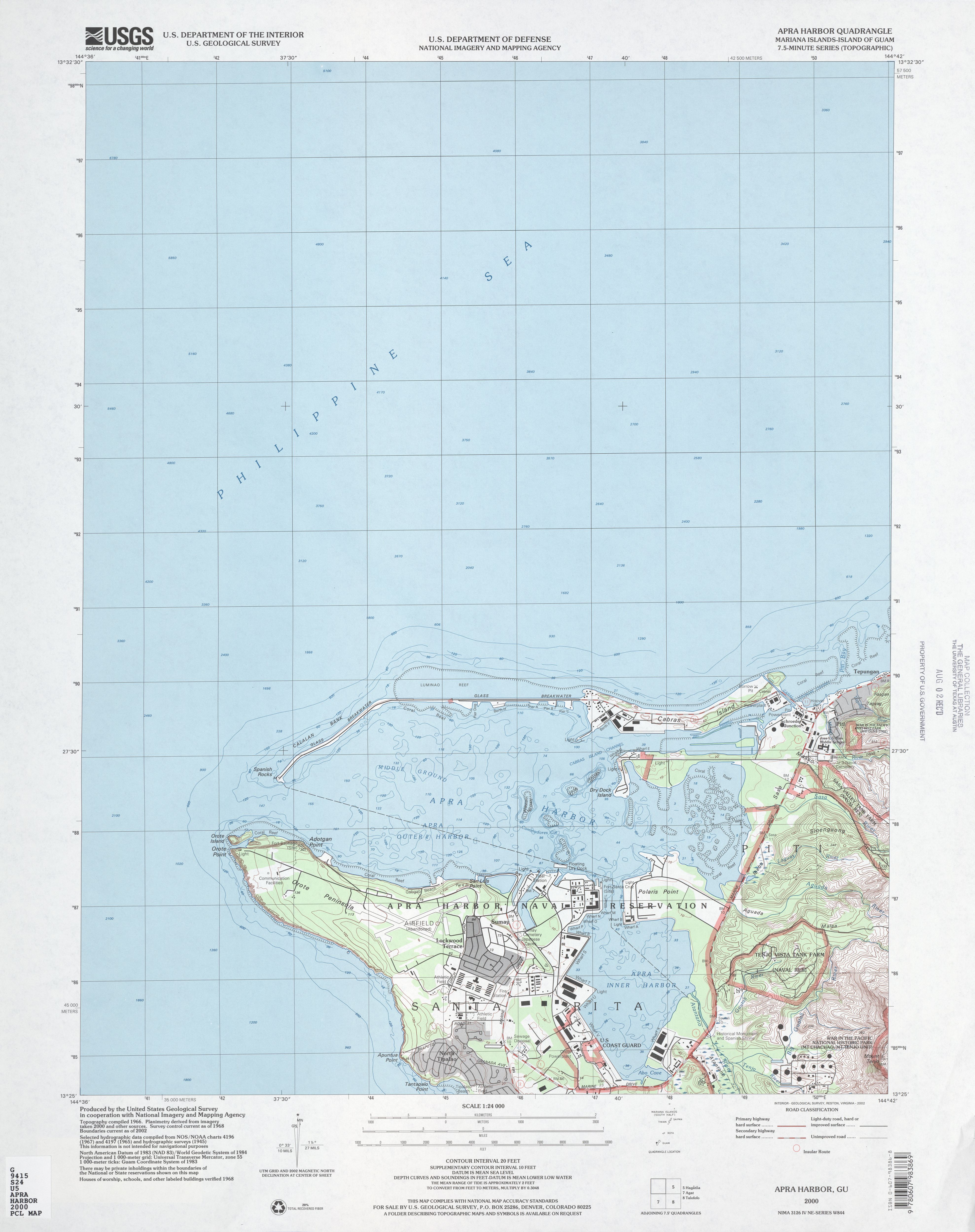
- Point Udall, Guam (13°26′51″N 144°37′5.5″E / 13.44750°N 144.618194°E) — westernmost point in all of U.S. territory, by direction of travel
- Peaked Island, offshore from Cape Wrangell, Attu Island, Alaska 52°55′14″N 172°26′16″E / 52.92056°N 172.43778°E — westernmost point in the 50 states, by direction of travel, and last sunset (at equinox) in all of U.S. territory
- Amatignak Island, Alaska 51°16′7″N 179°8′55″W / 51.26861°N 179.14861°W — westernmost point in all of US territory, by longitude
- Adak, Alaska 51°49′21″N 176°42′53″W / 51.8224°N 176.7147°W — westernmost incorporated town in the 50 states
- Unalaska, Alaska (176.636° West) - westernmost city of more than 2500 residents in the 50 states
- Cape Prince of Wales, Alaska 65°38′32″N 168°7′8″W / 65.64222°N 168.11889°W — westernmost point on the North American continent
- Anchor Point, Alaska (59°46′N 151°52′W / 59.767°N 151.867°W) — Westernmost point on the continuous road system of North America[3]
- Umatilla Reef, offshore from Cape Alava, Washington (48°11.1′N 124°47.1′W / 48.1850°N 124.7850°W) — westernmost point in the 48 contiguous states occasionally above water at low tide
- Bodelteh Islands, offshore from Cape Alava, Washington 48°10′42.7″N 124°46′18.1″W / 48.178528°N 124.771694°W — westernmost point in the 48 contiguous states continuously above water
- Cape Alava, Washington (48°9′51″N 124°43′59″W / 48.16417°N 124.73306°W) — westernmost point on the U.S. mainland (contiguous)
- Ozette, Washington — westernmost town in the 48 contiguous states
- Port Orford, Oregon 42°45′15″N 124°30′45″W / 42.754065°N 124.512605°W — westernmost incorporated place in the 48 contiguous states
- Brookings, Oregon — westernmost city of more than 5000 residents in the 48 contiguous states
- Eureka, California — westernmost city of more than 25,000 residents in the 48 contiguous states
- Corvallis, Oregon — westernmost city of more than 50,000 residents in the 48 contiguous states
- Eugene, Oregon — westernmost city of more than 100,000 residents in the 48 contiguous states
- Portland, Oregon — westernmost city of more than 500,000 residents in the 48 contiguous states
- Hawaii has the westernmost geographic center of all the states. Oregon has the westernmost geographic center of the 48 contiguous states.
- Note that maps of the 48 states that are displayed in an equal-area projection can give the impression that the state of California extends farther west than it actually does. The westernmost point in California (Cape Mendocino) is approximately seven miles east of the westernmost point in Oregon (Cape Blanco), and approximately 14 miles (23 km) east of the westernmost point in Washington (Cape Alava).
Extremes in elevation
- Mount McKinley, Alaska 63°4′10″N 151°0′26″W / 63.06944°N 151.00722°W (20,320 feet; 6,194 meters) — highest point in all of U.S. territory
- Mount Whitney, California 36°34′42.89″N 118°17′31.18″W / 36.5785806°N 118.2919944°W (14,505 feet; 4,421 meters) — highest point in the 48 contiguous states
- Mount Evans, Colorado 39°35′16″N 105°38′34″W / 39.58778°N 105.64278°W (14,120 feet, 4,304 meters) — highest road in the 48 contiguous states[4]
- Winter Park, Colorado 39°53′34″N 105°45′43″W / 39.89278°N 105.76194°W (12,060 feet; 3,676 meters) — highest city limits in all of U.S. territory (However, note that there are no permanent residents in Winter Park above the level of 10,000 ft.)
- Alma, Colorado 39°17′2″N 106°3′46″W / 39.28389°N 106.06278°W (10,355 feet; 3,156 meters) — highest town with permanent residents above 10,000 ft. in all of U.S. territory[5]
- Leadville, Colorado 39°14′50″N 106°17′30″W / 39.24722°N 106.29167°W (10,152 feet; 3,094 meters) — highest city, golf course (Mt Massive GC) and airport runway in all of U.S. territory
- Calipatria, California 33°07′32″N 115°30′51″W / 33.12556°N 115.51417°W (−184 feet; −56 meters) — lowest city in all of U.S. territory
- Badwater Basin (Death Valley), California 36°14′23″N 116°50′5″W / 36.23972°N 116.83472°W (−282 feet; −86 meters) — lowest surface point in all of U.S. territory
- Crater Lake bottom, Oregon 42°57′N 122°5′W / 42.950°N 122.083°W (−1,943 feet; −593 meters below surface / 4,230 feet; 1,289 meters above sea level) — deepest point below water surface in the United States[6]
- Lake Superior bottom, Michigan 46°54′31″N 86°35′52″W / 46.90861°N 86.59778°W (−1,333 feet; −406 meters below surface / −732 feet; −223 meters below sea level) — deepest point below water surface in the Great Lakes[7]
- Puget Sound bottom, Washington 47°44.9′N 122°25.7′W / 47.7483°N 122.4283°W (−949 feet; −289 meters below mean lower low water/ approximately −956 feet; −291 meters below mean sea level) — deepest point below sea level in the interior United States[8]
Extremes in distance
- Greatest distance between any two points within U.S. Territory: 9,514 miles from Point Udall, Guam to Point Udall, St. Croix, U.S. Virgin Islands (formerly known as Orote Point and East Point, respectively).[9]
- Greatest distance between any two points within the 50 states: 5,859 miles from Kure Atoll, Hawaii to Log Point, Elliott Key, Florida.[9]
- Greatest distance between any two points within the contiguous 48 states: 2,892 miles from Point Arena, California to West Quoddy Head, Maine.[9]
- Greatest distance between two points on the same latitude: 5,823 miles from Kure Atoll, Hawaii to Riviera Beach, Florida.[9]
- Note that some map projections make diagonal lines appear longer than they actually are. However, the diagonal line from Kure Atoll, Hawaii to West Quoddy Head, Maine is only 5,797 miles and the diagonal from Cape Wrangell, Attu Island, Alaska to Log Point on Elliott Key, Florida is only 5,505 miles.
Other
- Most remote point in the 50 states: Ipnavik River, National Petroleum Reserve–Alaska, 68°45′N 156°41′W / 68.750°N 156.683°W; 120 miles (195 km) from nearest habitation
- Geographic center of the 50 states: approximately 20 miles (34 km) north of Belle Fourche, South Dakota, 44°58′N 103°46′W / 44.967°N 103.767°W
- Geographic center of the 48 contiguous states: approximately 4 miles (6 km) west of Lebanon, Kansas, 39°50′N 98°35′W / 39.833°N 98.583°W
- Geographic center of North America: near Rugby, North Dakota, at 48°22′2″N 99°59′46″W.
- Continental pole of inaccessibility of North America: between Kyle and Allen, South Dakota, located 1650 km (1024 mi) from the nearest coastline at 43°22′N 101°58′W / 43.36°N 101.97°W.[10]
- Closest to the equator: Baker Island is located at 0°11′41″N 176°28′46″W / 0.19472°N 176.47944°W.[11][12][13]
Interpretation of easternmost and westernmost
There are three methods for reckoning the eastern and western extremes of the United States.
One method is to use the Prime Meridian as the dividing line between east and west. This meridian running through Greenwich, London, is defined as zero degrees longitude and could be called the least eastern and least western place in the world. The 180th meridian, on the opposite side of the globe, is therefore the easternmost and westernmost place in the world.
Another method is to use the International Date Line as the easternmost–westernmost extreme. On the equinox, the easternmost place would be where the day first begins, and the westernmost is where the day last ends.
Still another method is to first determine the geographic center of the country and from there measure the shortest distance to every other point. All U.S. territory is spread across less than 180° of longitude, so from any spot in the U.S. it is more direct to reach Point Udall, U.S. Virgin Islands, by traveling east than by traveling west. Likewise, there is not a single point in U.S. territory from which heading east is a shorter route to Point Udall, Guam, than heading west would be, even accounting for circumpolar routes. The two Udalls for whom the two Points are named were brothers, Mo Udall in Guam and Stewart Udall in the Virgin Islands.[14]
See also
- Geography of the United States
- Extreme points of Earth
- Extreme points of North America
- Extreme points of the Americas
- Extreme points of New England
- Extreme points of U.S. states (each state's extreme points)
- List of U.S. states by elevation
- Geographic centers of the United States
References
- ^ International Boundary Commission
- ^ http://www.quoddyloop.com/ep.shtml
- ^ The Milepost 61st edition pg. 626 ISBN 978-1892-15426-2
- ^ "Colorado". MSN Encarta. Archived from the original on 2009-10-31. Retrieved 2009-09-09.
{{cite web}}: Unknown parameter|deadurl=ignored (|url-status=suggested) (help) - ^ Rippold, R Scott (2007). "High on Alma". The Gazette (Colorado Springs). Retrieved 2007-08-05.
- ^ 2009 Crater Lake National Park map
- ^ Sounding at 46° 54' 31"N, 86° 35' 52"W on NOAA chart 14963, Grand Marais to Big Bay Point, scale 1:120,000, 2006. Chart datum (as shown on the chart) is 601.1 feet above mean sea level at Rimouski, Quebec
- ^ Two identical soundings at 47° 45.2'N, 122° 26.0'W and 47° 44.6'N, 122° 25.4'W on NOAA chart 18446, Puget Sound: Apple Cove Point to Keyport, scale 1:25,000, 2005. Chart datum (as shown on the chart) is lower low water.
- ^ a b c d http://egsc.usgs.gov/isb/pubs/booklets/elvadist/elvadist.html#Extreme
- ^ Garcia-Castellanos, D. (2007). "Poles of Inaccessibility: A Calculation Algorithm for the Remotest Places on Earth" (PDF). Scottish Geographical Journal. 123 (3): 227–233. doi:10.1080/14702540801897809. Retrieved 2008.
{{cite journal}}: Check date values in:|accessdate=(help); Unknown parameter|coauthors=ignored (|author=suggested) (help) - ^ "Baker Island". Geographic Names Information System. United States Geological Survey, United States Department of the Interior. Retrieved 2009-02-24.
- ^ "State University Encyclopedia: Equator". State University Encyclopedia. Retrieved 2009-07-03.
- ^ "CIA World Factbook: Jarvis Island". CIA World Factbook. Retrieved 2009-07-03.
- ^ Donald Winslow Carson; James W. Johnson (2001). Life and times of Morris K. Udall. University of Arizona Press. p. 220. ISBN 0816520496.
External links
- Text of congressional resolution designating Udall Point, Guam
- Maps of Orote Point, Guam:
- Map of Ballast Key, FL
- Detailed US coastline maps