
Cortland County, New York
Cortland County | |
|---|---|
 Location within the U.S. state of New York | |
 New York's location within the U.S. | |
| Coordinates: 42°36′00″N 76°04′00″W / 42.6°N 76.0667°W | |
| Country | |
| State | |
| Founded | 1808 |
| Seat | Cortland |
| Population (2000) | |
| • Total | 48,599 |
| Website | www |
Cortland County is a county located in the U.S. state of New York. As of the 2000 census, the population was 48,599. The county seat is Cortland. The name is in honor of Pierre Van Cortlandt (despite the difference in spelling), president of the convention at Kingston that wrote the first New York State Constitution in 1777 and first lieutenant governor of the state.
History
Early history
Located in the glaciated Appalachian Plateau area of Central New York State, midway between Syracuse and Binghamton, this predominantly rural county is the southeastern gateway to the Finger Lakes Region. Scattered archaeological evidence indicates three different aboriginal cultures hunted the area beginning about 1500 A. D.
What was to become Cortland County remained within Indian territory until the American Revolution. It became part of the Military Tract, when in 1781, more than 1¼ million acres (5,100 km²) were set aside by the State's Legislature to compensate two regiments formed to protect the State's western section from the English and their Iroquois allies, at the close of the Revolution. To encourage settlement in the upstate isolated wilderness, the State constructed a road from Oxford through Cortland County to Cayuga Lake in 1792-94. This, and construction of privately financed roads, were the major impetus to settlement.
When counties were established in New York State in 1683, the present Cortland County was part of Albany County. This was an enormous county, including the northern part of New York State as well as all of the present State of Vermont and, in theory, extending westward to the Pacific Ocean. This county was reduced in size on July 3, 1766 by the creation of Cumberland County, and further on March 16, 1770 by the creation of Gloucester County, both containing territory now in Vermont.
On March 12, 1772, what was left of Albany County was split into three parts, one remaining under the name Albany County. One of the other pieces, Tryon County, contained the western portion (and thus, since no western boundary was specified, theoretically still extended west to the Pacific). The eastern boundary of Tryon County was approximately five miles west of the present city of Schenectady, and the county included the western part of the Adirondack Mountains and the area west of the West Branch of the Delaware River. The area then designated as Tryon County now includes 37 counties of New York State. The county was named for William Tryon, colonial governor of New York.
In the years prior to 1776, most of the Loyalists in Tryon County fled to Canada. In 1784, following the peace treaty that ended the American Revolutionary War, the name of Tryon County was changed to honor the general, Richard Montgomery, who had captured several places in Canada and died attempting to capture the city of Quebec, replacing the name of the hated British governor. Montgomery County was reduced in size in 1789 by the splitting off of Ontario County. The actual area split off from Montgomery County was much larger than the present county, also including the present Allegany, Cattaraugus, Chautauqua, Erie, Genesee, Livingston, Monroe, Niagara, Orleans, Steuben, Wyoming, Yates, and part of Schuyler and Wayne Counties.
In 1791, Herkimer County was one of three counties split off from Montgomery (the others being Otsego, and Tioga Counties).
Onondaga County was formed from Herkimer County in 1794.
Cortland County was formed by the splitting of Onondaga County in 1808.
Settlement of the county
Eastern New Yorkers and New Englanders, wanting new land to farm, welcomed the opening of this frontier. The first white settlement in the county was made in 1791 by Amos Todd, Joseph Beebe and Rhoda Todd Beebe, emigrants from Connecticut who paddled up the Tioughnioga River from Windsor, to live near the head of navigation in the Town of Homer. Following them came a flood of settlers who, in 1808, petitioned the State Legislature for county status. Thus, Cortland County was created from the southern half of Onondaga County as part of the Boston Ten Towns on April 8, 1808, and was named in honor of the Pierre Van Cortlandt family - Pierre, Sr. having been the first lieutenant governor of the state.
The Nineteenth Century
The 76th New York Volunteer Infantry was one of the most famous of the New York units in the Civil War. It was raised in 1861 primarily from Cortland County and the surrounding areas (about a third of the men were from the Cherry Valley area). The 76th was in most of the major battles the Army of the Potomac fought from Second Bull Run through Petersburg, at which time the three-year enlistment of most of the men ran out and the 300 or so men remaining from the 1,100 who left Cortland either returned home or transferred to other units.
At the Battle of Gettysburg, the 76th New York was one of the first infantry regiments on the field, holding down the extreme right of the Union line on the first day. The regiment took huge casualties in that battle - nearly one-third of its strength - including its commander Major Andrew J. Grover, the first infantry officer killed in the battle.
Modern Cortland County
Today, Cortland county is noted for the production of CNC milling machines; hospitality supplies; medical instruments and components; textiles; electrical components; plastic consumer goods; components for NASA and a variety of other goods and services. International exporting is an integral part of many of the corporations in the area.
The county's present reflects its past. Agri-business flourishes yet, consistent with the pattern elsewhere in New York State, the number of farms has declined while farm size and yield have increased. Continued growth in the service and light industry sectors is contributing to the growing strength of the Central New York region.
The proximity to major highways, a diverse workforce and the influx of technological research and other resources from nearby Universities and Colleges contribute to the economic strength and potential of the region. Cornell University, Syracuse University, SUNY Binghamton and Ithaca College are all within an easy 45 minute drive of the City of Cortland. In addition the State University College SUNY at Cortland (rated #11 on the top partying schools list in Playboy Magazine) and local Community College TC-3 contribute to the cultural and economic fabric of central New York.
Notable county residents
- William Dillon, Composer, lyricist, and vaudevillian.
- Nancy Duffy, Syracuse news personality and founder of the Syracuse St. Patrick's Day Parade.
- John J. McGraw, Hall Of Fame Major League Baseball player and manager from (Truxton).
- Ronnie James Dio , former frontman for Rainbow and Black Sabbath who now fronts his own band. A street in Cortland is named for him (Dio Way).
- Alton B. Parker, Democratic candidate for President in 1904.
- Elmer Ambrose Sperry, Prolific Inventor who invented gyroscopic compass and held over 400 patents. USS Sperry (AS-12) named after him.
Geography
Cortland County is somewhat to the west of the center of New York State, south of Syracuse and north of Binghamton.
According to the U.S. Census Bureau, the county has a total area of 1,299 km² (502 mi²). 1,294 km² (500 mi²) of it is land and 5 km² (2 mi²) of it (0.37%) is water.
- Onondaga County, New York - north
- Madison County, New York - northeast
- Chenango County, New York - east
- Broome County, New York - southeast
- Tompkins County, New York - southwest
- Tioga County, New York - southwest
- Cayuga County, New York - northwest
Demographics
As of the census² of 2000, there were 48,599 people, 18,210 households, and 11,617 families residing in the county. The population density was 38/km² (97/mi²). There were 20,116 housing units at an average density of 16/km² (40/mi²). The racial makeup of the county was 96.95% White, 0.86% Black or African American, 0.27% Native American, 0.41% Asian, 0.01% Pacific Islander, 0.32% from other races, and 1.18% from two or more races. 1.16% of the population were Hispanic or Latino of any race.
There were 18,210 households out of which 31.00% had children under the age of 18 living with them, 49.20% were married couples living together, 10.30% had a female householder with no husband present, and 36.20% were non-families. 26.50% of all households were made up of individuals and 10.40% had someone living alone who was 65 years of age or older. The average household size was 2.50 and the average family size was 3.00.
In the county the population was spread out with 23.70% under the age of 18, 15.50% from 18 to 24, 26.50% from 25 to 44, 21.80% from 45 to 64, and 12.50% who were 65 years of age or older. The median age was 34 years. For every 100 females there were 93.50 males. For every 100 females age 18 and over, there were 90.00 males.
The median income for a household in the county was $34,364, and the median income for a family was $42,204. Males had a median income of $30,814 versus $22,166 for females. The per capita income for the county was $16,622. About 9.30% of families and 15.50% of the population were below the poverty line, including 16.40% of those under age 18 and 10.80% of those age 65 or over.
Cities and towns
- Cincinnatus (town)
- Cortland West
- Cortland (city)
- Cortlandville (town)
- Cuyler (town)
- Freetown (town)
- Harford (town)
- Homer (town)
- Homer (village)
- Lapeer (town)
- Marathon (town)
- Marathon (village)
- McGraw (village)
- Munsons Corners
- Preble (town)
- Scott (town)
- Solon (town)
- Taylor (town)
- Truxton (town)
- Virgil (town)
- Willet (town)
- => Label in parentheses is official political designation.
Education
External links
- Cortland County official website
- Cortland County at Curlie
- Cortland County Economic Development
- Cortland County Chamber of Commerce
- Cortland County Convention & Visitors Bureau
- Early history of Cortland County and its towns
Municipalities and communities of Cortland County, New York, United States | ||
|---|---|---|
| City | 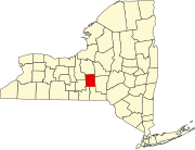 | |
| Towns | ||
| Villages | ||
| CDPs | ||
| Hamlets | ||