
Gulfton, Houston

Gulfton is a community of western Houston, Texas, United States.
Gulfton, a 3.2 sq mi (8.3 km2) group of apartment complexes with a mostly Hispanic and immigrant population, is located outside of the 610 Loop and inside Beltway 8, west of the city of Bellaire, east and south of U.S. Highway 59, and north of Bellaire Boulevard.[1] The Greater Southwest Houston Chamber of Commerce defines Gulfton as a part of "Southwest Houston."[2] Susan Rogers, author of "Superneighborhood 27: A Brief History of Change," described Gulfton as one of several "low-rent suburban environments."[3]
History

Gulfton consisted of greenfield land before the 1950s. Shenandoah, consisting of 16 blocks of ranch-style homes and the first subdivision in the area, opened in the mid-1950s.[3] The apartments opened during the Oil Boom of the 1970s; they were built for and housed many young, predominately White people who originated from Rust Belt areas in the Northeast and Midwest United States.[3]
In the 1980s the economy declined and thousands of renters left, causing a rise in vacancies. Apartment complex owners noticed that many immigrants from countries such as Mexico, El Salvador, and Vietnam wished to settle in Houston, so the owners abandoned previous adults only policies that barred children from living in the complexes, listed vacancies in Spanish, and reduced rents.[3]
Crime increased in the area, so many Houstonians gave the neighborhood the name Gulfton Ghetto[3]; A 2005 KHOU-TV report stated that Mara Salvatrucha (MS-13) criminals operate in Gulfton.[4] The Shenandoah subdivision barricaded its streets, closing itself from Gulfton.[3]
Robert Fisher, PhD, a professor and chair of Political Social Work at the Graduate School of Social Work at the University of Houston, and Lisa Taafe, LMSW, a project manager for Houston's "Communities in Schools" state inPublic Life in Gulfton: Multiple Publics and Models of Organization[5] that the development and decline of Gulfton originated from a "purely short term, relatively spontaneous speculative process" that focused on building apartment complexes, clubs, and warehouses for short-term profit without providing supporting infrastructure such as parks, libraries, recreation centers, small blocks, and sidewalks; one park exists in Gulfton.[3]
The prominence of the Hispanic community lead to changes in area businesses; for instance Kroger remodeled its Gulfton-area store to cater to Hispanics in the 2000s.[6]
Beatrice Marquez, a Houston Independent School District parent involvement specialist for the Gulfton area, stated in a 2004 Education Week article that many immigrants in many Central American communities specifically identify themselves as going to Gulfton instead of going to Houston.[7]
Geography
Gulfton includes around 90 apartment complexes with more than 15,000 apartment units. In the 1970s one apartment complex included seventeen swimming pools with seventeen hot tubs total, seventeen laundry rooms, and two club houses. Other buildings in Gulfton include strip centers and office blocks.[8][3]
The apartments contain features catering to young adults and lack features catering to families. Gulfton as of 2005 contains more than one hundred semi-private swimming pools; many of them had been filled.[3]
The city block pattern of Gulfton differs from the city block pattern of Downtown Houston; sixteen city blocks in Downtown could fit in one city block of Gulfton. Few areas in Gulfton have sidewalks.[3]
Demographics
Between 1980 and 2000 the population of Gulfton increased almost by 100% with no additional complexes established. By 2005 60% of Gulfton residents were not born in the United States and held citizenships of 42 countries. Many Gulfton residents were illegal immigrants. More than 20 percent of the households do not own cars.[3]
The 2000 Census stated that Gulfton, described as a "hard to enumerate" tract by the U.S. Census Bureau, is the densest neighborhood in the City of Houston; it reported 45,000 people in approximately three square miles. Some community leaders believed that the true population was closer to 70,000. Underrepresentation in the census is possible due to the fact that many of the area's immigrants, especially those residing in the country illegally, may be distrustful of the government's attempt to obtain personal information.[9][3]
By 2000 many Gulfton residents consisted of recent immigrants from Mexico and other Latin Americann countries.[10] In 2000, the City of Houston's Gulfton Super Neighborhood #27, which includes Gulfton and various surrounding subdivisions, reported a population of 46,369 people. Of them 34,410 (74%) were Hispanic. 5,029 were White, 4,047 were Black, 2,081 were Asian, 61 were Native American, 13 were Native Hawaiian, and 97 were of other races and were not Hispanic. 631 were of two or more races.[11]
Of the 32,298 reported residents aged above 18, 22,941 (71%) were Hispanic. 4,064 were non-Hispanic White, 2,980 were Black, 1,715 were Asian, 38 were Native American, 10 were Native Hawaiian, and 65 were of other races and were not Hispanic. 485 were of two or more races.[11]
The super neighborhood contained 17,467 housing units; of the 15,659 occupied units 14,865 were rental units and 794 were owner units. Super Neighborhood #27 had 9,930 families counted in the census, forming a total of 36,019 people within them. The super neighborhood's average family size was 3.63, compared with a city average of 3.39.[11]
The St. Luke's Episcopal Health Charities 2007 Community Health Report on Gulfton included Gulfton and some areas north of Gulfton; the U.S. Census reported that area to have 60,637 people in the 2000 census. Since 1990 that area's population increased by 16,000 people (over 26.5 percent) and the area's Hispanic population increased by nearly 16 percent. In a twenty year span ending in 2000 the non-Hispanic White population decreased by 50 percent. In 1980 about 15 percent of the area population consisted of children. In 2000 nearly 30 percent of the population consisted of children.[8]
Infrastructure and government

The department operates Gulfton is served by the Houston Police Department's Fondren Patrol Division, headquartered at 11168 Fondren Road.[12][13] The department operates the Gulfton Storefront Station, located at 5980 Renwick.[13] The storefront opened in Summer 1990.[14]
The Houston Fire Department provides fire protection services. The HFD Fire District 68 Primary Run Area covers Gulfton; Gulfton is located near Fire Station 51 Sharpstown.[15]
Two city council districts, District C and District F, cover portions of Gulfton. As of 2008 Anne Clutterbuck and M. J. Khan, respectively, represent the two districts.[16][17][18]
Gulfton is in Texas's 9th congressional district; as of 2008 Al Green represents the district.[19]
Metropolitan Transit Authority of Harris County, Texas (METRO) operates bus services in Gulfton. Lines serving Gulfton include 2 Bellaire, 9 North Main/Gulfton, 33 Post Oak Crosstown, 47 Hillcroft Crosstown, and 163 Fondren Express.[20][21]
Economy
The Gulfton area includes land used for commercial and light industrial purposes.[10] The corporate office for Rice Epicurean Markets, a Houston-area grocery store chain, is located at 5333 Gulfton Drive in the Gulfton area.[22]
Education


Primary and secondary schools
Gulfton is zoned to public schools in the Houston Independent School District.
The attendance boundaries of Benavidez Elementary School, Braeburn Elementary School, Cunningham Elementary School, and Rodriguez Elementary School cover sections of Gulfton.[23][24][25][26]
The area is zoned to Jane Long Middle School (with Pin Oak Middle School as an option) and Lee High School (with Lamar and Westside high schools as options).[27][28][29][30] Most Gulfton high school-aged residents attend Lee High School.[1] [31]
Gabriela Mistral Early Childhood Center in Gulfton is the early childhood center closest to Gulfton. Poor students, homeless students, students who are not proficient in English, and children of active-duty members of the U.S. military or whose parent has been killed, injured, or missing in action while on active duty may attend Mistral.[32]
The former Las Américas Education Center (containing Las Américas Middle School, Las Américas Early Childhood, and Kaleidoscope Middle School) in Gulfton closed due to an expired lease. The early childhood center merged with Mistral. The middle schools moved to a new building at 6501 Bellaire Boulevard.[33]
Due to the increasing populations, Cunningham Elementary School and Benavidez Elementary School became overcrowded in the 1990s.[34]
The Holy Ghost School, a PreK-8 Roman Catholic school operated by the Roman Catholic Archdiocese of Galveston-Houston, is near Gulfton.[35]
Gallery of schools
-
 Cunningham Elementary School
 -
 Long Middle School
 -

-
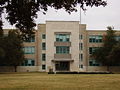
 Lee High School serves most Gulfton high school-aged students
 -
-


Colleges and universities

Gulfton is within the jurisdiction of the Houston Community College System (HCCS). The community college district operates the HCCS Gulfton Center, located at 5407 Gulfton Drive. The West Loop Center at 5601 West Loop South, also operated by HCCS, is in close proximity to Gulfton.
Sports and recreation
The Houston Parks and Recreation Department operates Burnett Bayland Park and Burnett Bayland Community Center, located in Gulfton. The complex has an outdoor basketball court, a hike and bicycle trail, a playground, a lighted athletics field, a playground, and a water playground.[36]
The popularity of soccer (football) in the neighborhood flourished after the Southwest Houston Soccer Association was established in the 1990s; prior to its establishment, a few adult team existed while a children's league did not exist. Silvia Ramirez, a soccer coach, said in a 1995 Houston Press article that a lack of confidence in English language abilities and time consumed by work prevented many area residents from creating soccer leagues. Some people stated in the same article that the will to play soccer prevented them from joining gangs.[37]
See also
References
- ^ a b "Success Stories." Office of Juvenile and Delinquency Prevention. United States Department of Justice. Accessed April 5, 2008.
- ^ "WELCOME TO SOUTHWEST HOUSTON!." Greater Southwest Houston Chamber of Commerce.
- ^ a b c d e f g h i j k l Rogers, Susan. "Superneighborhood 27: A Brief History of Change." California Digital Library.
- ^ "Up Close: Life is tough in the 'Gulfton Ghetto'." KHOU-TV. June 17, 2005.
- ^ "Public Life in Gulfton: Multiple Publics and Models of Organization." Community Practice: Models in Action. 31.
- ^ "RETAIL / H-E-B turning a store into `a Mexican village' / Grocery chain looks to Latinos with the concept of Mi Tienda." Houston Chronicle. October 3, 2006
- ^ "Personal Touches." Education Week.
- ^ a b "2007 Community Health Report: The Gulfton Area Neighborhood." St. Luke's Episcopal Health Charities. Retrieved on May 10, 2008.
- ^ "AFRAID TO BE COUNTED / New immigrants often bring fears from homelands." Houston Chronicle.
- ^ a b "Super Neighborhood #27 Gulfton." City of Houston.
- ^ a b c "Census 2000: Demographic Data by Super Neighborhood Gulfton #27." City of Houston.
- ^ "Crime Statistics for Fondren Patrol Division." City of Houston.
- ^ a b "VOLUNTEER INITIATIVES PROGRAM - Citizens Offering Police Support." City of Houston.
- ^ "`Storefront' police station funding debated." Houston Chronicle. Accessed April 16, 2008.
- ^ "Primary Run Area." Houston Fire Department Station 68.
- ^ "COUNCIL DISTRICT MAPS > DISTRICT C." City of Houston.
- ^ "COUNCIL DISTRICT MAPS > DISTRICT F." City of Houston.
- ^ "City Council." City of Houston. Retrieved on May 10, 2008.
- ^ "Congressional District 9." National Atlas of the United States.
- ^ "System Map." Metropolitan Transit Authority of Harris County, Texas.
- ^ "Schedules." Metropolitan Transit Authority of Harris County, Texas.
- ^ "Rice Epicurean Store Locations." Rice Epicurean Markets.
- ^ "Benavidez Elementary Attendance Zone." Houston Independent School District.
- ^ "Benavidez Elementary Attendance Zone." Houston Independent School District.
- ^ "Cunningham Elementary Attendance Zone." Houston Independent School District.
- ^ "Rodriguez Attendance Zone." Houston Independent School District.
- ^ "Long Middle Attendance Zone." Houston Independent School District.
- ^ "Pin Oak Middle School." The Southwest District. Houston Independent School District.
- ^ "Lee High School Attendance Zone." Houston Independent School District.
- ^ Home Page as of May 9, 2005. Lee High School.
- ^ "2007 Community Health Report: The Gulfton Area Neighborhood." St. Luke's Episcopal Health Centers.
- ^ "Early Childhood and Prekindergarten Programs." Houston Independent School District.
- ^ "Charter School Agreements Renewed, But Las Américas to Close." Houston Independent School District.
- ^ "AFRAID TO BE COUNTED / New immigrants often bring fears from homelands." Houston Chronicle.
- ^ "Gulfton." Greater Southwest Houston Chamber of Commerce.
- ^ "Burnett Bayland Park and Burnett Bayland Community Center." City of Houston.
- ^ "Kicking the Gang Attraction." Houston Press.
