Port Jervis Line
| Port Jervis Line | |||
|---|---|---|---|
| File:Port Jervis Train at Middletown.jpg A Port Jervis Train boarding at Middletown Station, bound for Port Jervis. | |||
| Overview | |||
| Status | Operating | ||
| Owner | New Jersey Transit (Hoboken Terminal to Suffern) Norfolk Southern Railway (Suffern to Port Jervis, Southern Tier Line leased to and maintained by Metro-North Railroad) | ||
| Locale | Northern New Jersey and Hudson Valley, United States | ||
| Termini |
| ||
| Stations | 26 | ||
| Service | |||
| Type | Commuter rail | ||
| System | New Jersey Transit and Metro-North Railroad | ||
| Operator(s) | New Jersey Transit (under contract to Metro-North Railroad) | ||
| Rolling stock | F40PH-2CAT/GP40PH-2/GP40FH-2/PL42AC/ALP-45DP locomotives Comet V | ||
| Technical | |||
| Track length | 95.0 miles (152.9 km) | ||
| Track gauge | 1,435 mm (4 ft 8+1⁄2 in) | ||
| |||
The Metro-North Railroad's Port Jervis Line is a predominantly single-track commuter rail line running between Suffern and Port Jervis, in the U.S. state of New York. At Suffern, the line continues south into New Jersey as New Jersey Transit's Main Line.
New Jersey Transit provides service on the sections of the lines in New York State via a working agreement with Metro-North. This includes trains along the Port Jervis extension of the line with 13 New York-bound and 14 Port Jervis-bound trains on weekdays, and nine trains in each direction on weekends. Norfolk Southern Railway (NS) shares use of this track for local freight operations between Suffern and Port Jervis. The New York, Susquehanna and Western Railway operates over the line between Hudson Junction (east of Campbell Hall) and Port Jervis, and onward to Binghamton over the former Erie's Delaware Division. The tracks have been owned by NS since the 1999 split of Conrail, but were built by the New York and Erie Rail Road and incorporated into Conrail on its formation on April 1, 1976. Metro-North leased the entire line from NS in 2003, with the possibility of outright purchase after 2006. MNR immediately began a substantial track and signal improvement program, in order to provide more reliable and comfortable service.
The Port Jervis line runs through some of the most remote and rural country found on the Metro-North system, and includes both its longest bridge and longest tunnel.
History
The portions of the line from Suffern to Harriman and from Otisville to Port Jervis were built as the main line of the New York and Erie Rail Road, opening to Port Jervis in 1848. The route south of Suffern is slightly younger (connected for through service in 1853); the original main line ran east from Suffern to Piermont. The portion from Harriman to Otisville was built in 1904–1908 as a low-level freight bypass named the Graham Line. This portion of the line bypasses the original Erie main line through Monroe, Chester, Goshen and Middletown.
The line, along with the Main Line through Paterson, served as a segment of the Erie Railroad's long-distance flagship trains to points west such as Binghamton, Buffalo, New York State's Southern Tier and Chicago, on daily routes such as the day route, the Erie Limited. Additional through trains to Chicago were the Pacific Limited, and its east-bound counterpart, the Atlantic Limited. The Lake Cities and the Pacific Limited were night-time departures.[1][2]The Erie Limited was discontinued in 1963. Other routes west were eliminated throughout the course of the 1960s. The last train west of Port Jervis, #21/#22, a daily train to Binghamton, had its final run on November 27, 1966.[3]
On November 14, 1973, the MTA agreed to subsidize existing Erie Lackawanna Railway service to Port Jervis, which became part of Conrail on April 1, 1976.[4]
In 1983 the Metro-North Railroad was formed to take over the commuter operations of Conrail in the state of New York.[5] This included service west of the Hudson River, where rail lines do not connect directly with New York City. These lines pass through New Jersey, stopping at Secaucus Junction, where New Jersey Transit trains provide service to New York Penn Station multiple times per hour, and terminating at Hoboken Terminal.
The MTA initially equipped the lines with second-hand equipment. In 1984 the Main Line between Harriman and Middletown was abandoned, and service was moved to the longer (by 6 miles) Graham Line, the Erie's freight cutoff. Officially, the first day of regular service on the Graham Line was April 18, 1983. New stations were built, but at low cost and without facilities. At the time this was a very unpopular move with commuters, who were used to having their trains stop right in the center of their towns. Alternatively, there was pressure put on the MTA by the towns to have the service moved out of the populated areas due to "traffic concerns." The Graham Line passed though no populated areas, and driving to the new stations added significant time to their commutes. However, others wanted trains out of the center of the towns, and so the switch was made. The old main line was no longer used for freight, so following the move to the Graham line, it was abandoned. The line from Harriman to Middletown is now the Orange County Heritage Trail.

In the mid-1990s, as Orange County started to become a popular place for commuters, political pressure caused the MTA to start improving service, building a new station in Middletown-Town of Wallkill, expanding parking at Harriman, and other improvements. In the 2000s growth in Orange County accelerated, so that the MTA added more service, and started to expand parking lots, which made paid lots in line with the rest of the Metro-North system.
One oddity that results from the unusual arrangement between the MTA and NJ Transit, is that although the MTA subsidizes the service and maintains all of the facilities (except for the Suffern station), the actual operation of the line is almost totally under the control of NJ Transit- the trains are operated by NJT personnel, the trains are dispatched from Hoboken, and the fare system is also under NJT control but with a mixture of NJT and Metro-North rules. Thus, the ticket vending machines on station platforms are NJT machines, not Metro-North's. This also means New York passengers on the Port Jervis Line only pay the maximum in-state fare NJT charges for its non-NYC in-state destinations.
Hurricane Irene
Service north of Suffern was suspended due to severe damage from Hurricane Irene in late August 2011. Shuttle train service between Harriman and Port Jervis started in September;[6] and full train service resumed on November 28, 2011.[7]

Future expansion
In 2008 Metro-North and the Port Authority of New York and New Jersey (PANYNJ) began a joint feasibility study of a possible branch from the line to Stewart International Airport, which the Port Authority had taken over the year before, ending a seven-year privatization experiment. The PANYNJ withdrew from the study after its first phase, having decided that express bus service could meet the same needs much more cheaply. Metro-North is continuing the study on its own. Future improvements for the line include the completion of the cab signalling system and the construction of a yard near Salisbury Mills to relieve pressure on the Suffern yard.[8] The Port Jervis Line runs from Hoboken Terminal to Port Jervis, via Middletown, NY.
Description


The Main Line starts at Hoboken and then stops at Secaucus Junction. Many of the Port Jervis Line trains travel non-stop from Secaucus to Suffern, some of them stopping at Ramsey Route 17 station. Some of the Port Jervis locals run via the Main Line between Secaucus and Ridgewood and the others run via the parallel Bergen County Line; the expresses may be routed either way at the discretion of the dispatchers. From Suffern northwards the line follows the same narrow valley as the New York State Thruway and NY 17. The Sloatsburg station is not very far from 17, Tuxedo is right on 17 and Harriman has its entrance on 17 but its actual platform adjacent to the Thruway. Harriman is the busiest station on the line. One peak hour train in each direction runs express from Harriman, with the next (or previous) stop being Secaucus Junction. The Tuxedo station is the one stop on the line with the original (1883) station house.
After crossing under the on ramp from 17 to the Thruway and passing Woodbury Commons the line gradually moves away from the Thruway, crossing NY 32 and running along the shoulder of Schunemunk Mountain, where it twice is crossed by hiking trails. At Schunemunk's north end it curves along to the Moodna Viaduct, the highest and longest railroad trestle east of the Mississippi River. Immediately afterwards it crosses NY 94 and arrives at Salisbury Mills-Cornwall in the Town of Cornwall.
The westward curve accelerates afterwards and the line begins to run almost east-west across central Orange County. Campbell Hall station services the towns of Goshen, Montgomery and Walden.
The track crosses the Wallkill River, then Interstate 84, to run parallel to NY 211 near Highland Lakes State Park for a while. Shortly after leaving the highway's side, trains arrive at Middletown near the popular Galleria at Crystal Run shopping mall.
Almost unnoticed from the highway, the line crosses under the Route 17 expressway (the future Interstate 86) after leaving Middletown. A second track begins at Howells, to accommodate trains waiting for others to clear the Otisville Tunnel. The siding rejoins the main line just after the Otisville station as trains enter a mile-long (1.6 km) tunnel under the Shawangunk Ridge, the longest on Metro-North.
Once on the western end, in some of the most undeveloped countryside Metro-North passes through, trains make a long descent of the west side of Shawangunk Ridge, parallel to the Neversink River valley southwards, reaching valley level just before the terminal station Port Jervis and the yard beyond.
Stations
Rolling stock

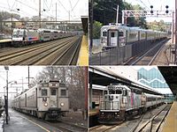
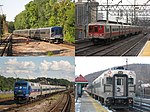
Since equipment is pooled with NJ Transit, quite a selection can be seen on the line. Most locomotives are NJT, ranging from EMD GP40PH2-CATs, F40PH2-CATs, PL42ACs, with the occasional ALP-45DP and P40DC. A total of eleven locomotives are in Metro-North colors. The entire group of Metro North locomotives are in the process of being rebuilt, one at a time, and will return re-numbered in the 4900–4910 series.
To equip the line, Metro-North has always used an 'add on' clause in their agreements with NJT. This allows Metro-North the option to add onto any NJT rolling stock purchases. With the 2003 purchase of 65 Comet V coaches, Metro-North included a provision for keeping the Metro-North labeled cars on the New York-based lines as much as possible, and the Bombardier-built coaches previously used were moved to East-of-Hudson service. Currently, all of the peak services are composed of MTA labeled equipment, but some off peak trains carry NJT branding (and vice versa).
Operation is push-pull, with locomotives normally facing west.
References
- ^ Erie timetable http://2.bp.blogspot.com/-hbGD2mfyMkc/T7kjQd-KydI/AAAAAAAAA60/yehO5grmGoA/s1600/PassSchedNY_PortJervis.png
- ^ Erie Lackawanna Long Distance Passenger Operations http://trainmanjim.tripod.com/id9.html
- ^ "The Decline and Fall of E-L Passenger Service" http://rails.jimgworld.com/psngrs.html
- ^ "http://www.prrths.com/Hagley/PRR1973%20Jun%2005.pdf" (PDF).
{{cite web}}: External link in|title= - ^ http://web.mta.info/mnr/html/aboutmnr.htm
- ^ Haughney, Christine (September 15, 2011). "Metro-North's Port Jervis Line Slowly Returns". The New York Times. Retrieved September 15, 2011.
- ^ Moses, Robert (November 23, 2011). "Metro North Port Jervis Line Set to Resume Service". Retrieved November 24, 2011.
- ^ Rife, Judy (May 16, 2012). "No Stewart rail link on horizon". Times-Herald Record. Middletown, NY. Retrieved May 19, 2012.
- ^ a b c "New Port Jervis Service - April 18, 1983". New York, New York: Metro-North Railroad. April 18, 1983. Retrieved May 26, 2013.
External links
| External videos | |
|---|---|
- The Port Jervis Line at piercehaviland.org
- NJT Port Jervis Line by Peggy Darlington[dead link]


