Rendelsham, South Australia
Appearance
| Rendelsham South Australia | |||||||||||||||
|---|---|---|---|---|---|---|---|---|---|---|---|---|---|---|---|
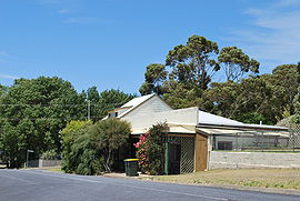
 House at Rendelsham | |||||||||||||||
| Coordinates | 37°32′59″S 140°13′28″E / 37.54973°S 140.22443°E[1] | ||||||||||||||
| Population | 200 (2016 census)[2] | ||||||||||||||
| Established | 22 January 1880 (town) 23 February 1995 (locality)[1] | ||||||||||||||
| Postcode(s) | 5280 | ||||||||||||||
| Elevation | 16 m (52 ft)(railway station)[3] | ||||||||||||||
| Time zone | ACST (UTC+9:30) | ||||||||||||||
| • Summer (DST) | ACST (UTC+10:30) | ||||||||||||||
| Location |
| ||||||||||||||
| LGA(s) | Wattle Range Council | ||||||||||||||
| Region | Limestone Coast[1] | ||||||||||||||
| County | Grey[1] | ||||||||||||||
| State electorate(s) | MacKillop[4] | ||||||||||||||
| Federal division(s) | Barker[5] | ||||||||||||||
| |||||||||||||||
| Footnotes | Adjoining localities[1] | ||||||||||||||
Rendelsham is a town in the south-east of South Australia, 392 kilometres (244 mi) south east of the state capital, Adelaide.[1] It is on the Southern Ports Highway between Beachport and Millicent.
Rendelsham was also on the narrow-gauge railway between Beachport and Mount Gambier from its opening in 1878 until 1957. When part of the line was converted to broad gauge, the part between Millicent and Beachport was decommissioned instead of converted, removing railway service from Rendelsham.
Rendelsham is located within the federal division of Barker, the state Electoral district of MacKillop and the local government area of the Wattle Range Council.[5][4][1]
References
- ^ a b c d e f g "Search results for 'Rendelsham, LOCB' with the following datasets being selected - 'Suburbs and Localities', 'Government Towns', 'Counties', 'Hundreds', 'Local Government Areas', 'SA Government Regions', 'Land Development Plan Zone Categories' and 'Gazetteer'". Location SA Map Viewer. Government of South Australia. Retrieved 22 February 2018.
- ^ Australian Bureau of Statistics (27 June 2017). "Rendelsham". 2016 Census QuickStats. Retrieved 22 February 2018.
- ^ "Search results for 'Rendelsham Railway Station' with the following datasets being selected - 'Suburbs and Localities', 'Government Towns' and 'Gazetteer'". Location SA Map Viewer. Government of South Australia. Retrieved 22 February 2018.
- ^ a b "District of MacKillop Background Profile". Electoral Commission SA. Retrieved 29 March 2016.
- ^ a b "Federal electoral division of Barker" (PDF). Australian Electoral Commission. Retrieved 28 March 2016.
Wikimedia Commons has media related to Rendelsham, South Australia.

