Longuenesse
Appearance
Longuenesse
Langenesse | |
|---|---|
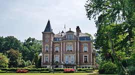
 The town hall of Longuenesse | |
| Coordinates: 50°44′11″N 2°14′18″E / 50.7364°N 2.2383°E | |
| Country | France |
| Region | Hauts-de-France |
| Department | Pas-de-Calais |
| Arrondissement | Saint-Omer |
| Canton | Longuenesse |
| Intercommunality | Pays de Saint-Omer |
| Government | |
| • Mayor (2020–2026) | Christian Coupez[1] |
Area 1 | 8.4 km2 (3.2 sq mi) |
| Population (2021)[2] | 10,568 |
| • Density | 1,300/km2 (3,300/sq mi) |
| Time zone | UTC+01:00 (CET) |
| • Summer (DST) | UTC+02:00 (CEST) |
| INSEE/Postal code | 62525 /62219 |
| Elevation | 3–79 m (9.8–259.2 ft) (avg. 75 m or 246 ft) |
| 1 French Land Register data, which excludes lakes, ponds, glaciers > 1 km2 (0.386 sq mi or 247 acres) and river estuaries. | |
Longuenesse (French pronunciation: [lɔ̃ɡnɛs]; Template:Lang-vls) is a commune in the Pas-de-Calais department in the Hauts-de-France region of France.[3]
Geography
Longuenesse is a large suburb of Saint-Omer, one mile southwest of the centre, on the D928 road.
Population
Graphs are unavailable due to technical issues. Updates on reimplementing the Graph extension, which will be known as the Chart extension, can be found on Phabricator and on MediaWiki.org. |
| Year | Pop. | ±% p.a. |
|---|---|---|
| 1968 | 4,794 | — |
| 1975 | 9,397 | +10.09% |
| 1982 | 11,970 | +3.52% |
| 1990 | 12,604 | +0.65% |
| 1999 | 12,518 | −0.08% |
| 2007 | 11,120 | −1.47% |
| 2012 | 11,108 | −0.02% |
| 2017 | 11,023 | −0.15% |
| Source: INSEE[4] | ||
Places of interest
- The church of St.Quentin, dating from the nineteenth century.
- An old abbey hostel.
- The fountain of Saint-Quentin.
- Vestiges of a monastery founded in 1298.
Twin towns
See also
References
- ^ "Répertoire national des élus: les maires" (in French). data.gouv.fr, Plateforme ouverte des données publiques françaises. 13 September 2022.
- ^ "Populations légales 2021" (in French). The National Institute of Statistics and Economic Studies. 28 December 2023.
- ^ INSEE commune file
- ^ Population en historique depuis 1968, INSEE
Wikimedia Commons has media related to Longuenesse.


