Si Phang Nga National Park
Appearance
| Si Phang Nga National Park | |
|---|---|
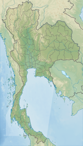
Map of Thailand | |
| Location | Phang Nga Province, Thailand |
| Nearest city | Takua Pa |
| Coordinates | 9°08′53″N 98°28′19″E / 9.148°N 98.472°E[1] |
| Area | 246.08 km2 (95.01 sq mi) |
| Established | 16 Apr 1988 |
| Governing body | Department of National Parks, Wildlife and Plant Conservation |
| Department of National Parks | |
Si Phang Nga National Park (Thai: ศรีพังงา) is in Phang Nga Province in southern Thailand, covering the eastern parts of the districts Khura Buri and Takua Pa.
The landscape of the park is dominated by rugged mountains covered with dipterocarp forests, similar to the Khao Sok adjoining it to the east.
The establishment of the park was announced in the Royal Gazette, Issue 105, Chapter 60 of 16 April 1988.
References
- ^ "Si Phangnga National Park". protectedplanet.net.
External links
Wikimedia Commons has media related to Si Phangnga National Park.

