Buffalo Narrows Airport
Appearance
Buffalo Narrows Airport | |||||||||||||||
|---|---|---|---|---|---|---|---|---|---|---|---|---|---|---|---|
| Summary | |||||||||||||||
| Airport type | Public | ||||||||||||||
| Operator | Ministry of Highways & Infrastructure | ||||||||||||||
| Location | Buffalo Narrows, Saskatchewan | ||||||||||||||
| Time zone | CST (UTC−06:00) | ||||||||||||||
| Elevation AMSL | 1,423 ft / 434 m | ||||||||||||||
| Coordinates | 55°50′31″N 108°25′03″W / 55.84194°N 108.41750°W | ||||||||||||||
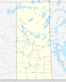
| Map | |||||||||||||||
 | |||||||||||||||
| Runways | |||||||||||||||
| |||||||||||||||
| Statistics (2010) | |||||||||||||||
| |||||||||||||||
Buffalo Narrows Airport, (IATA: YVT, ICAO: CYVT), is located 2 NM (3.7 km; 2.3 mi) east southeast of Buffalo Narrows, Saskatchewan, Canada.
Courtesy Air (formally called Buffalo Narrows Airways Ltd.) is based out of the airport, where it operates its maintenance facilities.[4]
Voyage Air maintains a base at the airport, including hangar and maintenance facilities for its Turbo Otter and DeHavilland Beaver.[5]
Airlines and destinations
| Airlines | Destinations |
|---|---|
| Transwest Air | Fort McMurray, Saskatoon |
See also
References
- ^ Canada Flight Supplement. Effective 0901Z 16 July 2020 to 0901Z 10 September 2020.
- ^ Synoptic/Metstat Station Information Archived June 27, 2013, at the Wayback Machine
- ^ Total aircraft movements by class of operation
- ^ Courtesy Air
- ^ Voyage Air
External links
- Page about this airport on COPA's Places to Fly airport directory
- Past three hours METARs, SPECI and current TAFs for Buffalo Narrows Airport from Nav Canada as available.


