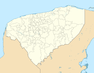
Cansahcab
Appearance
Cansahcab | |
|---|---|
Municipal Seat | |
 | |
| Coordinates: 21°9′26″N 89°6′7″W / 21.15722°N 89.10194°W | |
| Country | |
| State | Yucatán |
| Municipality | Cansahcab |
| Area | |
| • Total | 146.9 km2 (56.7 sq mi) |
| Elevation | 6 m (20 ft) |
| Population (2010)[2] | |
| • Total | 4,580 |
| Time zone | UTC-6 (Central Standard Time) |
| • Summer (DST) | UTC-5 (Central Daylight Time) |
| Postal code (of seat) | 92394 |
| Area code | 991 |
| INEGI code | 310090001 |
Cansahcab is a town and the municipal seat of the Cansahcab Municipality, Yucatán in Mexico.
References
- ^ Gobierno del Estado de Yucatán (2016). "Municipios de Yucatán - Cansahcab".
- ^ Instituto Nacional de Estadística y Geografía (2016). "Número de habitantes. Yucatán".


