
Berlin S-Bahn
| S-Bahn Berlin | |||
|---|---|---|---|
 Berlin Friedrichstrasse railway station, crossing point for the Stadtbahn and the Nord-Süd-Tunnel routes of the Berlin S-Bahn | |||
| Overview | |||
| Locale | Berlin | ||
| Transit type | Rapid transit | ||
| Number of lines | 15[1] | ||
| Number of stations | 166[1] | ||
| Daily ridership | 1,300,000 (average weekday, 2015)[2] | ||
| Annual ridership | 416.8 million (2015)[2] | ||
| Website | S-Bahn Berlin GmbH | ||
| Operation | |||
| Began operation | August 8, 1924 | ||
| Operator(s) | S-Bahn Berlin GmbH | ||
| Technical | |||
| System length | 327.4 km (203 mi)[1] | ||
| Track gauge | 1,435 mm (4 ft 8+1⁄2 in) (standard gauge) | ||
| Electrification | 800 V DC Third rail | ||
| Average speed | 39.9 km/h | ||
| |||

The Berlin S-Bahn is a rapid transit railway system in and around Berlin, the capital city of Germany. It has been in operation under this name since December 1930, having been previously called the special tariff area Berliner Stadt-, Ring- und Vorortbahnen (Berlin city, circular, and suburban railways).[1] It complements the Berlin U-Bahn and is the link to many outer-Berlin areas, such as Berlin Schönefeld Airport.
While in the first decades of this tariff zone the trains were steam-drawn, and while even after the electrification of large parts of the network a number of lines remained under steam, today the term S-Bahn is used in Berlin only for those lines and trains with third-rail electrical power transmission and the special Berlin S-Bahn loading gauge. The third unique technical feature, of the Berlin S-Bahn, the automated mechanical train control is being phased out and replaced by a communications-based train control system, but which again is specific to the Berlin S-Bahn.
In other parts of Germany and other German-speaking countries, the brand name S-Bahn is used without those Berlin specific features. The Hamburg S-Bahn is the only other system using third-rail electrification.
Today, the Berlin S-Bahn is no longer defined as this special tariff area of the national railway company, but is instead just one specific means of transportation, defined by its special technical characteristics, in an area-wide tariff administered by a public transport authority. The Berlin S-Bahn is now an integral part of the Verkehrsverbund Berlin-Brandenburg, the regional tariff zone for all kinds of public transit in and around Berlin and the federal state (Bundesland) of Brandenburg.
Introduction
The brand name "S-Bahn" chosen in 1930 mirrored U-Bahn, which had become the official brand name for the Berlin city-owned rapid transit lines begun under the name of Berliner Hoch- und Untergrundbahnen (Berlin elevated and underground lines), where the word of mouth had abbreviated "Untergrundbahn" to "U-Bahn", in parallel to "U-Boot" formed from "Unterseeboot" ("undersea boat" – submarine).
Services on the Berlin S-Bahn have been provided by the Prussian or German national railway company of the respective time, which means the Deutsche Reichsbahn-Gesellschaft after the First World War, the Deutsche Reichsbahn of the GDR (in both East and West Berlin) until 1993 (except West Berlin from 1984 to 1994, the BVG period) and Deutsche Bahn after its incorporation in 1994.
The Berlin S-Bahn consists today of 15 lines serving 166 stations, and runs over a total route length of 332 kilometres (206 mi).[1] The S-Bahn carried 395 million passengers in 2012.[2] It is integrated with the mostly underground U-Bahn to form the backbone of Berlin's rapid transport system. Unlike the U-Bahn, the S-Bahn crosses Berlin city limits into the surrounding state of Brandenburg, e.g. to Potsdam.
Although the S- and U-Bahn are part of a unified fare system, they have different operators. The S-Bahn is operated by S-Bahn Berlin GmbH, a subsidiary of the Deutsche Bahn, whereas the U-Bahn is run by BVG, the main public transit company for the city of Berlin.
Operation
Network
The S-Bahn routes all feed into one of three core lines: a central, elevated east-west line (the Stadtbahn), a central, mostly underground north-south line (the Nord-Süd Tunnel), and a circular line (the Ringbahn). Outside the Ringbahn, suburban routes radiate in all directions.
Lines S1, S2 and S25 are north-south lines that use the North-South tunnel as their midsection. They were equally distributed into Oranienburg, Bernau and Hennigsdorf in the north, and Teltow Stadt, Lichtenrade and Wannsee.
Lines S3, S5, S7 and S75 are east-west lines using the Stadtbahn cross-city railway (S3 ends temporarily, from December 2011 to 2017, at Ostkreuz instead of Spandau during a phase of the remodelling of the Ostkreuz interchange station[3]). The western terminii are located at Potsdam and Spandau. The eastern terminii are Erkner, Strausberg Nord, Ahrensfelde and Wartenberg. Before 2009 and after 2017, the S9 used and will use a connector curve (Südkurve) at Ostkreuz to change from Stadtbahn to the South-Western leg of the Ringbahn. Another curve, the Nordkurve to the North-Western Ringbahn, was originally served by the S86 line, but it was demolished in preparation of the rebuilding of Ostkreuz station and will not be rebuilt afterwards. Both connector curves were heavily used in the time of the Berlin Wall, as trains coming from the North-Eastern routes couldn't use the West Berlin North-South route and the Southern leg of the pre- and post-Wall Ringbahn was in West Berlin.
Lines S41 and S42 continuously circle around the Ringbahn, the former clockwise, the latter anti-clockwise. Lines S45, S46 and S47 link destinations in the southeast with the southern section of the Ringbahn via the tangential link from the Görlitzer Bahn to the Ring via Köllnische Heide.
Lines S8, S85, and S9 are north-south lines using the eastern section of the Ringbahn between Bornholmer Straße and Treptower Park via Ostkreuz, using the Görlitzer Bahn in the South.
Routes
Generally speaking, the first digit of a route number denotes the main route or a group of routes. Thus, S25 is a branch of S2, while S41, S42, S45, S46, and S47 are all Ringbahn routes that share some of the same route. So S41, S42, S45, S46 and S47 are together S4. However, the S4 does not exist as an independent entity.
Since 9 January 1984, all the West Berlin S-Bahn routes are labelled with an "S" followed by a number. This system had been in use with other West German S-Bahn systems (such as Hamburg) for years. On 2 June 1991 this was extended to the East Berlin lines as well. Internally, the Berlin S-Bahn uses Zuggruppen (literally groups of trains) which normally run every twenty minutes. Some lines, e.g. the S85, are made up of only one Zuggruppe, while others, like S5, are actually multiple Zuggruppen combined.
| Line | Terminus | Route | Terminus | Color |
|---|---|---|---|---|
| Template:BLNMT-icon | Wannsee | Wannsee - Nikolassee - Mexikoplatz - Schöneberg - Yorckstraße - Potsdamer Platz - Friedrichstraße - Nordbahnhof - Gesundbrunnen - Schönholz - Wittenau - Waidmannslust - Frohnau - Hohen Neuendorf - Birkenwerder - Oranienburg | Oranienburg | RAL 4003 |
| Template:BLNMT-icon | Blankenfelde | Blankenfelde - Lichtenrade - Südkreuz - Yorckstraße - Potsdamer Platz - Friedrichstraße - Nordbahnhof - Gesundbrunnen - Bornholmer Straße - Pankow - Blankenburg - Karow - Buch - Bernau | Bernau | RAL 6001 |
| Template:BLNMT-icon | Teltow Stadt | Teltow Stadt - Lichterfelde Süd - Lichterfelde Ost - Südkreuz - Yorckstraße - Potsdamer Platz - Friedrichstraße - Nordbahnhof - Gesundbrunnen - Bornholmer Straße - Schönholz - Karl-Bonnhoeffer-Nervenklinik - Tegel - Hennigsdorf | Hennigsdorf | RAL 6001 |
| Template:BLNMT-icon | Erkner | Erkner - Ostkreuz | Ostkreuz | RAL 5017 |
| Template:BLNMT-icon | Südkreuz | Ringbahn | Südkreuz (clockwise) | RAL 8004 |
| Template:BLNMT-icon | Südkreuz | Ringbahn | Südkreuz (counter-clockwise) | RAL 8021 |
| Template:BLNMT-icon | ✈ Berlin-Schönefeld | Südkreuz - Tempelhof - Neukölln - Baumschulenweg - Schöneweide - Schönefeld | Südkreuz (↔ Bundesplatz) | RAL 1011 |
| Template:BLNMT-icon | Königs Wusterhausen | Westend - Messe Nord/ICC - Westkreuz - Halensee - Schöneberg - Südkreuz - Tempelhof - Hermannstraße - Neukölln - Schöneweide - Grünau - Königs Wusterhausen | Westend | RAL 1011 |
| Template:BLNMT-icon | Spindlersfeld | Spindlersfeld - Schöneweide - Neukölln - Hermannstraße | Hermannstraße | RAL 1011 |
| Template:BLNMT-icon | Spandau | Spandau - Olympiastadion - Messe Süd - Westkreuz - Charlottenburg - Zoologischer Garten - Hauptbahnhof - Friedrichstraße - Hackescher Markt - Alexanderplatz - Jannowitzbrücke - Ostbahnhof - Warschauer Straße - Ostkreuz - Nöldnerplatz - Lichtenberg - Friedrichsfelde Ost - Wuhletal - Kaulsdorf - Mahlsdorf - Hoppegarten - Strausberg - Strausberg Stadt - Strausberg Nord | Strausberg Nord | RAL 2008 |
| Template:BLNMT-icon | Ahrensfelde | Ahrensfelde - Marzahn - Springpfuhl - Lichtenberg - Nöldnerplatz - Ostkreuz - Warschauer Straße - Osbahnhof - Jannowitzbrücke - Alexanderplatz - Hackescher Markt - Friedrichstraße - Hauptbahnhof - Zoologischer Garten - Charlottenburg - Westkreuz - Nikolassee - Wannsee - Potsdam Griebnitzsee - Potsdam Hauptbahnhof | Potsdam Hauptbahnhof | RAL 4005 |
| Template:BLNMT-icon | Wartenberg | Wartenberg - Hohenschönhausen - Gehrenseestraße - Springpfuhl - Lichtenberg - Nöldnerplatz - Ostkreuz - Warschauer Straße - Osbahnhof - Jannowitzbrücke - Alexanderplatz - Hackescher Markt - Friedrichstraße - Hauptbahnhof - Zoologischer Garten - Savignyplatz - Charlottenburg - Westkreuz | Westkreuz | RAL 4005 |
| Template:BLNMT-icon | (Zeuthen ↔) Grünau | Zeuthen - Grünau - Schöneweide - Baumschulenweg - Treptower Park - Ostkreuz - Frankfurter Allee - Landsberger Allee - Greifswalderstraße - Prenzlauer Allee - Schönhauser Allee - Bornholmer Straße - Pankow - Blankenburg - Bergfelde - Hohen Neuendorf - Birkenwerder | Birkenwerder | RAL 6018 |
| Template:BLNMT-icon | (Grünau ↔) Schöneweide | Not in Service | Waidmannslust | RAL 6018 |
| Template:BLNMT-icon | ✈ Berlin-Schönefeld | Schönefeld - Schöneweide - Baumschulenweg - Treptower Park - Ostkreuz - Frankfurter Allee - Landsberger Allee - Greifswalderstraße - Prenzlauer Allee - Schönhauser Allee - Bornholmer Straße - Pankow | Pankow | RAL 2003 |
Stations in brackets are serviced at certain times only (Monday through Friday during offpeak in the case of Template:SBB lines and during peak in the case of Template:SBB lines and Template:SBB lines). Template:SBB lines only runs Monday through Friday.
Also, not every train reaches the nominal terminus of a line. For example, every other train on Template:SBB lines runs only to Frohnau, five stops before Oranienburg, and the last stop on Template:SBB lines towards Erkner which is reached by every train is Friedrichshagen. Similarly, some northbound Template:SBB lines trains terminate at Gesundbrunnen, and most Template:SBB lines trains run only to Strausberg or even Mahlsdorf, rendering Strausberg Nord the least served stop on the whole network.
On 31 August 2009 a few permanent changes to the line routes were applied. Because of renovations to Ostkreuz station, which includes dismantling tracks connecting the Stadtbahn and the Ringbahn, Template:SBB lines (formerly ✈ Berlin-Schönefeld ↔ Spandau) cannot turn west at this station any more. The line thus follows the Ringbahn and then branches northwards past Schönhauser Allee, like Template:SBB lines and Template:SBB lines, and terminates at Pankow. To compensate for the diminished throughput on the Stadtbahn, the Template:SBB lines (formerly Erkner ↔ Ostbahnhof) was extended westwards to Spandau. Because of the progress achieved in the Ostkreuz renovation, the S3 now operates only between Ostkreuz and Erkner. As a replacement, the S5 now travels to Spandau and the S75 operates every 10 minutes between Westkreuz and Wartenberg.
Service hours
The S-Bahn generally operates between 4am and 1am Monday to Friday, between 5am and 1am on Saturdays and between 6:30am and 1am on Sundays during normal daytime service. However, there is a comprehensive night-time service on most lines between 1am and 5am on Saturdays and 01:00 and 06:30 on Sundays, which means that most stations enjoy a continuous service between Friday morning and Sunday evening. One exception to this is the section of the Template:SBB lines between Template:SBB stationsand Template:SBB stationswhich sees no service in these hours. Most other lines operate without route changes, but some are curtailed or extended during nighttime. Particularly, the Template:SBB lines, Template:SBB lines, Template:SBB lines, Template:SBB lines, Template:SBB lines, Template:SBB lines, Template:SBB lines, Template:SBB lines are unchanged, and the Template:SBB lines and Template:SBB lines have no nighttime service. Westbound lines Template:SBB lines, Template:SBB lines, Template:SBB lines, and northbound Template:SBB lines terminate at stations Südkreuz, Schöneweide, Lichtenberg and Treptower Park, respectively.
History

From the beginnings till the end of World War II
With individual sections dating from the 1870s, the S-Bahn was formed in time as the network of suburban commuter railways running into Berlin, then interconnected by the circular railway connecting the various terminal railway stations, and in 1882 enhanced by the east-west cross-city line (called the "Stadtbahn", "city railway"). The forming of a distinct identity for this network began with the establishment of a special tariff for the area which was then called the "Berliner Stadt-, Ring- und Vorortbahnen", and which differed from the normal railway tariff. While the regular railway tariff was based on multiplying the distance covered with a fixed price per kilometer, the special tariff for this Berlin tariff zone was based on a graduated tariff based on the number of stations touched during the travel.[4]
The core of this network, that is the cross-city ("Stadtbahn") East-West line and the circular Ringbahn, and several suburban branches were converted from steam operation to a third-rail electric railway in the latter half of the 1920s. The Wannsee railway, the suburban line with the highest number of passengers, was electrified in 1932/33. A number of suburban trains remained steam-hauled, even after the Second World War.
After building the East-West cross-city line connecting western suburban lines, which until then terminated at Charlottenburg station with eastern suburban lines which had terminated at Frankfurter Bahnhof (later Schlesischer Bahnhof), the logical next step was a North-South cross-city line connecting the northern suburban lines terminating at Stettiner Bahnhof with the southern suburban lines terminating at the subsidiary stations of the Berlin Potsdamer Bahnhof. The first ideas for this project emerged only 10 years after the completion of the East-West cross-city line, with several concrete proposals resulting from a 1909 competition held by the Berlin city administration. Another concrete proposal, already very close to the final realisation, was put forward in 1926 by Professor Jenicke of Breslau university.

Many sections of the S-Bahn were closed during the war, both through enemy action and flooding of the Nord-Süd-Bahn tunnel on 2 May 1945 during the final Battle of Berlin. The exact number of casualties is not known, but up to 200 people are presumed to have perished, since the tunnel was used as a public shelter and also served to house military wounded in trains on underground sidings. Service through the tunnel commenced again in 1947.
The time of expansion
Before the construction of Berlin Wall
After hostilities ceased in 1945, Berlin was given special status as a "Four-Sector City," surrounded by the Soviet Occupation Zone, which later became the German Democratic Republic (GDR). The Allies had decided that S-Bahn service in the western sectors of Berlin should continue to be provided by the Reichsbahn (DR), which was by now the provider of railway services in East Germany. (Rail services in West Germany proper were provided by the new Deutsche Bundesbahn.)
Before the construction of the Berlin Wall in 1961, the Berlin S-Bahn had grown to about 335 kilometres. On the 13 August 1961, it was the biggest turning point in the operation and network for the S-Bahn.
As relations between East and West began to sour with the coming of the Cold War, it had become the victim of the hostilities. Although services continued operating through all occupation sectors, checkpoints were constructed on the borders with East Berlin and on-board "customs checks" were carried out on trains. From 1958 onward, some S-Bahn trains ran non-stop through the western sectors from stations in East Berlin to stations on outlying sections in East Germany so as to avoid the need for such controls. East German government employees were then forbidden to use the S-Bahn since it travelled through West Berlin.
After the construction of Berlin Wall
The S-Bahn has also been operated in two separate subnets of the Deutsche Reichsbahn. In East Berlin, the S-Bahn remained a transport share of approximately 35 percent, the transport with the highest passenger share. In the 1970s and 1980s the route network continued to grow. In particular, the new housing estates were connected to the grid in the northeast of the city (Marzahn and Hohenschönhausen).
The construction of the Berlin Wall led to West Berlin calling for the unions and politicians to boycott the S-Bahn. Subsequently, passenger numbers fell.
However, the Berlin S-Bahn strike brought the S-Bahn to the attention of the public, and aroused the desire to for West Berlin to manage its section of the S-Bahn itself. In 1983 negotiations of representatives of the Senate, the SNB and the Deutsche Reichsbahn. In December 1983, these were concluded with Allied consent to the agreement between the Deutsche Reichsbahn and the Berlin Senate for the transfer of operating rights of the S-Bahn in the area of West Berlin. The BVG received the oldest carriages from the DR; but the BVG was eager to quickly get to modern standards for a subway. Therefore, soon new S-Bahn trains were purchased on their behalf, who are still in use on the Berlin S-Bahn network as the 480 series.
Even before the Wall fell, there were efforts to substantial re-commissioning of the S-Bahn network in West Berlin.
Reunification

After the Berlin Wall came down in November 1989, the first broken links were re-established, with Friedrichstraße on 1 July 1990, as the first. The BVG and DR jointly marketed the services soon after the reunification. Administratively, the divided S-Bahn networks remained separate in this time of momentous changes, encompassing German reunification and reunification of Berlin into a single city, although the dividing line was no longer the former Berlin Wall. DR and BVG (of the whole of reunified Berlin from 1 January 1992, after absorbing BVB of East Berlin) operated individual lines end to end, both into the other party's territories. For example, S2 was all BVG even after it was extended northward and southward into Brandenburg/former East German territory. The main east-west route (Stadtbahn) was a joint operation. Individual trains were operated by either BVG or DR end-to-end on the same tracks. This arrangement ended on 1 January 1994, with the creation of Deutsche Bahn due to the merger between DR and the former West Germany's Deutsche Bundesbahn. All S-Bahn operations in Berlin were transferred to the newly formed S-Bahn Berlin GmbH as a subsidiary of Deutsche Bahn, and the BVG withdrew from running S-Bahn services.
Technically, a number of projects followed in the steps of re-establishing broken links in order to restore the former S-Bahn network to its 1961 status after 1990, especially the Ringbahn. In December 1997 the connection between Neukölln and Treptower Park via Sonnenallee was reopened, enabling S4 trains to run 75% of the whole ring between Schönhauser Allee and Jungfernheide. On 16 June 2002, the section Gesundbrunnen – Westhafen also reopened, re-establishing the Ringbahn operations.
Tendering programme for the Berlin S-Bahn
MTR Corporation, National Express Group, Berlin S-Bahn GmbH and RATP Development had tendered for their procurement process, and were soon followed by train manufacturer Stadler Rail for their operations from 2018 to 2033. The specific contracts are:
Ringbahn -
- S41 Südkreuz - Südkreuz (clockwise Ring)
- S42 Südkreuz - Südkreuz (anticlockwise Ring)
- S46 Berlin Hauptbahnhof - Westend - Königs Wusterhausen
- S47 Spindlersfeld – Südkreuz, and
- S8 Hohen Neuendorf - Zeuthen
Stadtbahn -
- S3 Erkner - Ostkreuz
- S5 Spandau - Strausberg-Nord
- S7 Ahrensfelde - Wannsee
- S75 Wartenberg - Westkreuz
- S9 Berlin-Schönefeld - Pankow
Nord-Süd Bahn -
- S1 Potsdam - Oranienburg
- S2 Blankenfelde - Bernau
- S25 Teltow Stadt - Hennigsdorf
- S45 Berlin-Schönefeld - Südkreuz
- S85 Grünau - Waidmannslust
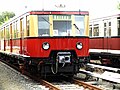
Rolling stock
There were several depots in Berlin S-Bahn. They are Schöneweide, Friedrichsfelde, Grünau, Wannsee, Erkner and Oranienburg.
Closed depots do include:
- Stettiner Bahnhof
- Papestraße
- Westend
- Bernau
- Hundekehle
- Velten
- Yorckstraße
Current
- BVG Class 480 (since 1986, in use on lines S41, S42, and S8)
- DB Class 481/482 (since 1996, in use on all lines)
- DR Class 485/885 (since 1987, in use on lines S46, S47, S75, and S9)
-
 Class 480
 -
 Class 481
 -
 Class 485


Future
In December 2015, S-Bahn Berlin signed a framework contract with the Stadler/Siemens consortium for the supply of up to 1380 electric multiple unit cars. The initial base order, to be completed by 2023, consists of 85 four-car and 21 two-car sets, which will be used on the Ring and the southeastern branches.[5]
Former
- DR Class ET 125 (from 1935 until 2003)
- DR Class ET 165 (from 1928 until 1997)
- DR Class ET 166 (from 1936 until 2000)
- DR Class ET 167 (from 1938 until 2003)
- DR Class ET 168 (from 1926 until about 1962, some units converted to train type EIII for the Berlin U-Bahn)
- DR Class ET 169 (from 1925 until 1962)
- DR Class ET 170 (from 1959 until 1970)
-
 DR Class ET 165
 -
 DR Class ET 167
 -
 DR Class ET 170


Excursion trains
- DB Class 488.0 (Panorama train, converted from former DB Class ET 167 coaches from 1997-1999)
- Museum train Class ET/ES 165
- Tradition train Class ET/ES/EB 165
- Viertel train Class ET/EB 167 (built in 1938, converted in 1991)
Expansion
Redevelopment projects
Ostkreuz
.jpg)
In 1988, Deutsche Reichsbahn presented plans for the transformation of Ostkreuz station. The long postponed renovation of the station began in 2007.
With nine lines (four on the Stadtbahn and five on the Ringbahn), Ostkreuz is one of the busiest stations on the network. Since the reconstruction is taking place during full operations, it is not known when it will be completed. Deutsche Bahn expects it to be finished in 2016.
With the progress of construction work on 31 August 2009, the southern connection and platform A were decommissioned. This route had to be realigned as a result. The construction plans envisaged that the connection would be restored by 2014. After its completion, traffic will again be able to be run from the southern Ringbahn onto the Stadtbahn.
In October 2009, the new Regionalbahn station on the Ringbahn was sufficiently complete for S-Bahn trains on the Ringbahn to use it temporarily. Demolition of the Ringbahn platform could then start and the new platform, including a concourse, could be built. This was put into operation on 16 April 2012, after a 16-day possession.[6]
Berlin–Görlitz railway (Baumschulenweg–Grünauer Kreuz)

Rehabilitation work at Grünauer Kreuz on the Berlin–Görlitz railway began on 12 July 2006.[7][8] In 2010 and 2011, rebuilt stations were put into operation in several stages at Baumschulenweg and Adlershof and the bridges over the Britz Canal and the Teltow Canal were replaced. During the reconstruction, the platform at Adlershof was relocated directly above Rudower Chaussee (street).[9][10]
Other major construction projects are planned along the route:
- Rebuilding of Schöneweide station, including the construction of a new road underpass
- Replacement of bridges over Sterndamm (street)
- Construction of additional electronic interlocking equipment along the route
- Conversion of Wildau station
- Renewal of the mainline tracks and the re-establishment of the overhead contact line system
New lines
Berlin-Schönefeld Airport-Berlin Brandenburg Airport extension
In preparation for the opening of Berlin-Brandenburg Airport in Schönefeld in the south of Berlin, the S-Bahn line will be extended from the current terminus at Berlin-Schoenefeld Airport in a long curve to the new terminal. Directly below the not yet opened terminal, Berlin Brandenburg, a station has been built with six platform tracks. Four through platform tracks are provided for long-distance services. Two tracks are being built for the S-Bahn on the approach from the west. In early July 2008, the first 185-metre-long section of the station was completed so that the terminal could be built. On 24 July 2009, the airport company transferred the completed shell of the airport railway station and the first part of the tunnel to DB.[11] The new line includes the stations of Waßmannsdorf and Berlin Brandenburg Airport and has a length of approximately 7.8 kilometres.[11][12] The construction cost was specified as €636 million. This amount also included the cost of construction of long-distance tracks.[11]
Planning of line S21 (Second Nord-Süd Bahn: first stage)
| Proposed Line S21 | ||||||||||||||||||||||||||||||||||||||||||||||||||||||||||||||||||||||||||||||||||||||||||||||||||||||||||||||||||||||||||||||||||||||||||||||||||||||||||||||||||||||||||||||||||||||||||||||||||||||||||||||||||||||||
|---|---|---|---|---|---|---|---|---|---|---|---|---|---|---|---|---|---|---|---|---|---|---|---|---|---|---|---|---|---|---|---|---|---|---|---|---|---|---|---|---|---|---|---|---|---|---|---|---|---|---|---|---|---|---|---|---|---|---|---|---|---|---|---|---|---|---|---|---|---|---|---|---|---|---|---|---|---|---|---|---|---|---|---|---|---|---|---|---|---|---|---|---|---|---|---|---|---|---|---|---|---|---|---|---|---|---|---|---|---|---|---|---|---|---|---|---|---|---|---|---|---|---|---|---|---|---|---|---|---|---|---|---|---|---|---|---|---|---|---|---|---|---|---|---|---|---|---|---|---|---|---|---|---|---|---|---|---|---|---|---|---|---|---|---|---|---|---|---|---|---|---|---|---|---|---|---|---|---|---|---|---|---|---|---|---|---|---|---|---|---|---|---|---|---|---|---|---|---|---|---|---|---|---|---|---|---|---|---|---|---|---|---|---|---|---|---|
 | ||||||||||||||||||||||||||||||||||||||||||||||||||||||||||||||||||||||||||||||||||||||||||||||||||||||||||||||||||||||||||||||||||||||||||||||||||||||||||||||||||||||||||||||||||||||||||||||||||||||||||||||||||||||||
| Overview | ||||||||||||||||||||||||||||||||||||||||||||||||||||||||||||||||||||||||||||||||||||||||||||||||||||||||||||||||||||||||||||||||||||||||||||||||||||||||||||||||||||||||||||||||||||||||||||||||||||||||||||||||||||||||
| Line number | 6017 Westhafen–Hbf–Potsdamer Platz 6019 Wedding–Hauptbahnhof | |||||||||||||||||||||||||||||||||||||||||||||||||||||||||||||||||||||||||||||||||||||||||||||||||||||||||||||||||||||||||||||||||||||||||||||||||||||||||||||||||||||||||||||||||||||||||||||||||||||||||||||||||||||||
| Locale | Berlin | |||||||||||||||||||||||||||||||||||||||||||||||||||||||||||||||||||||||||||||||||||||||||||||||||||||||||||||||||||||||||||||||||||||||||||||||||||||||||||||||||||||||||||||||||||||||||||||||||||||||||||||||||||||||
| Technical | ||||||||||||||||||||||||||||||||||||||||||||||||||||||||||||||||||||||||||||||||||||||||||||||||||||||||||||||||||||||||||||||||||||||||||||||||||||||||||||||||||||||||||||||||||||||||||||||||||||||||||||||||||||||||
| Track gauge | 1,435 mm (4 ft 8+1⁄2 in) standard gauge | |||||||||||||||||||||||||||||||||||||||||||||||||||||||||||||||||||||||||||||||||||||||||||||||||||||||||||||||||||||||||||||||||||||||||||||||||||||||||||||||||||||||||||||||||||||||||||||||||||||||||||||||||||||||
| ||||||||||||||||||||||||||||||||||||||||||||||||||||||||||||||||||||||||||||||||||||||||||||||||||||||||||||||||||||||||||||||||||||||||||||||||||||||||||||||||||||||||||||||||||||||||||||||||||||||||||||||||||||||||
The second Nord-Süd Bahn will link the northern ring to the Hauptbahnhof, Potsdamer Platz station and the Wannsee Railway to the southern ring. Today's plans are almost identical to plans submitted to the 1907-1910 Greater Berlin competition by Albert Sprickerhof.[14] Since then, there have been a number of alternatives proposals for such a route. A similar line was included in the plans for Welthauptstadt Germania ("World Capital Germania") in the 1930s.[15]
The line will be built in sections. In 2005, the zoning approval for the northern part of the route from the Ringbahn to Hauptbahnhof was adopted.[16] In October 2009 a loan agreement was entered into between the Senate and Deutsche Bahn for the first section. This provided for total costs of €226.5 million. On 27 November 2009, the preparatory work for this phase of construction started at the Hauptbahnhof. For the underground excavation in Invalidenstrasse, diaphragm walls were built into the ground and the trench in between was covered with a reinforced concrete lid.[17][18][19]
This stage involves the construction of a curve to the Westhafen and an eastern connection to Wedding inside the northern Ringbahn. Structural preparation for these junctions to these lines had already been made during the construction of the North–South mainline in 2006. From there, the existing line will run in a southerly direction (in the tunnel layer) to the Berlin Hauptbahnhof east of the North–South mainline. The realization of an intermediate station under the working name of Perleberger Brücke (as a two-level station in a V-shape) is provided as an option. It is proposed to build this 1,600-meter-long section by 2016.[20]
Planning of line S21 (Second Nord-Süd Bahn: second stage)
The construction of the second section of the S21 is to begin no earlier than 2018 and is expected to be completed in 2023. The new S-Bahn line will run in a tunnel from near the Hauptbahnhof past the Reichstag to Potsdamer Platz. It will run next to the existing Nord-Süd Tunnel to Brandenburg Gate and separate from it to run to Potsdamer Platz. The first north-south S-Bahn tunnel was designed in 1939 with room for an additional two tracks at Potsdamer Platz and to its south for the new line. The cost of the S-Bahn line (phases 1 and 2) has been estimated at €317 million (2009 prices).[17] The benefits of additional expenditure to the east of the Reichstag are still under investigation. This would increase the cost to about €330 million.
There are currently no dates set for the other phases of construction to the southern Ringbahn. It has so far only been defined in the Berlin land use plan.[21]
Proposals for further extensions
Since reunification, there have been suggestions that lines that have not been used since 1961 or 1980 should be rebuilt and connected to the network by some new lines. Many of these plans have changed several times since then or have been abandoned.
Following a decision of the Berlin House of Representatives, the goal is essentially to restore the S-Bahn network to its extent in 1961. This was stated in an agreement between Deutsche Bahn, the Federal Ministry of Transport and the Senate on 4 November 1993.[22] The network was to be restored by 2002. On this basis, the plans were included in the land use plan of 1995. In a study of the transport development by the then Department for Transport and Commerce in 1995, a plan was published for a network. Only the Jungfernheide–Stresow, Spandau–Staaken and Zehlendorf–Düppel sections, which had existed until 1980, were not incorporated in these plans. This political commitment is now only symbolic as some projects are now aimed at points beyond the original destinations or to miss them entirely. Budgetary difficulties, changing traffic flows and alternative development projects using Regionalbahn trains have led to the cancellation or postponement of projects that had already been developed.
Lines closed in 1961:
- Blankenfelde - Rangsdorf
- Spandau - Falkensee (- Finkenburg)
- Wannsee - Stahnsdorf
Lines closed in 1980:
- Jungfernheide - Gartenfield (- Hakenfelde)
- Zehlendorf - Düppel (- Dreilinden Europarc)
Lines closed in 1983 (Isolated operation after Berlin Wall was built):
- Hennigsdorf - Velten
New lines:
- Wartenberg - Karower Kreuz
- Springpfuhl - Grünauer Kreuz
- Teltow Stadt - Stahnsdorf
- Karow - Wandlitzsee
- Anhalter Bahnhof - Plänterwald
Gallery
-
 DB Class 488.0
 -
 Museum train Class ET/ES 165


See also
References
- ^ a b c d e "S-Bahn Berlin - A company of the Deutsche Bahn Group". S-Bahn Berlin. 2013. Retrieved 2013-09-22.
- ^ a b c "S-Bahn Berlin GmbH - Unternehmen - Mobilität für die Hauptstadt und das Umland" (in German). S-Bahn Berlin. 2013. Retrieved 2013-09-23.
{{cite web}}: Unknown parameter|trans_title=ignored (|trans-title=suggested) (help) - ^ "Vier Jahre lang: Endstation Ostkreuz" (Interview with Mario Wand, Jens Hebbbe, and Michael Baufeld) (in German). S-Bahn Berlin GmbH. September 20, 2011. Retrieved 2014-03-13.
Die S 3 Erkner – Spandau wird ab 11. Dezember 2011 für voraussichtlich vier Jahre am Ostkreuz enden. Das ist die Folge der neuen Bauphase, die dann auf der Großbaustelle beginnt. Drei Experten begründen diese Entscheidung.
{{cite web}}: Unknown parameter|trans_title=ignored (|trans-title=suggested) (help) - ^ Oberreichsbahnrat Dr. von Gersdorff (1939). "Die Nordsüd-S-Bahn und der Berliner S-Bahn-Tarif". Nordsüd-S-Bahn Berlin. Technisch-Wirtschaftliche Bücherei (in German). Berlin: Otto Elsner Verlagsgesellschaft.
{{cite book}}: Unknown parameter|trans_chapter=ignored (|trans-chapter=suggested) (help) - ^ "DB places Berlin S-Bahn rolling stock order". Railway Gazette. 22 December 2015.
- ^ "Ostkreuz: Bahnhofshalle für S-Bahn auf dem Ring eröffnet" (Press release) (in German). Deutsche Bahn AG. 16 April 2012.
- ^ Heft – DB Info zur Südoststrecke (PDF) (in German). DB ProjektBau.
- ^ "Baubeginn für Grundsanierung der S-Bahnstrecke zwischen Baumschulenweg und dem Grünauer Kreuz" (Press release) (in German). S-Bahn Berlin GmbH. 12 July 2006. Retrieved 20 May 2014.
- ^ S-Bahn Berlin GmbH (8 April 2011). "Deutsche Bahn – DB Netz AG informiert: Grunderneuerung der S9" (in German). Retrieved 20 May 2014.
- ^ "Grunderneuerung 2006/09". Berlin-Görlitzer Eisenbahn (in German). Retrieved 20 May 2014.
- ^ a b c Faktenblatt zum Bahnhof BBI (in German). Deutsche Bahn.
- ^ Detlef Hoge. "Bahnanbindung des Flughafens BBI" (in German). Retrieved 20 May 2013.
- ^ Eisenbahnatlas Deutschland [German railway atlas] (in German) (Updated ed.). Cologne: Schweers + Wall. 2020. p. 128. ISBN 978-3-89494-149-9.
- ^ Ulrich Conrad (2008). Planungen der Berliner U-Bahn und anderer Tunnelstrecken (in German). Verlag Neddermeyer. pp. 175ff. ISBN 3-933254-87-6.
- ^ Michael Braun (26 October 2008). "Die Nordsüd-S-Bahn" (in German). Retrieved 21 May 2014.
- ^ "Planning approval for the plan of the DB Netz AG for the construction project S21 - North Ring connection to Hauptbahnhof, Berlin-West Port - Berlin Hauptbahnhof - Berlin-Wedding" (PDF) (in German). Federal Railway Office. 12 February 2005. Retrieved 21 May 2014.
- ^ a b "Bau der neuen Nord-Süd-Bahn startet". B.Z. (in German). 5 October 2009. Retrieved 21 May 2014.
- ^ "Bauvorbereitungen für die künftige S21". Punkt 3 (in German) (22/2009): 4.
- ^ "Tunnelarbeiten vor dem Hauptbahnhof". Der Tagesspiegel (in German). 1 December 2009. Retrieved 21 May 2014.
- ^ Thomas Krickstadt. "Vorleistung für die S21 im Hauptbahnhof Berlin" (in German). Retrieved 20 May 2014.
- ^ "Flächennutzungsplan der Stadt Berlin" (in German). Senate Department for Urban Development. Retrieved 22 May 2014.
{{cite web}}: Unknown parameter|trans_title=ignored (|trans-title=suggested) (help) - ^ Mündliche Anfrage Nr. 16 des Abgeordneten Michael Cramer (Bü 90/Grüne) über Vereinbarung vom 4. November 1993 über die Sanierung des S-Bahn-Netzes in Höhe von 8,9 Milliarden DM [Oral question No 16 by Michael Cramer (Bu 90/Grüne) on the agreement of 4 November 1993 on the reorganization of the S-Bahn network in the amount of DM 8.9 billion DM]. House of Representatives of Berlin. 8 June 1995. p. 7462. Archived from the original (PDF; 841 kB) on 2015-12-27. Retrieved 22 May 2014.
External links
- S-Bahn Berlin GmbH – Official Site Template:En icon
- regular network (PDF)
- VSWB.de - Disused Rails and Lanes in Berlin
- OpenStreetMap - Transport map rendering, centered on Berlin

| Authority control databases: National |
|---|