
Burwash Airport
Burwash Airport | |||||||||||
|---|---|---|---|---|---|---|---|---|---|---|---|
 | |||||||||||
| Summary | |||||||||||
| Airport type | Public | ||||||||||
| Operator | Government of Yukon | ||||||||||
| Location | Burwash Landing, Yukon | ||||||||||
| Time zone | PST (UTC−08:00) | ||||||||||
| • Summer (DST) | PDT (UTC−07:00) | ||||||||||
| Elevation AMSL | 2,645 ft / 806 m | ||||||||||
| Coordinates | 61°22′14″N 139°02′24″W / 61.37056°N 139.04000°W | ||||||||||
| Map | |||||||||||
 CYDB Location in Yukon | |||||||||||
| Runways | |||||||||||
| |||||||||||
| Statistics (2010) | |||||||||||
| |||||||||||
Burwash Airport (IATA: YDB, ICAO: CYDB) is located 2 nautical miles (3.7 km; 2.3 mi) northwest of Burwash Landing, Yukon, Canada, and is operated by the Yukon government.
-
 Runway, Burwash Landing Airport
 -
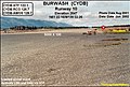 Runway 10, Burwash Landing Airport


References
- ^ Canada Flight Supplement. Effective 0901Z 16 July 2020 to 0901Z 10 September 2020.
- ^ Total aircraft movements by class of operation
External links
- Yukon Government Airports/Aerodromes
- Burwash Airport on COPA's Places to Fly airport directory
- Accident history for YDB: Burwash Landings Airport at Aviation Safety Network
- Past three hours METARs, SPECI and current TAFs for Burwash Airport from Nav Canada as available.
| By name | |
|---|---|
| By location indicator | |
| By province/territory | |
| By area | |
| National Airports System | |
| Related | |
This article about an airport in the Yukon is a stub. You can help Wikipedia by expanding it. |