Coffins Corner, New Jersey
Coffins Corner, New Jersey | |
|---|---|
| Coordinates: 39°51′36″N 74°59′20″W / 39.86000°N 74.98889°W | |
| Country | United States |
| State | New Jersey |
| County | Camden |
| Township | Cherry Hill |
| Elevation | 105 ft (35 m) |
| Time zone | UTC-5 (Eastern (EST)) |
| • Summer (DST) | UTC-4 (EDT) |
| Area code | 856 |
| GNIS feature ID | 875534[1] |
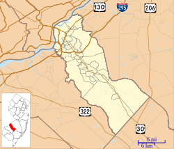
Coffins Corner is an unincorporated community located within Cherry Hill Township, in Camden County, New Jersey, United States.[2] Located near the border of Voorhees, Coffins Corner is at the crossroads of County Route 561 (Haddonfield-Berlin Road), County Route 544 (Evesham Road), and County Route 678 (Somerdale Road).
References


