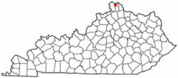
Erlanger, Kentucky
Erlanger, Kentucky | |
|---|---|
 Location of Erlanger, Kentucky | |
| Country | United States |
| State | Kentucky |
| County | Kenton |
| Government | |
| • Type | Local or city government |
| • Mayor of Erlanger | Thomas L. Rouse |
| • City Administrator | Linda G. Carter |
| Area | |
| • Total | 8.4 sq mi (21.8 km2) |
| • Land | 8.3 sq mi (21.6 km2) |
| • Water | 0.1 sq mi (0.3 km2) |
| Elevation | 912 ft (278 m) |
| Population (2010) | |
| • Total | 18,368 |
| • Density | 2,213.0/sq mi (850.4/km2) |
| Time zone | UTC-5 (Eastern (EST)) |
| • Summer (DST) | UTC-4 (EDT) |
| ZIP codes | 41018 |
| Area code | 859 |
| FIPS code | 21-25300 |
| GNIS feature ID | 0491808 |
| Website | www.ci.erlanger.ky.us |
Erlanger is a city in Kenton County, Kentucky, United States. The population was 18,368 at the 2010 census.
Geography
Erlanger is located at 39°0′49″N 84°35′39″W / 39.01361°N 84.59417°W (39.013511, -84.594042)Template:GR.
According to the United States Census Bureau, the city has a total area of 8.4 square miles (22 km2), of which 8.3 square miles (21 km2) is land and 0.1 square miles (0.26 km2) (1.19%) is water.
Demographics
As of the censusTemplate:GR of 2000, there were 16,676 people, 6,597 households, and 4,406 families residing in the city. The population density was 2,002.4 people per square mile (772.9/km²). There were 6,865 housing units at an average density of 824.3 per square mile (318.2/km²). The racial makeup of the city was 96.08% White, 1.81% African American, 0.08% Native American, 0.71% Asian, 0.02% Pacific Islander, 0.42% from other races, and 0.87% from two or more races. Hispanic or Latino of any race were 1.52% of the population.
There were 6,597 households out of which 34.3% had children under the age of 18 living with them, 51.8% were married couples living together, 11.1% had a female householder with no husband present, and 33.2% were non-families. 28.0% of all households were made up of individuals and 9.3% had someone living alone who was 65 years of age or older. The average household size was 2.50 and the average family size was 3.09.
| Census | Pop. | Note | %± |
|---|---|---|---|
| 1900 | 453 | — | |
| 1910 | 700 | 54.5% | |
| 1920 | 711 | 1.6% | |
| 1930 | 1,853 | 160.6% | |
| 1940 | 2,416 | 30.4% | |
| 1950 | 3,694 | 52.9% | |
| 1960 | 7,072 | 91.4% | |
| 1970 | 12,676 | 79.2% | |
| 1980 | 14,466 | 14.1% | |
| 1990 | 15,979 | 10.5% | |
| 2000 | 16,676 | 4.4% | |
| 2010 | 18,368 | 10.1% | |
| U.S. Census Bureau[1] | |||
In the city the population was spread out with 26.4% under the age of 18, 8.7% from 18 to 24, 33.0% from 25 to 44, 20.2% from 45 to 64, and 11.7% who were 65 years of age or older. The median age was 34 years. For every 100 females there were 92.8 males. For every 100 females age 18 and over, there were 87.8 males.
The median income for a household in the city was $42,835, and the median income for a family was $51,442. Males had a median income of $36,585 versus $27,296 for females. The per capita income for the city was $20,834. About 4.0% of families and 5.6% of the population were below the poverty line, including 7.9% of those under age 18 and 4.6% of those age 65 or over.
A large subdivision of mostly single-family dwellings, called "Cherry Hill" is in the city of Erlanger. The Kenton County and Boone County lines intersect within "Cherry Hill". This subdivision also is home to Cherry Hill Swim Club. Approximately one-half of the subdivision is within an unincorporated area of Boone County, which is adjacent the Greater Cincinnati International Airport.[2]
Economy
Toyota Boshoku America and Perfetti Van Melle USA are located in Erlanger.
Companies originating
This section needs additional citations for verification. (May 2009) |
The United States Playing Card Company is based in Erlanger.
References
- ^ Census Bureau Retrieved on 2010-2-10
- ^ Boone County Property Valuation Administration www.boonecountypva.org, Kenton County Property Valuation Administration www.kentonpva.org

