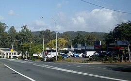
Ferny Hills, Queensland
| Ferny Hills Moreton Bay, Queensland | |||||||||||||||
|---|---|---|---|---|---|---|---|---|---|---|---|---|---|---|---|
 Ferny Way, Ferny Hills | |||||||||||||||
 | |||||||||||||||
| Coordinates | 27°23′30″S 152°55′32″E / 27.3916°S 152.9255°E | ||||||||||||||
| Population | 8,726 (2021 census)[1] | ||||||||||||||
| • Density | 855/km2 (2,216/sq mi) | ||||||||||||||
| Postcode(s) | 4055 | ||||||||||||||
| Area | 10.2 km2 (3.9 sq mi) | ||||||||||||||
| Time zone | AEST (UTC+10:00) | ||||||||||||||
| Location |
| ||||||||||||||
| LGA(s) | City of Moreton Bay | ||||||||||||||
| State electorate(s) | Ferny Grove | ||||||||||||||
| Federal division(s) | Dickson | ||||||||||||||
| |||||||||||||||
Ferny Hills is a suburb in the City of Moreton Bay, Queensland, Australia.[2] In the 2021 census, Ferny Hills had a population of 8,726 people.[1]
Geography
[edit]Ferny Hills is north-west of Brisbane, the state capital, and is located along Samford Road. Informally it is part of the Hills District.[citation needed]
The western part of the suburb is within the Samford Conservation Park. The eastern part of the suburb is residential.[3]
History
[edit]Ferny Hills is situated in the Yugarabul traditional Indigenous Australian country.[4]
Ferny Way State School opened on 27 January 1970. In 1973 it was renamed Ferny Hills State School.[5]
Patricks Road State School opened on 24 January 1977.[5]
Until 2006, a notable feature of Ferny Hills was the Australian Woolshed, which was an Australian farming and wildlife attraction featuring shows and animal exhibits. This has since been demolished and a residential development has been built called 'Woolshed Grove' paying homage to its previous life. The Australian Woolshed was also featured as a setting in Episode 12, Season 4 of The Amazing Race. [6][7]
Demographics
[edit]In the 2011 census, Ferny Hills had a population of 8,721 people, 50.1% female and 49.9% male. The median age of the Ferny Hills population was 36 years, 1 year below the national median of 37. 82.6% of people living in Ferny Hills were born in Australia. The other top responses for country of birth were England 4.4%, New Zealand 3.6%, South Africa 0.8%, Scotland 0.6%, India 0.4%. 94.3% of people spoke only English at home; the next most common languages were 0.5% Italian, 0.3% German, 0.2% Polish, 0.2% Spanish, 0.2% Mandarin.[8]
In the 2016 census, Ferny Hills had a population of 8,739 people.[9]
In the 2021 census, Ferny Hills had a population of 8,726 people.[1]
Education
[edit]Ferny Hills State School is a government primary (Prep-6) school for boys and girls at Illuta Avenue (27°24′07″S 152°56′36″E / 27.4020°S 152.9433°E).[10][11] In 2018, the school had an enrolment of 343 students with 31 teachers (25 full-time equivalent) and 23 non-teaching staff (14 full-time equivalent).[12] It includes a special education program.[10]
Patricks Road State School is a government primary (Prep-6) school for boys and girls at Patricks Road (27°23′36″S 152°56′05″E / 27.3932°S 152.9348°E).[10][13] In 2018, the school had an enrolment of 789 students with 56 teachers (49 full-time equivalent) and 28 non-teaching staff (19 full-time equivalent).[12] It includes a special education program.[10]
There is no secondary school in Ferny Hills. The nearest government secondary school is Ferny Grove State High School in neighbouring Ferny Grove to the south.[3]
Amenities
[edit]There are convenience centres located on Ferny Way on the southern end of the suburb.[citation needed]
References
[edit]- ^ a b c Australian Bureau of Statistics (28 June 2022). "Ferny Hills (SAL)". 2021 Census QuickStats. Retrieved 28 February 2023.
- ^ "Ferny Hills – suburb in Moreton Bay Region (entry 45436)". Queensland Place Names. Queensland Government. Retrieved 20 July 2021.
- ^ a b "Queensland Globe". State of Queensland. Retrieved 14 December 2021.
- ^ "AIATSIS code E66: Yugarabul". Federal government. Australian Institute of Aboriginal and Torres Strait Islander Studies. Archived from the original on 13 August 2020. Retrieved 31 July 2020.
- ^ a b Queensland Family History Society (2010), Queensland schools past and present (Version 1.01 ed.), Queensland Family History Society, ISBN 978-1-921171-26-0
- ^ "The Amazing Race" He's a Few Ticks Away from Having a Heart Attack! (TV Episode 2003) - IMDb, archived from the original on 14 December 2021, retrieved 4 September 2021
- ^ Spurrier, Jeff (10 April 1988). "It's Shear Fun in the Woolshed". Los Angeles Times. Archived from the original on 4 September 2021. Retrieved 4 September 2021.
- ^ Australian Bureau of Statistics (31 October 2012). "Ferny Hills (SSC)". 2011 Census QuickStats. Retrieved 3 June 2024.
- ^ Australian Bureau of Statistics (27 June 2017). "Ferny Hills (SSC)". 2016 Census QuickStats. Retrieved 20 October 2018.
- ^ a b c d "State and non-state school details". Queensland Government. 9 July 2018. Archived from the original on 21 November 2018. Retrieved 21 November 2018.
- ^ "Ferny Hills State School". Ferny Hills State School. 26 February 2020. Archived from the original on 1 November 2020. Retrieved 14 December 2021.
- ^ a b "ACARA School Profile 2018". Australian Curriculum, Assessment and Reporting Authority. Archived from the original on 27 August 2020. Retrieved 28 January 2020.
- ^ "Patricks Road State School". Patricks Road State School. 31 March 2020. Archived from the original on 10 March 2021. Retrieved 14 December 2021.
External links
[edit]- "Ferny Hills". Queensland Places. Centre for the Government of Queensland, University of Queensland.

