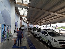
Goiânia International Airport
You can help expand this article with text translated from the corresponding article in Portuguese. Click [show] for important translation instructions.
|
Goiânia/Santa Genoveva International Airport Aeroporto Internacional de Goiânia/Santa Genoveva | |||||||||||
|---|---|---|---|---|---|---|---|---|---|---|---|
 | |||||||||||
 | |||||||||||
| Summary | |||||||||||
| Airport type | Public | ||||||||||
| Operator | |||||||||||
| Serves | Goiânia | ||||||||||
| Time zone | BRT (UTC−03:00) | ||||||||||
| Elevation AMSL | 748 m / 2,453 ft | ||||||||||
| Coordinates | 16°37′57″S 049°13′16″W / 16.63250°S 49.22111°W | ||||||||||
| Website | www | ||||||||||
| Map | |||||||||||
 | |||||||||||
| Runways | |||||||||||
| |||||||||||
| Statistics (2021) | |||||||||||
| |||||||||||
Goiânia/Santa Genoveva International Airport (IATA: GYN, ICAO: SBGO) is the airport serving Goiânia, Brazil.
It is operated by CCR (Companhia de Concessoes Rodoviarias), a Brazilian toll road operator.
History
[edit]The airport was commissioned in 1955, although operations started a few years earlier. In 1974, Infraero started to operate the airport.
In 2010, the government of the state of Goiás, in order to encourage tourism and aviation, reduced the tax on petrol from 15% to 3%.[5] After such a reduction, there was some interest from airlines to build a hub at Santa Genoveva Airport,[6] but operational limitations prevented the immediate implementation of such a plan.
The old passenger terminal was capable of handling 600,000 passengers/year, but in its last few years it had been operating beyond its capacity; in 2015, it handled more than 5 times its capacity. On May 9, 2016, a new passenger terminal located on the opposite side of the old and across the runway was opened. It is capable of handling 6,3 million passengers/year.[7] This new terminal has 32 check-in counters and 8 jetways, apart from the usual amenities such as stores and restaurants.[8]
Previously operated by Infraero, on April 7, 2021, CCR won a 30-year concession to operate the airport.[9]
Airlines and destinations
[edit]Accidents and incidents
[edit]- 22 February 1975: VASP Boeing 737-2A1 registration PP-SMU en route from Goiânia to Brasília was hijacked by 1 person who demanded ransom. The hijacker was taken down.[10]
- 29 September 1988: VASP Boeing 737-300 registration PP-SNT operating Flight 375 en route from Belo Horizonte-Confins to Rio de Janeiro was hijacked by 1 person who wanted to force a crash on the Palácio do Planalto, the official presidential workplace in Brasília. The pilot convinced the hijacker to divert to Goiânia where an emergency landing was made. The hijack ended with 1 victim.[11][12]
Access
[edit]The airport is located 8 km (5 mi) from downtown Goiânia.

See also
[edit]References
[edit]- ^ "Estatísticas". Infraero (in Portuguese). 14 February 2022. Retrieved 5 March 2022.
- ^ "Goiânia". CCR Aeroportos (in Portuguese). Retrieved 30 May 2023.
- ^ "Aeródromos". ANAC (in Portuguese). 15 October 2019. Retrieved 28 May 2020.
- ^ "SANTA GENOVEVA (SBGO)". DECEA (in Portuguese). Retrieved 26 August 2023.
- ^ Schapochnik, Claudio (1 April 2010). "Goiás reduz a alíquota do ICMS sobre querosene de aviação" (in Portuguese). Panrotas. Retrieved 4 April 2011.
- ^ "Fórum de Turismo anuncia instalação em setembro. Serão 14 voos diários" (in Portuguese). Governo do Estado de Goiás. 21 May 2010. Retrieved 4 April 2011.
- ^ "Novo aeroporto de Goiânia deve ser inauguado com a presença de Dilma" (in Portuguese). G1. 9 May 2015. Retrieved 15 May 2015.
- ^ "Novo terminal do aeroporto de Goiânia foi inaugurado hoje". Aeroflap (in Portuguese). 9 May 2016. Retrieved 25 October 2019.
- ^ "Governo federal arrecada R$ 3,3 bilhões com leilão de 22 aeroportos". Agência Brasil (in Portuguese). Retrieved 7 April 2021.
- ^ "Incident description PP-SMU". Aviation Safety Network. Retrieved 30 May 2011.
- ^ "Incident description PP-SNT". Aviation Safety Network. Retrieved 16 May 2011.
- ^ "Sangue no vôo 375". Abril: Veja (in Portuguese). 5 October 1988. Retrieved 16 May 2011.
External links
[edit]- Airport information for SBGO at Great Circle Mapper. Source: DAFIF (effective October 2006).
- Current weather for SBGO at NOAA/NWS
- Accident history for GYN at Aviation Safety Network

