Randolph County, West Virginia
Randolph County | |
|---|---|
 Randolph County Courthouse and Jail in Elkins | |
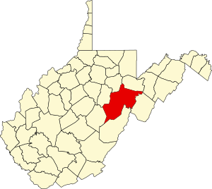
 Location within the U.S. state of West Virginia | |
 West Virginia's location within the U.S. | |
| Coordinates: 38°47′N 79°52′W / 38.78°N 79.87°W | |
| Country | |
| State | |
| Founded | October 16, 1787 |
| Named for | Edmund Jennings Randolph |
| Seat | Elkins |
| Largest city | Elkins |
| Area | |
• Total | 1,040 sq mi (2,700 km2) |
| • Land | 1,040 sq mi (2,700 km2) |
| • Water | 0.3 sq mi (0.8 km2) 0.03% |
| Population | |
• Estimate (2015) | 29,126 |
| • Density | 28/sq mi (11/km2) |
| Time zone | UTC−5 (Eastern) |
| • Summer (DST) | UTC−4 (EDT) |
| Congressional district | 2nd |
| Website | randolphcountycommissionwv |
Randolph County is a county located in the U.S. state of West Virginia. As of the 2010 census, the population was 29,405.[1] Its county seat is Elkins.[2] The county was founded in 1787 and is named for Edmund Jennings Randolph.[3]
Randolph County comprises the Elkins, West Virginia, Micropolitan Statistical Area.
Geography


According to the U.S. Census Bureau, the county has a total area of 1,040 square miles (2,700 km2), of which 1,040 square miles (2,700 km2) is land and 0.3 square miles (0.78 km2) (0.03%) is water.[4] It is the largest county in West Virginia by area.
Rivers
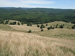
Mountains
- Point Mountain
- Cheat Mountain
- White Top, a knob of Cheat Mountain
- Laurel Mountain
- Rich Mountain
- Shavers Mountain
- Gaudineer Knob, a knob of Shavers Mountain
Caves and caverns
National Natural Landmarks
Major highways
Adjacent counties
- Tucker County (northeast)
- Pendleton County (east)
- Pocahontas County (south)
- Webster County (southwest)
- Upshur County (west)
- Barbour County (northwest)
National protected area
Demographics
| Census | Pop. | Note | %± |
|---|---|---|---|
| 1790 | 951 | — | |
| 1800 | 1,826 | 92.0% | |
| 1810 | 2,854 | 56.3% | |
| 1820 | 3,357 | 17.6% | |
| 1830 | 5,000 | 48.9% | |
| 1840 | 6,208 | 24.2% | |
| 1850 | 5,243 | −15.5% | |
| 1860 | 4,990 | −4.8% | |
| 1870 | 5,563 | 11.5% | |
| 1880 | 8,102 | 45.6% | |
| 1890 | 11,633 | 43.6% | |
| 1900 | 17,670 | 51.9% | |
| 1910 | 26,028 | 47.3% | |
| 1920 | 26,084 | 0.2% | |
| 1930 | 25,049 | −4.0% | |
| 1940 | 30,259 | 20.8% | |
| 1950 | 30,558 | 1.0% | |
| 1960 | 26,349 | −13.8% | |
| 1970 | 24,596 | −6.7% | |
| 1980 | 28,734 | 16.8% | |
| 1990 | 27,803 | −3.2% | |
| 2000 | 28,262 | 1.7% | |
| 2010 | 29,405 | 4.0% | |
| 2015 (est.) | 29,126 | [5] | −0.9% |
| U.S. Decennial Census[6] 1790–1960[7] 1900–1990[8] 1990–2000[9] 2010–2015[1] | |||
2000 census
As of the census[10] of 2000, there were 28,262 people, 11,072 households, and 7,661 families residing in the county. The population density was 27 people per square mile (10/km²). There were 13,478 housing units at an average density of 13 per square mile (5/km²). The racial makeup of the county was 97.69% White, 1.07% Black or African American, 0.16% Native American, 0.38% Asian, 0.01% Pacific Islander, 0.16% from other races, and 0.53% from two or more races. 0.68% of the population were Hispanic or Latino of any race.
There were 11,072 households out of which 29.80% had children under the age of 18 living with them, 54.70% were married couples living together, 9.80% had a female householder with no husband present, and 30.80% were non-families. 26.30% of all households were made up of individuals and 11.90% had someone living alone who was 65 years of age or older. The average household size was 2.41 and the average family size was 2.89.
In the county, the population was spread out with 22.30% under the age of 18, 8.70% from 18 to 24, 28.50% from 25 to 44, 25.40% from 45 to 64, and 15.10% who were 65 years of age or older. The median age was 39 years. For every 100 females there were 101.30 males. For every 100 females age 18 and over, there were 99.70 males.
The median income for a household in the county was $27,299, and the median income for a family was $32,632. Males had a median income of $24,751 versus $17,819 for females. The per capita income for the county was $14,918. About 13.40% of families and 18.00% of the population were below the poverty line, including 24.30% of those under age 18 and 12.90% of those age 65 or over.
2010 census
As of the 2010 United States Census, there were 29,405 people, 11,695 households, and 7,753 families residing in the county.[11] The population density was 28.3 inhabitants per square mile (10.9/km2). There were 14,189 housing units at an average density of 13.6 per square mile (5.3/km2).[12] The racial makeup of the county was 97.3% white, 1.2% black or African American, 0.3% Asian, 0.2% American Indian, 0.1% from other races, and 0.8% from two or more races. Those of Hispanic or Latino origin made up 0.7% of the population.[11] In terms of ancestry, 26.3% were German, 15.9% were Irish, 12.0% were English, 10.2% were American, and 5.4% were Italian.[13]
Of the 11,695 households, 27.1% had children under the age of 18 living with them, 51.0% were married couples living together, 10.5% had a female householder with no husband present, 33.7% were non-families, and 28.4% of all households were made up of individuals. The average household size was 2.32 and the average family size was 2.81. The median age was 43.4 years.[11]
The median income for a household in the county was $36,176 and the median income for a family was $47,071. Males had a median income of $34,903 versus $25,988 for females. The per capita income for the county was $18,472. About 12.7% of families and 17.1% of the population were below the poverty line, including 26.1% of those under age 18 and 11.4% of those age 65 or over.[14]
Politics
| Year | Republican | Democrat |
|---|---|---|
| 2012 | 63.00% 6,160 | 34.18% 3,342 |
| 2008 | 55.94% 6,060 | 41.90% 4,539 |
| 2004 | 56.68% 6,512 | 42.58% 4,892 |
| 2000 | 55.00% 5,248 | 42.21% 4,028 |
Communities

City
- Elkins (county seat)
Towns
Census-designated places
Unincorporated communities
- Adolph
- Aggregates
- Alpena
- Arnold Hill
- Bemis
- Brady Gate
- Bruxton
- Canfield
- Cassity
- Crystal Springs
- Czar
- Dryfork
- Elkins Junction
- Elkwater
- Ellamore
- Evenwood
- Faulkner
- Glady
- Horton
- Jimtown
- Kerens
- Little Italy
- Mabie
- Mingo
- Monterville
- Newlonton
- Norton
- Osceola
- Pumpkintown
- Read
- Smith Crossing
- Spangler
- Sullivan
- Tigheville
- Upper Mingo
- Weaver
- Whyte
Registered historic places
- Beverly Historic District
- Blackman-Bosworth Store
- Butcher Hill Historic District
- Rich Mountain Battlefield
- Tygart Valley Homesteads Historic District
- Albert and Liberal Arts Halls
- Baldwin-Chandlee Supply Company-Valley Supply Company
- Davis Memorial Presbyterian Church
- Davis and Elkins Historic District
- Downtown Elkins Historic District
- Dr. John C. Irons House
- Elkins Milling Company
- Gov. H. Guy Kump House
- Graceland
- Randolph County Courthouse and Jail
- Senator Stephen Benton Elkins House
- Taylor-Condry House
- Warfield-Dye Residence
- Wees Historic District
- West Virginia Children's Home
- Glady Presbyterian Church and Manse
- Day-Vandevander Mill
- Cheat Summit Fort
- E. E. Hutton House
- Tygarts Valley Church
- See-Ward House
- Middle Mountain Cabins
Notable people
- Herman Ball, football player
- Lemuel Chenoweth, master covered bridge builder
- William Wallace Barron, former governor who was indicted for bribery and jury tampering.
- Dellos Clinton "Sheriff" Gainer, major league baseball player
- Marshall Goldberg, football player
- Wilma Lee Cooper Grand Ole Opry and WWVA Jamboree star
- Stoney Cooper, Grand Ole Opry and WWVA Jamboree star
- Eldora Marie Bolyard Nuzum, American newspaper editor and interviewer of U.S. Presidents
38°47′N 79°52′W / 38.78°N 79.87°W
See also
- Becky Creek Wildlife Management Area
- National Register of Historic Places listings in Randolph County, West Virginia
References
- ^ a b "State & County QuickFacts". United States Census Bureau. Retrieved January 11, 2014.
- ^ "Find a County". National Association of Counties. Retrieved 2011-06-07.
- ^ http://www.wvculture.org/history/counties/randolph.html
- ^ "2010 Census Gazetteer Files". United States Census Bureau. August 22, 2012. Retrieved July 30, 2015.
- ^ "Annual Estimates of the Resident Population for Incorporated Places: April 1, 2010 to July 1, 2015". Retrieved April 5, 2016.
- ^ "U.S. Decennial Census". United States Census Bureau. Retrieved January 11, 2014.
- ^ "Historical Census Browser". University of Virginia Library. Retrieved January 11, 2014.
- ^ "Population of Counties by Decennial Census: 1900 to 1990". United States Census Bureau. Retrieved January 11, 2014.
- ^ "Census 2000 PHC-T-4. Ranking Tables for Counties: 1990 and 2000" (PDF). United States Census Bureau. Retrieved January 11, 2014.
- ^ "American FactFinder". United States Census Bureau. Retrieved 2011-05-14.
- ^ a b c "DP-1 Profile of General Population and Housing Characteristics: 2010 Demographic Profile Data". United States Census Bureau. Retrieved 2016-04-03.
- ^ "Population, Housing Units, Area, and Density: 2010 - County". United States Census Bureau. Retrieved 2016-04-03.
- ^ "DP02 SELECTED SOCIAL CHARACTERISTICS IN THE UNITED STATES – 2006-2010 American Community Survey 5-Year Estimates". United States Census Bureau. Retrieved 2016-04-03.
- ^ "DP03 SELECTED ECONOMIC CHARACTERISTICS – 2006-2010 American Community Survey 5-Year Estimates". United States Census Bureau. Retrieved 2016-04-03.
- ^ "Dave Leip's Atlas of U.S. Presidential Elections". Retrieved 2016-04-05.

