
Renkum
Renkum | |
|---|---|
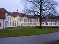
.jpg) Renkum town hall | |
 Flag  Coat of arms | |
.svg) Location in Gelderland | |
| Country | Netherlands |
| Province | Gelderland |
| Government | |
| • Body | Municipal council |
| • Mayor | vacant |
| Area | |
| • Total | 47.23 km2 (18.24 sq mi) |
| • Land | 45.95 km2 (17.74 sq mi) |
| • Water | 1.28 km2 (0.49 sq mi) |
| Elevation | 51 m (167 ft) |
| Population (January 2021)[4] | |
| • Total | 31,417 |
| • Density | 684/km2 (1,770/sq mi) |
| Demonym | Renkumer |
| Time zone | UTC+1 (CET) |
| • Summer (DST) | UTC+2 (CEST) |
| Postcode | 6860–6874 |
| Area code | 026, 0317 |
| Website | www |
Renkum (ⓘ) is a municipality and a town in the eastern Netherlands. The municipality had a population of 31,417 in 2021 and has a land area of 45.95 km2 (17.74 sq mi). Renkum is situated along the river Rhine. The municipality Renkum is part of the Stadsregio (English: City region) Arnhem-Nijmegen.
The surrounding of the municipality are mainly forest and river forelands. In the forest one can find tumulus of thousand years old. Findings from these tumulus can be seen in the Historic museum in Arnhem.[5]
History
Renkum is more than thousand years old. In 1970 the thousand-year anniversary was celebrated. In the early days, the name was written as Redinchem. In the 19th century Renkum developed itself. There existed six paper mills, three water-cornmills and one water-oil mill. There were two factories, a treacle factory and a potato starch-flour factory. There was also a beer brewery and a tavern de Bok.
Nowadays there is still paper industry The company is Parenco B.V., acquired by H2 Equity Partners in 2012.
Population centres
Topography

Dutch Topographic map of the municipality of Renkum, June 2015.
Image gallery
-
 Castle Grunsfort (1638)
 -
 Orange Nassau's Oord
 -
 Oldest existing church of the Netherlands (Oosterbeek)
 -
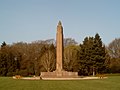 War memorial in Oosterbeek


_Oosterbeek_2008.jpg)

References
- ^ "Burgemeester" (in Dutch). Gemeente Renkum. Retrieved 15 July 2014.
{{cite web}}: Unknown parameter|trans_title=ignored (|trans-title=suggested) (help) - ^ "Kerncijfers wijken en buurten 2020" [Key figures for neighbourhoods 2020]. StatLine (in Dutch). CBS. 24 July 2020. Retrieved 19 September 2020.
- ^ "Postcodetool for 6861GG". Actueel Hoogtebestand Nederland (in Dutch). Het Waterschapshuis. Retrieved 15 July 2014.
{{cite web}}: Cite has empty unknown parameter:|trans_title=(help) - ^ "Bevolkingsontwikkeling; regio per maand" [Population growth; regions per month]. CBS Statline (in Dutch). CBS. 1 January 2021. Retrieved 2 January 2022.
- ^ Historic museum Arnhem
External links
 Media related to Renkum at Wikimedia Commons
- Official website
Places adjacent to Renkum | ||||||||||||||||
|---|---|---|---|---|---|---|---|---|---|---|---|---|---|---|---|---|
| ||||||||||||||||

This Gelderland location article is a stub. You can help Wikipedia by expanding it. |