Jump to content

South Side, Nova Scotia

Coordinates: 43°26′57″N 65°35′52″W / 43.44917°N 65.59778°W / 43.44917; -65.59778 (South Side, Nova Scotia)
From Wikipedia, the free encyclopedia

This is an old revision of this page, as edited by JJMC89 bot (talk | contribs) at 08:13, 25 March 2017 (Migrate {{Infobox settlement}} coordinates parameters to {{Coord}}, see Wikipedia:Coordinates in infoboxes). The present address (URL) is a permanent link to this revision, which may differ significantly from the current revision.

South Side
Community
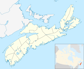
South Side, Nova Scotia is located in Nova Scotia
South Side, Nova Scotia
Location of South Side, Nova Scotia
Coordinates: 43°26′57″N 65°35′52″W / 43.449167°N 65.597778°W / 43.449167; -65.597778[1]
Country Canada
Province Nova Scotia
CountyShelburne
Municipal districtBarrington
Time zoneUTC-4 (AST)
 • Summer (DST)UTC-3 (ADT)
Area code902
Access RoutesSouth Side Road
via Route 330

South Side is a community on Cape Sable Island in the Canadian province of Nova Scotia, located in the Barrington municipal district of Shelburne County.[2]

See also

References


43°26′57″N 65°35′52″W / 43.44917°N 65.59778°W / 43.44917; -65.59778 (South Side, Nova Scotia)