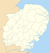
Tendring District
Tendring District | |
|---|---|
 Tendring shown within Essex | |
| Sovereign state | United Kingdom |
| Constituent country | England |
| Region | East of England |
| Non-metropolitan county | Essex |
| Status | Non-metropolitan district |
| Admin HQ | Clacton-on-Sea |
| Incorporated | 1 April 1974 |
| Government | |
| • Type | Non-metropolitan district council |
| • Body | Tendring District Council
Chairman = Cllr Alan Goggin (C) Vice Chairman = Cllr Danny Mayzes (C) |
| • Leadership | Leader & Cabinet (Conservative) Leader = Cllr Neil Stock (C) |
| • MPs | Douglas Carswell (C) Bernard Jenkin (C) |
| Area | |
| • Total | 130.34 sq mi (337.58 km2) |
| • Rank | 110th (of 296) |
| Population (2022) | |
| • Total | 151,451 |
| • Rank | 145th (of 296) |
| • Density | 1,200/sq mi (450/km2) |
| • Ethnicity | 96.0% White 1.3% S.Asian 1.1% Black 1.0% Mixed Race |
| Time zone | UTC0 (GMT) |
| • Summer (DST) | UTC+1 (BST) |
| ONS code | 22UN (ONS) E07000076 (GSS) |
| OS grid reference | TM170150 |
| Website | www |
Tendring is a local government district in North East Essex, England. It extends from the River Stour in the north, to the coast and the River Colne in the south, with the coast to the East and the town of Colchester to the west. Its council is based in Clacton-on-Sea. Towns in the district include Frinton-on-Sea, Walton-on-the-Naze, Brightlingsea and Harwich. Large villages in the district include St Osyth and Great Bentley.
Sometimes referred to as the "Tendring Peninsula", the district was formed on 1 April 1974 as a merger of the borough of Harwich, with Brightlingsea, Clacton and Frinton and Walton urban districts, and Tendring Rural District. The name Tendring comes from the ancient Tendring Hundred which is named after the small Tendring village at the centre of the area. The Tendring Poor Law Union covered the same area as the present district.
During the English civil war, the witch-finder general, Matthew Hopkins carried out many trials throughout this and the surrounding area especially in the towns of Manningtree and Mistley on the River Stour.
The largest town in the Tendring district is Clacton-on-Sea, with a population of 53,000.
Etymology
There are these theories about the origin of its name:-
- From Anglo-Saxon tynder = "tinder": "place where tinder or fuel is gathered."
- From the German placename Tündern in Lower Saxony (old spelling Tundiriun) plus Anglo-Saxon -ing or -ingas: "people who came across the sea from Tündern".
Topology
The highest part of the district is a low (35 metres) ridge running west to east only 3 km south of the River Stour. The greater part of the district is undulating land sloping very gently to the south which is traversed by a number of streams.
Parishes
The district is divided into the following parishes. "From" indicates older parishes which have now been merged.
- Alresford
- Ardleigh
- Beaumont-cum-Moze
- Bradfield
- Brightlingsea
- Elmstead
- Frating
- Frinton and Walton (from Frinton, Great Holland, Kirby-le-Soken, and Walton-le-Soken)[1]
- Great Bentley
- Great Bromley
- Great Oakley
- Harwich (from Dovercourt and St Nicholas)
- Lawford
- Little Bentley
- Little Bromley
- Little Clacton
- Little Oakley
- Manningtree
- Mistley
- Ramsey and Parkeston
- St Osyth
- Tendring
- Thorpe-le-Soken
- Thorrington
- Weeley
- Wix
- Wrabness
Soken
In the extreme east of the district is an area formerly known as the Soken which was granted special privileges in Saxon times. It is remembered in the place names Kirby-le-Soken, Thorpe-le-Soken and Walton-le-Soken (an older name for Walton-on-the-Naze).
Notes
External links
- Entry in Kelly's Directory of Essex, 1894
- The local water supply company preserves the old name: Tendring Hundred Water Services Ltd
- Review of ward boundaries by the Boundary Committee with maps
- History notes on the Sokens
- Unofficial Frinton website
- Tendring Social Network Website
 Media related to Tendring at Wikimedia Commons

