Yılanlı Island
Native name: Yılanlı Ada | |
|---|---|
 | |
| Geography | |
| Location | Mediterranean Sea |
| Coordinates | 36°06′48″N 33°22′4″E / 36.11333°N 33.36778°E |
| Administration | |
| İl (province) | Mersin Province |
| İlçe | Aydıncık |
Yılanlı Ada (literally "the island with snakes") is a small Mediterranean island in Turkey.
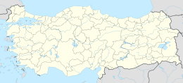
The island at 36°06′48″N 33°22′40″E / 36.11333°N 33.37778°E is situated about 1.75 kilometres (1.09 mi) offshore (Sancak Burnu). The nearest coastal settlement is Aydıncık ilçe (district) center of Mersin Province about 6 kilometres (3.7 mi) northwest of the island. It is a narrow island lying west to east direction, approximately 180 metres (590 ft) long. The Aydıncık Islands are nearby.
The uninhabited island was known as "Spurie" during antiquity. [1] The area around the island was declared an archaeological site (Turkish: SIT).[2] During recent exploration many anchors were found around the island, indicating that it was a popular anchorage area from the Bronze Age. Also a wreck with amphorae LP1 type from the Roman Empire was found. Two amphorae, three stone anchors, a lead stock and its collar, and a stone stock were delivered to the Silifke Museum.[1]

