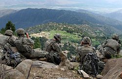
Chawkay District
Tools
Actions
General
Print/export
In other projects
Appearance
From Wikipedia, the free encyclopedia
This is an old revision of this page, as edited by Tom Radulovich (talk | contribs) at 11:36, 30 October 2022 (altitude > elevation, link). The present address (URL) is a permanent link to this revision, which may differ significantly from the current revision.
Revision as of 11:36, 30 October 2022 by Tom Radulovich (talk | contribs) (altitude > elevation, link)
District of Kunar, Afghanistan
This article includes a list of references, related reading, or external links, but its sources remain unclear because it lacks inline citations. Please help improve this article by introducing more precise citations. (April 2022) (Learn how and when to remove this message) |
Chawkay District is situated in the central part of Kunar Province, Afghanistan. The population was reported in 2006 as 31,600. The district center is the village of Chawkay (34°41′46″N 70°55′29″E / 34.6961°N 70.9247°E / 34.6961; 70.9247) at 726 m elevation in the valley of the Kunar River. Roughly 80% of the houses in the district were destroyed during the wars.
See also
External links
Districts | ||
---|---|---|
Populated places | ||
Other |
This Kunar Province, Afghanistan location article is a stub. You can help Wikipedia by expanding it. |