
Argao: Difference between revisions
m robot Modifying: es:Argao |
m Added photo guide~~ |
||
| Line 94: | Line 94: | ||
*[http://elgu.ncc.gov.ph/ecommunity/argao-cebu/ The official website of Municipality of Argao] |
*[http://elgu.ncc.gov.ph/ecommunity/argao-cebu/ The official website of Municipality of Argao] |
||
*[http://www.argaotourism.com/ Argao Tourism website] |
*[http://www.argaotourism.com/ Argao Tourism website] |
||
*[http://www.batch2006.com/cebu/visit_st-michael_parish.htm/ Saint Michael Parish Church in Argao] |
|||
*[http://www.batch2006.com/cebu/visit_argao.htm/ Natural Photos of Argao Municipality] |
|||
*[http://www.nscb.gov.ph/activestats/psgc/default.asp Philippine Standard Geographic Code] |
*[http://www.nscb.gov.ph/activestats/psgc/default.asp Philippine Standard Geographic Code] |
||
{{Cebu}} |
{{Cebu}} |
||
Revision as of 03:47, 30 March 2009
Template:Infobox Philippine municipality Argao is a 1st class municipality in the province of Cebu, Philippines. According to the 2007 census, it has a population of 62,226 people.
Location
The municipality of Argao is located at the southeastern portion of the province of Cebu, approximately 68 kilometers from Cebu City. Argao is exactly between Cebu City and the southern tip of the island (Santander). It is approximately 26km from Carcar, from Alcoy, and from Loon which is across the Bohol Strait. The rectangle that is Argao (approximately 20 X 40 km) is bounded, clockwise, in the west by Badian, Alcantara, Ronda, and Dumanjug; in the north by Sibonga; in the east by the Bohol Strait; and in the south by Dalaguete. Aside from the Poblacion proper are 44 barangays which are, clockwise, Tulic, Bogo, Talaga, and Casay; then Balisong, Cambantug, Bala-as, and Linut-od; then Butong, Cansuje, and Tulang; then Anajao, Apo, Mompeller, Lengigon, Colawin, Gutlang, Langub, and Sumaguan; then Guiwanon, Taloot, Bulasa, Binlod, and Langtad. Inner barrios are Alambijud, Ubaub, Capio-an, Mandilikit, Mabasa, Jampang, then Usmad, Catang, Panadtaran, Jomgao, Talaytay, Canbanua, and Lamacan; and finally the southern group of Calagasan, Conalum, Tabayag, Lapay, Tiguib, and Bug-ot.
Barangays
Argao is administratively subdivided into 45 barangays.
|
|
|
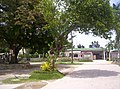
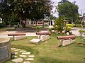
Photos
-
Saint Michael Parish Church
-
 Rizal statue at Municipal plaza
 -
 Sali-Argaw tree
 -
 Old cannons
 -
Pres. Diosdado Macapagal Sports & Cultural Center
-
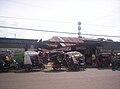 Argao Public Market
 -
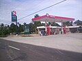 Argao Caltex gasoline station


See also
9°53′N 123°36′E / 9.883°N 123.600°E
External links
- The official website of Municipality of Argao
- Argao Tourism website
- Saint Michael Parish Church in Argao
- Natural Photos of Argao Municipality
- Philippine Standard Geographic Code
Cebu City (capital and largest city) | |
| Municipalities |
|
| Component cities | |
| Highly urbanized cities | (Administratively independent from the province but grouped under Cebu by the Philippine Statistics Authority. However, qualified voters in Mandaue are allowed to vote in elections for Cebu provincial officials by virtue of Republic Act No. 6641, in accordance with Section 452-c of the Local Government Code of 1991.) |