
Third Ward, Houston: Difference between revisions
WhisperToMe (talk | contribs) |
No edit summary |
||
| Line 152: | Line 152: | ||
*[[Guy Lewis]] |
*[[Guy Lewis]] |
||
*[[Allison Roche]] |
*[[Allison Roche]] |
||
*[[Jay Electronica]] |
|||
==See also== |
==See also== |
||
{{Portal box|Houston|African American|Judaism}} |
{{Portal box|Houston|African American|Judaism}} |
||
Revision as of 20:33, 6 May 2012

The Third Ward is one of the six historic wards of Houston, Texas, United States. It is located in the Southeast Houston management district.
The Third Ward, located inside the 610 Loop is immediately southeast of Downtown Houston and to the east of the Texas Medical Center. The ward became the center of Houston's African American community. In rap circles the Third Ward is referred to as "The Trey."[1]
History

Soon after the 1836 establishment of Houston, the City Council established four wards as political subdivisions of the city.[2] The original Third Ward district extended south of Congress Street and east of Main Street and ended at the north shore of the Brays Bayou; what was then the district includes what is today portions of Downtown Houston and Midtown Houston in addition to residential African American area currently identified as the Third Ward, which is located southeast of Downtown Houston. As of 2003 the usage of the land within the boundaries of the historic Third Ward is more diverse than the land usage in the current Third Ward.[3]

In the 1800s much of what was the Third Ward, the present day east side of Downtown Houston, was what Stephen Fox, an architectural historian who lectured at Rice University, referred to as "the elite neighborhood of late 19th-century Houston." Ralph Bivins of the Houston Chronicle said that Fox said that area was "a silk-stocking neighborhood of Victorian-era homes." Bivins said that the construction of Union Station, which occurred around 1910, caused the "residential character" of the area to "deteriorate." Hotels opened in the area to service travelers. Afterwards, according to Bivins, the area "began a long downward slide toward the skid row of the 1990s" and the hotels were changed into flophouses. Passenger trains stopped going to Union Station.[4] The City of Houston abolished the ward system in the early 1900s, but the name "Third Ward" was continued to be used to refer to the territory that it used to cover.[3]

Historically White people lived in the southern part of the Third Ward, while African Americans were economically segregated and lived north of Truxillo Street. By the 1930s the White and Black populations of the Third Ward were about even. After World War II White residents and the Temple Beth Israel moved from the Third Ward to newly-developed suburbs on the southwest side, and the Third Ward became mostly African American.[5] In the era of racial segregation, Almeda Road, a road located in the Third Ward area that at that time served as a corridor to Downtown Houston, was a busy commercial corridor.[6] The construction of Interstate 45 in the 1950s separated portions of the historic Third Ward from the rest of the Third Ward and brought those portions into Downtown.[7]
The People's Party II, a Black Panther activist group led by Carl Hampton was organized in the Third Ward in the Spring of 1970 to address police brutality on Blacks in the community. Hampton died from gunshot wounds during that year.[8] In the 1960s and 1970s many families in the Third Ward relocated to racially integrated suburbs; racial integration allowed many Blacks to move to the suburbs, therefore the Third Ward lost some of its population and economic traffic. Despite the relocations the Almeda Road commercial corridor remained busy. Kent Hadnot, the executive director of the Third Ward Redevelopment Council, said in a 2000 Houston Press article that blockbusting beginning in the 1970s began to drive homeowners and business owners away from the Third Ward and into suburbs such as Missouri City. The construction of Texas State Highway 288, which offered a quicker alternative into Downtown, caused Almeda Road's commercial properties to decline. Many children of Third Ward area business owners, educated in universities, had no desire to work in their parents' businesses, reducing the employee base of the Third Ward businesses. The 1980s oil bust hurt the economy of the Third Ward and the nearby Almeda Road commercial corridor.[6]

From the 1980 U.S. Census to the 1990 Census, many African Americans left traditional African American neighborhoods like the Third Ward and went into areas in Southwest Houston.[9]
In 1987 Dr. Joyce Williams, the chairperson of the Southeast Area Council, an organization within the Mayor's Citizens Assistance Council, said that her group stopped referring to the area as the "Third Ward." The practice became official on Wednesday June 3, 1987 The group itself was formerly named the Third Ward Area Council.[10] Williams said "The city has become a cosmopolitan city. The term ‘ward’ is stagnant, unsophisticated, and places areas in isolation."[11] Williams hoped that fellow Houstonians would also stop referring to sections of the city as "wards." Kim Cobb of the Houston Chronicle explained that "She's particularly concerned about the Riverside-MacGregor area near the Medical Center that her group represents. She thinks the term "Third Ward" implies an economic division that will get in the way of the benefits that will come to the rest of the city from the opening of the George Brown Convention Center."[10] Betty Chapman, a historian, said in 2007 "The wards haven’t had any real meaning since 1905. But people are very interested in them. They’re an important part of our history."[11]
.jpg)
In 1998, a report by the Third Ward Redevelopment Council concluded that the area had 55,000 residents. In addition, the report concluded that area shoppers and residents spend $345 million dollars outside of the Third Ward per year; the residents and shoppers spend the money in other areas such as The Galleria, Meyerland, Rice Village, and Sharpstown.[6] By 2000 younger business owners began to increase activity in the Almeda Road corridor. Old Spanish Trail/Almeda TIRZ funded area businesses with collected property taxes and offered incentives to prospective business owners. The redevelopment council offered prospective entrepreneurs lists of contacts and other forms of assistance.[12] Between 1990 and 2000 the Hispanic population of the Third Ward increased by between 5 and 10 percent.[13] In 2002 the City of Houston planned to build its olympic village in the Third Ward if its bid for the 2012 Olympic Games was successful; many Third Ward residents and activists stated that they needed to receive some form of economic benefit from the proposed facilities.[14] Houston's bid was rejected later that year.[15]

Around 1996 many artists began moving into the Third Ward.[16] In 2011 Danyahel Norris, a Third Ward resident and a legal research instructor and attorney at Texas Southern University, said that he observed the first sign of gentrification in the Third Ward in 2000, when a crack house was converted into a high-end residence.[17] By 2004, many wealthier African Americans and Whites began to move into the Third Ward area. Some activists in the Third Ward area created campaigns encouraging area residents to not sell their homes to new residents to avoid gentrification and re-development.[18] By 2006 many townhouses appeared in the area across the freeway from the Third Ward, with childless couples, empty nesters, and yuppies occupying the movements. Garnet Coleman—a state representative from the area—expressed his opposition to gentrification and a desire to keep the original residents in the neighborhood. Coleman had some control over the Midtown Tax Increment Financing District, which bought land in the Third Ward and enacted deeds restricting what may be done with the land, so that the land could indefinitely be used to house low income residents.[16] In 2009, Coleman said "We learned a lot from the debacle in the Fourth Ward. So it would be stupid not to respond to the negative byproducts of rapid development. We want to find people who will make this community better by becoming part of its fabric, not by changing its fabric."[18] In 2010 Norris published an article in the Thurgood Marshall Law Review stating how existing Third Ward residents could continue to keep their properties, including enforcing deed restrictions; because the City of Houston does not have zoning, many Houston neighborhoods use deed restrictions to maintain their existing setups and atmospheres.[17]
Cityscape

The Third Ward is north of the Riverside Terrace community, North MacGregor Boulevard, and South MacGregor Boulevard. The area is northeast of the Texas Medical Center, Hermann Park, and the Houston Museum District, which are west of Texas State Highway 288.[19] It is in close proximity to Downtown Houston.[20]
Boundaries
Roger Wood, author of Down in Houston: Bayou City Blues, said that "determining exactly where to draw" the boundaries of the Third Ward "is not easily done" due to the variety of opinions about what the Third Ward is.[3] The redevelopment council has a defined set of boundaries, with the Houston Belt & Terminal Railroad as the eastern boundary of the Third Ward area.[19] Joe "Guitar" Hughes, a local musician, stated that the Third Ward's cultural southern boundary was Truxillo Street, regardless of any technical map divisions, due to the cultural division between the shotgun shack areas to the north and the houses to the south. According to Hughes, the eastern boundary is a low rent group of houses near Texas Southern University that he refers to as "Sugar Hill." Wood says that among area musicians, the Third Ward's boundaries are usually thought of as extending southward from the junction of Interstate 45 (Gulf Freeway) and U.S. Route 59 (Southwest Freeway) to the Brays Bayou, with Main Street forming the western boundary.[3]
The definition of the Third Ward as of 2004 differs from the definition of the historical Third Ward political entity. Will Howard, an assistant manager of the Texas and local history department of the Houston Public Library, said in 2004 "They are cultural entities today, not legal entities, and like any culture, they are almost obligated to change."[21] Jeannie Kever of the Houston Chronicle said "That evolution allows people to designate the area around Texas Southern University the Third Ward, for example, even though the city limits stopped far short of there in the early 1900s."[21]
Composition

In 1995 T. R. Witcher of the Houston Press reported that the Third Ward, as defined by the Third Ward Redevelopment Council, "may be the most variegated community in Houston."[19] Witcher described the area west of Texas Southern University, "the heart of the Third Ward," as having "blocks of sturdy, well-tended brick houses," and being the "home" to the "diminished but still-viable base of middle-class and working-class homeowners and renters" of the area.[19] The brick houses, south of Truxillo are larger and, in the words of Roger Wood, author of Down in Houston: Bayou City Blues, "nicer" than the housing stock north of Truxillo. Throughout the history of the Third Ward, African Americans gradually occupied the brick houses. As of 2003 the brick houses are in varying conditions; Woods said that some are "beautifully renovated," some are "respectfully maintained," and some are "severely neglected."[3]
Witcher described the northern part of the Third Ward, which in his view "more than any other in the Third Ward, call to mind the word 'ghetto,' Houston-style," as having "rows of shotgun shacks, worn frame houses and fraying apartments" owned by absentee landlords. The section included crime, families affected by welfare dependency, unemployment, and proliferation of recreational drugs. In the summer residents of that area who wanted to cool down from the summer heat sat on porches and visited friends on the streets. The Third Ward area included many churches of varying sizes; some churches still attracted members who lived in Missouri City and other suburbs.[19] The shotgun shacks, located north of Truxillo Street, are smaller and more cheaply built than the houses, and they have been historically occupied by working class African Americans. Some shotgun shacks have been continually occupied, and some shotgun shacks have been abandoned; some of the abandoned shotgun shacks have been boarded up.[3]
Dowling Street has served as the main northeast to southeast artery of the Third Ward. The street intersects with Elgin, Holman, Southmore, and Wheeler. It was named after the Confederate soldier Dick Dowling. Roger Wood, author of Down in Houston: Bayou City Blues, said that the street is widely viewed as the center of Houston's blues music culture.[5] Big Robert Smith, an area singer, called Dowling the "main street of black Houston."[5] Witcher described the Dowling Street corridor, which once functioned as the main commercial area of the Third Ward, as still having "many thriving enterprises" while its blocks have "an unsettling profusion of empty, overgrown lots and dilapidated structures."[19]
As of 2004 the Third Ward has the highest concentration of "you buy, we fry" fish restaurants in the City of Houston.[22]
Demographics
As of 2011 over 13,000 people live in the Third Ward.[23]
Government and infrastructure
Local government

The Houston Police Department's South Central Patrol Division,[24] headquartered at 2022 St. Emanuel in the Third Ward,[25] serves the neighborhood.
Fire and emergency medical services are provided by Houston Fire Department Station 25 Third Ward. The station is in Fire District 46.[26] The station opened at the intersection of Blodgett and Velasco in 1928 and opened in its current location at Rosewood at Scott in 1979.[27]

The city operates the Third Ward Multi-Service Center at 3611 Ennis Street.[28] The city multi-service centers provide several services such as child care, programs for elderly residents, and rental space.[29]
Houston City Council District D includes the Third Ward.[30] In the 2000s the Third Ward was split between districts D and I.[31][32] In the 1990s it was split between districts D, E, and I.[33]
In the 1991 Mayor of Houston election most Third Ward voters voted for Sylvester Turner.[34][35]
The Houston Housing Authority operates Cuney Homes, a public housing complex. Cuney is across from Texas Southern University. It first opened in 1938, and it was modernized in 1997.[36] It is named after Norris Wright Cuney, a Texas politician who assisted African-Americans during the Reconstruction.[37]
The Upper Third Ward Civic Club is a civic club serving part of the community.[38]
County, state, and federal representation
The Third Ward is in Texas's 18th congressional district.[39] Its representative as of 2008 is Sheila Jackson Lee.
Education
Colleges and universities

The historic Third Ward area has the campus of Texas Southern University. In addition, the University of Houston is located within proximity of the area.
The area previously housed the Houston Negro College of Nursing. The facility, as of 2003, now houses a charter school.[40]
Primary and secondary schools
Public schools

Area students attend schools in the Houston Independent School District. The community is within Trustee District IV, represented by Paula M. Harris as of 2009.[41][42][43]
Elementary schools serving sections of the Third Ward include Blackshear (located in the Third Ward),[44] Dodson (located in East Downtown),[45][46] and Lockart in Riverside Terrace,[47][48] All area residents are zoned to Ryan Middle School and Yates High School.[41][49][50]
The Texas Southern University/Houston Independent School District Charter Laboratory School is in the Third Ward.[51] The building housing the Contemporary Learning Center and the Young Women's College Preparatory Academy is in the Third Ward area.[52] DeBakey High School is also in the Third Ward area.[53]
KIPP: the Knowledge Is Power Program operates the KIPP Liberation College Preparatory School, a middle school charter school, in the Third Ward. KIPP operates KIPP Sunnyside High School near Sunnyside; that school has some students from the Third Ward.[54]
KIPP PEACE Elementary School, a KIPP school near the Third Ward, opened in 2011.[55]
History of public schools

Allan Turner of the Houston Chronicle said that the building now belonging to Ryan Middle School and formerly housing Yates High School served as an "educational anchor" for the Third Ward as many professionals in the Third Ward community such as educators, ministers, and lawyers received education in it.[23]
Allen Elementary School opened as an elementary school for White people on February 1, 1907; back then the schools were segregated.[56] Longfellow Junior High School, located at 2202 St. Emanuel Street, opened in 1913. Blackshear Elementary School opened in 1916. Bowie Elementary School opened in 1921. Johnston Middle School opened in 1925. Douglass opened in 1927. Bowie was renamed to Dodson Elementary School in 1945; for a period it was the second-largest Black elementary school in the Third Ward area.[57]

In 1955 a new Allen elementary opened in another area not in proximity to the Third Ward. The former Allen campus became the Yates Annex, a school for Black 7th Graders meant to relieve Yates High School. In 1956 the campus was renamed J. Will Jones Elementary School, relieving Blackshear and Dunbar schools.[56][57] In September 1959 the new Johnston opened in Meyerland and the old Johnston became Miller Junior High School. Blackshear received an expansion in 1960. In 1961 the Longfellow building began to house Dunbar Elementary School. Blackshear received expansions in 1965.[57] In 1966 J. Will Jones received a 12 classroom annex.[56] Contemporary Learning Center began in 1973 and moved into the former Miller building in 1976. Blackshear received an expansion in 1980. Dunbar closed in 1981.[57]
Due to a decline in enrollment,[58] HISD closed Douglass Elementary School in May 2005.[57][59] In spring 2005 Douglass Elementary had 274 students and had faced a 26 percent decline in enrollment in a five year period leading to 2005.[60] After Hurricane Katrina struck in the fall of that year Douglass temporarily reopened to accommodate hurricane refugees.[59] The HISD board voted 6-1 to lease Douglass to the KIPP program for one year, so the Katrina school could operate. KIPP opened NOW (New Orleans West) College Prep, a temporary K-8 school.[61] In March 2006, HISD agreed to sell the Douglass Building to Yellowstone Academy. Yellowstone bid on the building for $1.9 million.[58]
The TSU/HISD Lab School opened in fall 2006.[51] Before the start of the 2009-2010 school year J. Will Jones Elementary School, which was located in Midtown Houston and served sections of the Third Ward,[62][63] was consolidated into Blackshear.[64][65] During its final year of enrollment J. Will Jones had more students than Blackshear. Many J. Will Jones parents referred to Blackshear as "that prison school" and said that they will not send their children to Blackshear. Jones will house Houston Community College classes after its closure as a school.[66] Turner Elementary School, a school in Riverside Terrace which served a section of the Third Ward,[48][67] closed in 2009 and consolidated into Lockhart; by Spring 2011 a new campus appeared on the Lockhart site.[68]
Private schools

The Roman Catholic Archdiocese of Houston operates area Roman Catholic private schools. St. Mary of the Purification School (Kindergarten through grade 5) and St. Peter the Apostle Middle School (grades 6 through 8), are in the area.[69][70] St. Mary, located in the Riverside Terrace area, opened in a temporary building on September 8, 1930. The building was blessed on October 27. The Sisters of Dominic operated the school until it closed in 1967. The school reopened in 1980 as a Montessori school.[69]
Yellowstone Academy, a Christian private school, is in the Third Ward.[71] Yellowstone opened in August 2002, but in 2006 it agreed to purchase Douglass Elementary School from the Houston Independent School District.[58]
Gallery of schools
-
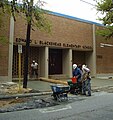 Blackshear Elementary School
 -
 Texas Southern University/Houston Independent School District Charter Laboratory School


Public libraries

The Third Ward is served by the Houston Public Library Smith Neighborhood Library at 3624 Scott Street.[72]
Health care
The Quentin Mease Community Hospital, operated by the Harris County Hospital District, is located in the Third Ward area.
The Martin Luther King Health Center first opened on April 28, 1972. Quentin Mease opened in 1983.[73] At one point, the MLK health center was located on the first and third floors of Quentin Mease.[74] MLK's standalone facility on Cullen Boulevard was scheduled to open in 2009 and free space at Quentin Mease.[75] On May 14, 2010, MLK relocated to a site in southern Houston, on Swingle Road.[73][76]
The southeast branch of the American Red Cross serves the Third Ward.[77]
Culture
This section needs expansion. You can help by adding to it. (February 2012) |
The Trinity United Methodist Church, which began in 1848, is the oldest African-American church congregation in the City of Houston. Trinity does not occupy the oldest church building.[40]
Project Row Houses is a group of shotgun houses restored in the 1990s. Some houses are art studios for art related to African-American themes. A row behind the art studio houses houses single mothers.[40]
Parks and recreation

Emancipation Park and Emancipation Community Center are located at 3018 Dowling.[78] Around 1870 the original owners of Emancipation Park purchased it to commemorate the end of slavery in the United States.[23] The community center includes an indoor gymnasium, a weight room, and meeting rooms. The park has an outdoor basketball pavilion, lighted sports fields, lighted tennis courts, a swimming pool, a playground, and picnic areas.[79]
Moses Leroy Park is located at 3100 Trulley Street.[80] Our Park is located at 2604 Alabama Street. Zurrie M. Malone Park is located at 2901 Nettleton Street, near Anita Street.Riverside Park is located at 2600 Calumet .[81]
The Third Ward is included in the service area of the Sam Houston Area Council Boy Scouts W.L. Davis District.[82]
Notable residents
Famous people who have lived in Third Ward include:
- Debbie Allen[citation needed]
- Arnett Cobb[2]
- Albert Collins[2]
- Johnny Copeland[2]
- Garnet Coleman (State representative)[18]
- Sam Lightnin' Hopkins[2][83]
- rapper Scarface[citation needed]
- Dexter Manley, Big Moe[citation needed]
- Anthony Obi (Fat Tony)[84]
- Pat Parker[85]
- Phylicia Rashad (Formerly Phylicia Ayers-Allen)[citation needed]
- Beyonce Knowles[citation needed]
- Sheila Jackson Lee[citation needed]
- Guy Lewis
- Allison Roche
- Jay Electronica
See also
References
- ^ Lomax, John Nova. "On Da Lingo, Part II." Houston Press. November 17, 2005. 1. Retrieved on February 24, 2010.
- ^ a b c d e Wood, Roger. Down in Houston: Bayou City Blues. 2003, University of Texas Press. 1st Edition. 71.
- ^ a b c d e f Wood, Roger. Down in Houston: Bayou City Blues. 2003, University of Texas Press. 1st Edition. 72.
- ^ Bivins, Ralph. "ON DECK/The stadium vote/Stadium gives hope to downtown landowners." Houston Chronicle. Sunday September 29, 1996. A1. Retrieved on August 12, 2010.
- ^ a b c Wood, Roger. Down in Houston: Bayou City Blues. 2003, University of Texas Press. 1st Edition. 73.
- ^ a b c Duggins, Kamilah. "Third-Ward Rebound." Houston Press. November 16, 2000. 1. Retrieved on April 13, 2009.
- ^ "Study Area 11." City of Houston. Accessed October 21, 2008.
- ^ "Parting shots Political activists recall the shooting death of a Black Panther leader by Houston police and the turmoil preceding it. " Fort Worth Star-Telegram. December 26, 1999. 4 METRO. Retrieved on April 4, 2009.
- ^ Rodriguez, Lori. "Census tracks rapid growth of suburbia." Houston Chronicle. Sunday March 10, 1991. Section A, Page 1.
- ^ a b Cobb, Kim. "Move afoot to train Houstonians to erase `ward' from vocabularies." Houston Chronicle. Saturday June 6, 1987. Section 1, Page 27. Retrieved on October 20, 2011.
- ^ a b "Looking back wards." City Savvy Online (City of Houston). (northern hemisphere) Winter 2008. Retrieved on October 20, 2011.
- ^ Duggins, Kamilah. "Third-Ward Rebound." Houston Press. November 16, 2000. 2. Retrieved on April 13, 2009.
- ^ Rodriguez, Lori. "SHIFTING DEMOGRAPHICS / Latinos bringing change to black neighborhoods / Newcomers are finding acceptance comes gradually." Houston Chronicle. Monday May 2, 2005. A1. Retrieved on February 4, 2009.
- ^ "Third Ward wants to get in the games." Houston Business Journal. Friday March 29, 2002. 1. Retrieved on December 5, 2009.
- ^ Shipley, Amy. "D.C. Bid for Olympic Games Rejected; San Francisco, New York Are U.S. Finalists for 2012." The Washington Post. August 28, 2002. A01. Retrieved on December 5, 2009.
- ^ a b Buntin, John. "Land Rush." Governing. March 2006. Retrieved on July 3, 2011.
- ^ a b Oaklander, Mandy. "Our HAUS." Houston Press. Wednesday July 6, 2011. 3. Retrieved on July 10, 2011.
- ^ a b c Axtman, Kris. "After years in the suburbs, many blacks return to city life." The Christian Science Monitor. April 29, 2004. Retrieved on May 1, 2009.
- ^ a b c d e f Witcher, T. R. "Third Ward Rising." Houston Press. July 20, 1995. 1. Retrieved on April 13, 2009.
- ^ Inskeep, Steve. "Fighting Gentrification With Money In Houston." NPR. September 17, 2009. Retrieved on April 20, 2012.
- ^ a b Kever, Jeannie. "Pride lives on in city's six historical wards." Houston Chronicle. September 7, 2004. Retrieved on October 20, 2011.
- ^ Walsh, Robb. "Southern-Fried Asian to Go." Houston Press. Thursday August 5, 2004. 1. Retrieved on January 20, 2012.
- ^ a b c Turner, Allan. "UH exhibit focuses on Third Ward history, people." Houston Chronicle. March 23, 2011. Retrieved on March 24, 2011.
- ^ "Crime Statistics for South Central Patrol Division." City of Houston. Retrieved on April 4, 2009.
- ^ "VOLUNTEER INITIATIVES PROGRAM - Citizens Offering Police Support." City of Houston. Accessed October 28, 2008.
- ^ "Fire Stations." City of Houston. Retrieved December 4, 2008.
- ^ "Fire Station 25." City of Houston. Retrieved on May 8, 2010.
- ^ "Third Ward Multi-Service Center." City of Houston. Accessed October 27, 2008.
- ^ "Multi-Service Centers." City of Houston. Accessed October 27, 2008.
- ^ City of Houston, Council District Maps, District D." City of Houston. Retrieved on November 5, 2011.
- ^ "City of Houston Council District "D"." City of Houston. February 4, 2003. Retrieved on November 7, 2011.
- ^ "City of Houston Council District "I"." City of Houston. February 4, 2003. Retrieved on November 7, 2011.
- ^ "map3.gif." City of Houston. February 11, 1997. Retrieved on November 7, 2011.
- ^ Rodriguez, Lori. "Saying goodbye, with no regrets." Houston Chronicle. Saturday November 9, 1991. A31.
- ^ Bernstein, Alan and Jim Simmon. "Black vote went solidly for Turner/Whitmire failed to produce split." Houston Chronicle. Thursday November 7, 1991. A21.
- ^ "Cuney Homes." Houston Housing Authority. Retrieved on October 16, 2011. "3260 Truxillo Houston, Texas 77004"
- ^ Radcliffe, Jennifer. "Celebrating Black History Month Politician Norris Wright Cuney." Houston Chronicle. February 24, 2011. Retrieved on August 14, 2011.
- ^ "Area residents feted at conference." Houston Chronicle. Wednesday October 11, 2000. ThisWeek 8. Retrieved on October 26, 2011.
- ^ "Congressional District 18." National Atlas of the United States.
- ^ a b c Davis, Rod. "Houston's really good idea Bus tour celebrates communities that forged a city." San Antonio Express-News. Sunday August 3, 2003. Travel 1M. Retrieved on February 11, 2012.
- ^ a b "Third Ward Urban Redevelopment Plan." City of Houston. April 2005. Retrieved on April 4, 2009.
- ^ "Trustee Districts Map." Houston Independent School District. Retrieved on November 11, 2008.
- ^ "Third Ward Urban Redevelopment Plan." City of Houston. April 2005. Retrieved on April 13, 2009.
- ^ "Blackshear Elementary Attendance Zone." Houston Independent School District. Retrieved on April 4, 2009.
- ^ "Dodson Elementary Attendance Zone." Houston Independent School District. Retrieved on April 4, 2009.
- ^ "Welcome to EaDo." East Downtown Management District. Retrieved on January 21, 2009.
- ^ "Lockhart Elementary Attendance Zone." Houston Independent School District. Retrieved on April 4, 2009.
- ^ a b Wollam, Allison. "Riverside Terrace bucks housing slowdown." Houston Business Journal. August 15, 2008. Retrieved on April 18, 2009.
- ^ "Ryan Middle Attendance Zone." Houston Independent School District. Retrieved on April 4, 2009.
- ^ "Yates High School Attendance Zone." Houston Independent School District. Retrieved on April 4, 2009.
- ^ a b "TSU/HISD Lab School." Houston Independent School District. Retrieved on August 19, 2009.
- ^ Aguilar, Charlotte. "HISD chief to trustees: please kick in $1m from your districts to spruce up new all-girls school." West University Examiner. Tuesday July 19, 2011. Updated Wednesday July 20, 2011. Retrieved on July 31, 2011.
- ^ Falkenberg, Lisa. (commentary) "Let's thank DeBakey for school, too." Houston Chronicle. Tuesday July 15, 2008. Retrieved on November 20, 2011.
- ^ "Overview." KIPP Sunnyside High School. Retrieved on May 21, 2011. "KIPP Sunnyside High School (KSHS) is in its inaugural school year and serves college-bound 9th graders from Houston’s Third Ward, Hiram Clarke, and Sunnyside communities." and "Address: 11000 Scott St. Houston, TX 77047"
- ^ "Overview." KIPP Peace School. Retrieved on May 21, 2011. "5400 MLK Jr. Blvd. Houston, TX 77021"
- ^ a b c "History." J. Will Jones Elementary School. September 15, 2004. Retrieved on April 5, 2009.
- ^ a b c d e "School Histories: the Stories Behind the Names." Houston Independent School District. Retrieved on September 24, 2008.
- ^ a b c Radcliffe, Jennifer. "HISD has buyer for historic campus." Houston Chronicle. Wednesday March 22, 2006. Retrieved on October 21, 2011.
- ^ a b Pace, Gina. "Schools Welcome Katrina Students." CBS News. September 16, 2005. Retrieved on April 4, 2009.
- ^ Tortolani, Amy. "HISD meets with angry parents on elementary school consolidations." KHOU-TV. Tuesday March 1, 2005. Retrieved on April 4, 2009.
- ^ Spencer, Jason. "HISD gives charter school lease to serve Katrina kids.' Houston Chronicle. Saturday October 1, 2005. Retrieved on October 21, 2011.
- ^ "Land Use & Development Map." Midtown. Retrieved on April 4, 2009.
- ^ "J. Will Jones Elementary Attendance Boundary." Houston Independent School District. Retrieved on November 15, 2008.
- ^ "Board of Education Votes on School Consolidations." Houston Independent School District. October 9, 2008.
- ^ Mellon, Ericka. "Tears and fears at HISD board meeting -- UPDATED." Houston Chronicle. October 9, 2008.
- ^ Downing, Margaret. "Backlash Upon Backlash at HISD." Houston Press. December 2, 2008. 1.
- ^ "Turner Elementary Attendance Zone." Houston Independent School District. Retrieved on April 4, 2009.
- ^ "Board Approves School Closings and Consolidations." Houston Independent School District. November 14, 2008.
- ^ a b "About St. Mary's Montessori School." St. Mary of the Purification School. Retrieved on April 14, 2009.
- ^ "St. Peter the Apostle Middle School." Roman Catholic Archdiocese of Houston. Retrieved on April 14, 2009.
- ^ Home. Yellowstone Academy. Retrieved on August 19, 2009.
- ^ "Smith Neighborhood Library." Houston Public Library. Retrieved on April 4, 2009.
- ^ a b "A Proud History of Caring for More Than 45 Years." Harris County Hospital District. Retrieved on February 9, 2012.
- ^ "Martin Luther King Health Center." Harris County Hospital District. Accessed October 28, 2008.
- ^ "Quentin Mease Community Hospital." Harris County Hospital District. Accessed October 28, 2008.
- ^ "Martin Luther King Jr. Health Center." Harris County Hospital District. Retrieved on September 30, 2010.
- ^ Andress, Lauri. "Southeast Red Cross will sponsor Christmas parade." Houston Chronicle. Wednesday November 8, 2000. ThisWeek 1. Retrieved on October 27, 2011.
- ^ "communitylist1.gif." City of Houston. Retrieved on April 13, 2009.
- ^ "Emancipation Community Center." City of Houston. Retrieved on April 13, 2009.
- ^ "Our Parks G-N." City of Houston. Retrieved on April 13, 2009.
- ^ "Our Parks O-Z." City of Houston. Retrieved on April 13, 2009.
- ^ "Community Briefs." Houston Chronicle. Thursday August 16, 2001. ThisWeek 2. Retrieved on October 27, 2011.
- ^ Lomax, John Nova. "O'Brien's Song." Houston Press. December 8, 2009 1. Retrieved on December 13, 2009.
- ^ Rhodes, Dusti. "Apostle of Hustle." Houston Press. Thursday January 14, 2010. 1. Retrieved on July 4, 2010.
- ^ Grahn, Judy. Preface, Movement in Black, 1989, Crossing Press, ISBN 0895941139
External links
- Third Ward Community Cloth Cooperative
- Third Ward Rising - Houston Press
- 2005 Third Ward Urban Redevelopment Plan
- Third Ward at Texas Southern University
