Amstelveen: Difference between revisions
Rescuing 1 sources and tagging 0 as dead. #IABot (v1.5.2) (Josve05a) |
|||
| Line 195: | Line 195: | ||
*{{Commons category-inline|Amstelveen}} |
*{{Commons category-inline|Amstelveen}} |
||
*[http://www.amstelveen.nl Official website] {{nl icon}} |
*[http://www.amstelveen.nl Official website] {{nl icon}} |
||
*[http://www.stadshartamstelveen.nl/W/do/centre/home Shopping Stadshart Amstelveen] |
*[https://web.archive.org/web/20160201163632/http://www.stadshartamstelveen.nl/W/do/centre/home Shopping Stadshart Amstelveen] |
||
{{Geographic location |
{{Geographic location |
||
Revision as of 22:48, 13 September 2017
This article needs additional citations for verification. (December 2008) |
Amstelveen | |
|---|---|
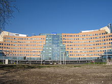
 Amstelveen city centre | |
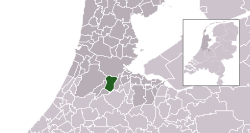
 Location in North Holland | |
| Coordinates: 52°18′N 4°51′E / 52.300°N 4.850°E | |
| Country | Netherlands |
| Province | North Holland |
| Government | |
| • Body | Municipal council |
| • Mayor | Mirjam van 't Veld (CDA) |
| Area | |
| • Total | 44.08 km2 (17.02 sq mi) |
| • Land | 41.13 km2 (15.88 sq mi) |
| • Water | 2.95 km2 (1.14 sq mi) |
| Elevation | −1 m (−3 ft) |
| Population (January 2021)[4] | |
| • Total | 90,829 |
| • Density | 2,208/km2 (5,720/sq mi) |
| Demonym | Amstelvener |
| Time zone | UTC+1 (CET) |
| • Summer (DST) | UTC+2 (CEST) |
| Postcode | 1180–1189 |
| Area code | 020 |
| Website | www |
 Amstelveen () is a municipality in the Netherlands, in the province of North Holland. It is a suburban part of the metropolitan area of Amsterdam. The municipality of Amstelveen consists of the following villages and/or districts: Amstelveen, Bovenkerk, Westwijk, Bankras-Kostverloren, Groenelaan, Waardhuizen, Middenhoven, Randwijk, Elsrijk, Keizer Karelpark, Nes aan de Amstel, Ouderkerk aan de Amstel (partly). The name Amstelveen comes from Amstel, a local river, and veen, meaning fen, peat, or moor.
KLM has its headquarters in Amstelveen. In addition Amstelveen has the international headquarters of one of the Big Four auditors, KPMG.[citation needed]
History

During the French occupation between 1810 and 1814, it was the capital of a canton in the French department Zuyderzée, and until 1964 the municipality of Amstelveen was called Nieuwer-Amstel. It is technically a large dorp (village), because it was never walled. The symbol adopted for Amstelveen was not based on the Amsterdam symbol of three crosses, with one additional cross for distinction, but rather Amsterdam has one cross less to indicate Amstelveen's and Ouder-Amstel's seniority. The Thijssepark (in full the Dr Jac. P. Thijssepark), was the first heempark in the Netherlands and is one of sixteen heemparks or heemgroen in Amstelveen. Designed by landscape architect C.P.Broerse; following the ideas of the great Dutch naturalist and conservationist Jac. P. Thijsse, it was developed between 1940 and 1972 and covers an area of 5 hectares, and is situated just south of the Amsterdamse Bos. Amstelveen was chosen as an unlikely host of a match in the 1999 Cricket World Cup, for which the Netherlands had not qualified. South Africa played Kenya in the match. Former Dutch prime minister Jan Peter Balkenende started his political career as member of the council for Amstelveen. As a result of the vicinity of Schiphol (Amsterdam Airport), and its links to Amsterdam, Amstelveen has grown and become a cosmopolitan mix of many cultures living in Amstelveen.
In the early 20th century Amstelveen was a small rural village. The turf industry had collapsed, so the revenues of it were gone. The village was somewhat isolated, because no major rail and waterway were connected. The main source of income was livestock farming with some arable, but the horticulture and floriculture were already emerging.
In 1852 the Haarlemmermeer polder was reclaimed and the "Fort at the Schiphol" was created as a defense for the capital Amsterdam. Forts were in those days more often named after rivers. "Fort at the Schiphol" was a separating ditch between Aalsmeer and Amstelveen, and named after a piece of land from Amstelveen. Fort Schiphol, became a military airport in 1916. Four years later Schiphol became a civilian airport. Schiphol Fort was demolished in 1934. The demolition was necessary for the construction of the provincial road (Mayor Of Sonweg) from Amstelveen to Schiphol, with a swing bridge over the circular canal of the Haarlemmermeer. The development of Schiphol attracted many people, many of whom settled in Amstelveen. The headquarters of KLM was established there. Amstelveen once was the fastest growing city in the Netherlands[citation needed] and has now grown to 81,003 inhabitants (2010).
After World War II Amstelveen caught a portion of Amsterdam's housing shortage, and was also a member of the municipality of Schiphol. Amsterdams Planning was to introduce Amstelveen as a metropolitan area, with its urban and green areas. Amstelveen remained an independent and self-conscious municipality and adopted a policy that reflected many attractive new residential areas. Amstelveens landscaping and added art attracted much international attention.
Amstelveen in 2003 was voted the most attractive city of the Netherlands to live in. Currently Amstelveen is in the top three on the national list of best cities to live in. With Amstelveen city center also receiving the number one award for best shopping center Netherlands in 2013, 2014 and 2015
Economy


KLM Netherlands has its headquarters in Amstelveen (52°18′22″N 4°50′35″E / 52.306117°N 4.842954°E).[5][6] Air France-KLM is represented by the KLM head office.[7]
In addition Amstelveen has the international headquarters of one of the Big Four auditors, KPMG.[citation needed]

Transport
Amstelveen has a metro and tram connection with Amsterdam. The Metro is a larger version of the tram in which some bicycles may be taken. It has a 'point to point' bus connection to other villages, Schiphol International Airport, Amsterdam as well as a local network. In the future there will be some changes in the metro. There will be added a new metroline what will connect Amstelveen with the North of Amsterdam. This line will be ready in 2020.
Tourism and attractions
- Shopping Amstelveen city center. Which has received the number one award for best shopping center Netherlands in 2013, 2014 and 2015
- Aan de Poel. A fine-dining restaurant that was awarded one Michelin star for the period 2009–2012. Since 2013 it carries two Michelin stars. Aan de Poel is located on the shore of lake De Poel.
- Cobra Museum is located in the centre (Stadshart) of Amstelveen.
- Museum Jan van der Togt, is centrehousing a glass art collection
- Birthplace of the artist Jan Cornelis Hofman.
- Birthplace of the actress Famke Janssen.
- Birthplace of the DJ and artist Martin Garrix
- A statue of Rembrandt overlooks the river Amstel, south east from the Amstelpark, where a windmill open to visitors is also situated
- An Electric Museum-tram line still connects Amstelveen to Amsterdam in the summer, passing by the Amsterdamse Bos and Olympic rowing lake
Secondary Education
- The Hermann Wesselink College offers vmbo-tl, havo, vwo (gymnasium and atheneum) and bilingual education
- The Keizer Karel College offers havo and vwo (atheneum, gymnasium and technasium).
- The Amstelveen College offers vmbo-tl, havo, and vwo (atheneum and gymnasium)
- The Panta Rhei offers vmbo, optionally with leerwegondersteunend onderwijs (literally, "learning path supporting education")
Other Education
- The International School Amsterdam is located in Amstelveen.
Local government
The municipal council of Amstelveen consists of 37 seats, which are divided as follows:
- VVD - 9 seats
- PvdA - 5 seats
- GroenLinks - 5 seats
- Burger Belangen - 4 seats
- CDA - 4 seats
- D66 - 6 seats
- Christen Unie - 1 seat
- OCA/VSP - 1 seat
- SP - 2 seats
Notable people
- Famke Janssen, actress
- Luca Gianquitto, guitarist and composer
- Martin Garrix, DJ and record producer
- Michiel Huisman, actor and musician
- Samantha Barning, badminton player
- Joost Taverne, politician
- Mitchell te Vrede, footballer
- Timme Hoyng, hockey player
- Robbert Schilder, footballer
- Nicole Muns-Jagerman, tennis player
- Arend Jan Boekestijn, politician
- Bert Goedkoop, volleyball player
- Marjolein Beumer, actress
- Hans van Manen, ballet dancer, choreographer and photographer
- Jolanda de Rover, backstroke swimmer
- Jules Maaten, politician
- Alexandra Verbeek, sailor
- Jan Cornelis Hofman, painter
- Theo Uittenbogaard, radio and TV producer
- Jordi van Gelderen, footballer
- Mesto, DJ and Future House Producer
- Mats Valk, speedcuber
- Carpainter, DJ and Electronic Producer
- Michael Reiziger, Footballer
International relations
Twin towns – Sister cities
Amstelveen is twinned with:
 Woking in United Kingdom[8]
 Villa El Salvador in Peru
 Tempelhof in Germany
 Óbuda-Békásmegyer in Hungary
See also
References
- ^ "Burgemeester mr. G.J. (Fred) de Graaf" (in Dutch). Gemeente Amstelveen. Retrieved 20 February 2014.
{{cite web}}: Unknown parameter|trans_title=ignored (|trans-title=suggested) (help) - ^ "Kerncijfers wijken en buurten 2020" [Key figures for neighbourhoods 2020]. StatLine (in Dutch). CBS. 24 July 2020. Retrieved 19 September 2020.
- ^ "Postcodetool for 1182JR". Actueel Hoogtebestand Nederland (in Dutch). Het Waterschapshuis. Archived from the original on 21 September 2013. Retrieved 20 February 2014.
{{cite web}}: Cite has empty unknown parameter:|trans_title=(help); Unknown parameter|deadurl=ignored (|url-status=suggested) (help) - ^ "Bevolkingsontwikkeling; regio per maand" [Population growth; regions per month]. CBS Statline (in Dutch). CBS. 1 January 2021. Retrieved 2 January 2022.
- ^ "Contact." KLM Corporate. Retrieved on 28 September 2009.
- ^ "Fact Sheet Archived 2009-02-26 at the Wayback Machine." SkyTeam. Retrieved on 27 December 2008.
- ^ "KLM office, Amsterdam[permanent dead link]." Air France-KLM. Retrieved on 18 June 2010.
- ^ "Woking Town twinning". The Woking Town Twinning Association. Retrieved 2013-07-19.
External links
 Media related to Amstelveen at Wikimedia Commons
- Official website Template:Nl icon
- Shopping Stadshart Amstelveen


