City of Hume
This article needs additional citations for verification. (August 2010) |
| City of Hume Victoria | |||||||||||||||
|---|---|---|---|---|---|---|---|---|---|---|---|---|---|---|---|
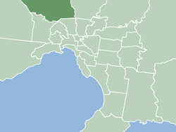
 Location within Melbourne metropolitan area | |||||||||||||||
| Population | 147,781 (2006) [1] | ||||||||||||||
| • Density | Lua error: Unable to convert population "147781 (2006) '"`UNIQ--ref-00000002-QINU`"'" to a number. | ||||||||||||||
| Area | 503 km2 (194.2 sq mi) | ||||||||||||||
| Mayor | Helen Patsikatheodorou | ||||||||||||||
| Region | Metropolitan Melbourne | ||||||||||||||
| State electorate(s) | Broadmeadows, Macedon, Yuroke | ||||||||||||||
| Federal division(s) | Calwell | ||||||||||||||
 | |||||||||||||||
| Website | [[1] City of Hume] | ||||||||||||||
| |||||||||||||||
The City of Hume is a Local Government Area located partially within the metropolitan area of Melbourne, Victoria, Australia. It includes outer north-western suburbs and a number of rural localities between 13 and 40 kilometres from the Melbourne city centre.
It has an area of 503 square kilometres, and at the 2006 Census it had a population of 147,781. It was formed on 15 December 1994 from the merger of the Shire of Bulla, City of Broadmeadows, and parts of the City of Whittlesea and City of Keilor.
The City is unique in Australia in that it was the first local government to introduce a Bill of Rights for its citizens in 2004, following the establishment of a Social Justice Charter in 2001. This Bill of Rights pre-dates the State Government's Charter of Rights and Responsibilities by three years, and is more sweeping in that it explicitly includes economic, social, and cultural rights[citation needed].
Localities
Suburbs
- Attwood
- Broadmeadows
- Campbellfield
- Coolaroo
- Craigieburn
- Dallas
- Gladstone Park
- Greenvale
- Jacana
- Keilor (shared with City of Brimbank)
- Meadow Heights
- Melbourne Airport
- Roxburgh Park
- Somerton
- Sunbury
- Tullamarine (shared with City of Brimbank)
- Westmeadows
Townships and rural localities
- Bulla
- Clarkefield (shared with Shire of Macedon Ranges)
- Diggers Rest (shared with Shire of Melton)
- Kalkallo
- Mickleham
- Oaklands Junction
- Wildwood
- Yuroke
Councillors
- Cr Jack Ogilvie, Mayor - Jacksons Creek Ward
- Cr Ros Spence, Deputy Mayor - Aitken Ward
- Cr Adem Atmaca - Aitken Ward
- Cr Drew Jessop - Aitken Ward
- Cr Helen Patsikatheodorou - Airport Ward
- Cr Geoff Porter - Airport Ward
- Cr Ann Potter - Jacksons Creek Ward
- Cr Vic Dougall - Merri Ward
- Cr Burhan Yigit - Merri Ward
See also
References
- ^ Australian Bureau of Statistics (25 October 2007). "Hume (Local Government Area)". 2006 Census QuickStats. Retrieved 2007-09-26.
