
North America


North America is a continent in the Earth's northern hemisphere and almost fully in the western hemisphere, bordered on the north by the Arctic Ocean, on the east by the North Atlantic Ocean, on the southeast by the Caribbean Sea, and on the south and west by the North Pacific Ocean; South America lies to the southeast. It covers an area of about 24,480,000 square kilometers (9,450,000 sq mi), or about 4.8% of the planet's surface. As of July 2002, its population was estimated at more than 514,000,000. It is the third largest continent in area, after Asia and Africa, and is fourth in population after Asia, Africa, and Europe.
Etymology
A number of theories exist regarding the naming of North and South America. The most widely recognized is that they are named after Amerigo Vespucci, who was the first European to suggest that the Americas were not the East Indies, but a New World, previously undiscovered by Europeans. The second and less generally accepted is that the continents are named after an English merchant named Richard Amerike from Bristol, who is believed to have financed John Cabot's voyage of discovery from England to Newfoundland in 1497. A third theory that has been advanced is that America was named for a Spanish sailor bearing the ancient Visigothic name of 'Amairick'.
Geography and extent
North America occupies the northern portion of the landmass generally referred to as the New World, the Western hemisphere, the Americas, or simply America. North America's only land connection is to South America at the narrow Isthmus of Panama. (For geopolitical reasons, all of Panama – including the segment east of the Panama Canal in the isthmus – is often considered a part of North America alone.) According to some authorities, North America begins not at the Isthmus of Panama but at the Isthmus of Tehuantepec, with the intervening region called Central America (or Middle America if the Caribbean is included) and resting on the Caribbean Plate. Before the Central American isthmus was raised, the region had been underwater. The islands of the West Indies delineate a submerged former land bridge, which had connected North America and South America via Florida.
The continental coastline is long and irregular. With the exception of the Gulf of Mexico, Hudson Bay is by far the largest body of water indenting the continent; others include the Gulf of Saint Lawrence and the Gulf of California (Sea of Cortez).
There are numerous islands off the continent’s coasts: principally, the Arctic Archipelago, the Greater and Lesser Antilles, the Alexander Archipelago, and the Aleutian Islands. Greenland, a Danish self-governing island and the world's largest, is part of North America geographically and on the same tectonic plate (the North American Plate) but is not considered to be part of the continent politically. Bermuda is not part of the Americas, but is an oceanic island formed on the fissure of the Mid-Atlantic Ridge. The nearest landmass to it is Cape Hatteras, North Carolina, and it is often thought of as part of North America, especially given its historical political and cultural ties to Virginia and other parts of the continent.
Physical geography

The vast majority of North America is on the North American Plate. Parts of California and western Mexico form the partial edge of the Pacific Plate, with the two plates meeting along the San Andreas fault.
The continent can be divided into four great regions (each of which contains many sub-regions): the Great Plains stretching from the Gulf of Mexico to the Canadian Arctic; the geologically young, mountainous west, including the Rocky Mountains, the Great Basin, California and Alaska; the raised but relatively flat plateau of the Canadian Shield in the northeast; and the varied eastern region, which includes the Appalachian Mountains, the coastal plain along the Atlantic seaboard, and the Florida peninsula. Mexico, with its long plateaus and cordilleras, falls largely in the western region, although the eastern coastal plain does extend south along the Gulf.
The western mountains are split in the middle, into the main range of the Rockies and the coast ranges in California, Oregon, Washington, and British Columbia with the Great Basin – a lower area containing smaller ranges and low-lying deserts – in between. The highest peak is Denali in Alaska.
The United States Geographical Survey states that the geographic center of North America is “6 miles west of Balta, Pierce County, North Dakota” at approximately 48⁰ 10′ North, 100⁰ 10′ West, approximately 15 miles (25 km) from Rugby, North Dakota. The USGS further states that “No marked or monumented point has been established by any government agency as the geographic center of either the 50 States, the conterminous United States, or the North American continent.” Nonetheless, there is a 4.5 metre (15 foot) field stone obelisk in Rugby claiming to mark the center.
-
 North America bedrock and terrain.
 -
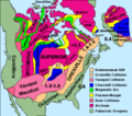 North American cratons and basement rocks.
 -
Tectonic elements of North America
-
 North American craton.


Human geography
Geopolitically, Northern America is sometimes used to refer to Canada, Mexico, and the United States together (plus Greenland, Bermuda, and St. Pierre and Miquelon), while Central America is mainland North America south of Mexico. The term Middle America is sometimes used to refer to Central America, and the Caribbean collectively.
From a linguistic and sociopolitical perspective, the United States, Canada, and the other English-speaking nations of North and South America (Belize, Guyana, and the anglophone Caribbean) are sometimes grouped under the term Anglo-America and included in the Anglosphere. The remaining nations of North and South America (i.e., including much of the West Indies) where Romance languages prevail, namely Spanish and Portguese, are referred to as Latin America; this usage has entered into common parlance.
Usage of the term "North America" often depends on context and may mean different things to different people. The term is often taken to mean the United States and Canada only by many people of those two countries and the other countries of Central America. In this respect, the term includes other countries only if the context makes it clear that they are to be included. In addition, guides to wild flora and fauna published by the National Audubon Society for "North America" frequently include only species found in Canada and the United States. Similarly, Canadians and Americans may often speak of a collective North American culture to describe only the continent's Anglophone communities.
Territories and regions

| Name of region[1] and territory, with flag |
Area (km²) |
Population (1 July 2002 est.) |
Population density (per km²) |
Capital |
|---|---|---|---|---|
| Caribbean: | ||||
| 102 | 13,254 | 129.9 | The Valley | |
| 443 | 68,722 | 155.1 | St. John's | |
| 193 | 71,566 | 370.8 | Oranjestad | |
| 13,940 | 301,790 | 21.6 | Nassau | |
| 431 | 279,254 | 647.9 | Bridgetown | |
| 153 | 22,643 | 148.0 | Road Town | |
| 262 | 44,270 | 169.0 | George Town | |
| 110,860 | 11,346,670 | 102.4 | Havana | |
| 754 | 69,029 | 91.6 | Roseau | |
| 48,730 | 8,950,034 | 183.7 | Santo Domingo | |
| 344 | 89,502 | 260.2 | St. George's | |
| 1,780 | 448,713 | 252.1 | Basse-Terre | |
| 27,750 | 8,121,622 | 292.7 | Port-au-Prince | |
| 10,991 | 2,731,832 | 248.6 | Kingston | |
| 1,100 | 432,900 | 393.5 | Fort-de-France | |
| 102 | 9,341 | 91.6 | Plymouth; Brades[3] | |
| 5 | — | — | — | |
| 960 | 219,958 | 229.1 | Willemstad | |
| 9,104 | 3,916,632 | 430.2 | San Juan | |
| 261 | 38,958 | 149.3 | Basseterre | |
| 616 | 166,312 | 270.0 | Castries | |
| 389 | 117,534 | 302.1 | Kingstown | |
| 5,128 | 1,088,644 | 212.3 | Port of Spain | |
| 430 | 20,556 | 47.8 | Cockburn Town | |
| 352 | 108,708 | 308.8 | Charlotte Amalie | |
| Central America: | ||||
| 22,966 | 279,457 | 12.2 | Belmopan | |
| 51,100 | 4,016,173 | 78.6 | San José | |
| 21,040 | 6,704,932 | 318.7 | San Salvador | |
| 108,890 | 14,655,189 | 134.6 | Guatemala City | |
| 112,090 | 6,975,204 | 62.2 | Tegucigalpa | |
| 1,972,550 | 106,202,903 | 53.8 | Mexico City | |
| 129,494 | 5,465,100 | 42.2 | Managua | |
| 52,853 | 2,498,717 | 47.3 | Panama City | |
| Northern America: | ||||
| 53 | 65,365 | 1,233.3 | Hamilton | |
| 9,984,670 | 32,805,041 | 3.3 | Ottawa | |
| 2,166,086 | 56,375 | 0.026 | Nuuk | |
| 242 | 7,012 | 29.0 | Saint-Pierre | |
| 9,629,091 | 295,734,134 | 30.7 | Washington | |
| Total | 24,481,177 | 514,144,046 | 21.0 | |
Notes:
- ^ Continental regions as per UN categorisations/map.
- ^ a b c Depending on definitions, Aruba, Netherlands Antilles, Panama, and Trinidad and Tobago have territory in one or both of North and South America.
- ^ Due to ongoing activity of the Soufriere Hills volcano beginning 1995, much of Plymouth, Montserrat's de jure capital, was destroyed and government offices relocated to Brades.
- ^ Panama is generally considered a transcontinental country in Central America (UN region) and South America; population and area figures are for North American portion only, west of the Panama Canal.
- ^ Includes the US state of Hawaii, which is distant from the North American landmass in the Pacific Ocean and is, thus, commonly included with the other territories of Oceania.
Sources
- "North America". The Columbia Gazetteer of the World Online. 2005. New York: Columbia University Press.
- "North America". Encyclopædia Britannica. 2006. Chicago: Encyclopædia Britannica, Inc.
- UN Statistics Division: Composition of macro geographical (continental) regions, geographical sub-regions, and selected economic and other groupings
See also
- Americas (terminology)
- Discoverer of the Americas
- Economy of North America
- European colonization of the Americas
- History of North America
- Birds of North America
External links
- http://www.america-norte.com/america-norte-mapa.htm
- http://www.earth-puzzle.com clickable map with links to related Wikipedia articles