
East Point City
 | |
 | |
| Location | Tseung Kwan O, Sai Kung District, New Territories, Hong Kong, China |
|---|---|
| Coordinates | 22°18′59″N 114°15′55″E / 22.31636°N 114.26516°E |
| Opening date | 1997 |
| Developer | Sun Hung Kai Properties |
| Management | Kai Shing Management[1] |
| Owner | Sun Hung Kai Properties |
| No. of stores and services | 150 |
| Total retail floor area | 400,000 sq ft (37,000 m2) |
| No. of floors | www |
East Point City (Chinese: 東港城) is a private housing estate and shopping centre in Hang Hau, Tseung Kwan O, New Territories, Hong Kong, near the Hang Hau MTR station. Built on reclaimed land and developed by Sun Hung Kai Properties, the estate consists of seven high-rise buildings and a two-storey shopping centre.[2] A large-scale renovation of the shopping centre was completed in 2008.[3]
Gallery
-
 East Point City Atrium in 2018
 -
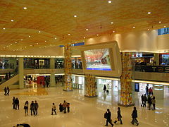 East Point City Atrium in 2008
 -
 JUSCO Department Store was located at East Point City, but closed in 2007
 -
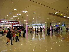 1st Floor of East Point City Shopping Centre after renovation in 2008


References
External links
Wikimedia Commons has media related to East Point City.