RAF Christchurch
 Christchurch Airfield - 4 March 1944. Christchurch was unusual as it was constructed on an existing airfield. However the airfield used before the war for club and commercial flying was too small to accommodate wartime aircraft so the airfield was expanded by building further runway areas to the south of the existing. | |||||||||||
| Summary | |||||||||||
| Airport type | Military | ||||||||||
| Owner | Air Ministry | ||||||||||
| Operator | Royal Air Force United States Army Air Forces | ||||||||||
| Location | Christchurch, Dorset, England | ||||||||||
| Built | 1940 | ||||||||||
| In use | 1940-1964 | ||||||||||
| Elevation AMSL | 26 ft / 8 m | ||||||||||
| Coordinates | 50°44′23″N 001°44′22″W / 50.73972°N 1.73944°W | ||||||||||
| Map | |||||||||||
 | |||||||||||
| Runways | |||||||||||
| |||||||||||


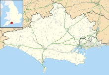
Royal Air Force Christchurch or more simply RAF Christchurch is a former Royal Air Force Advanced Landing Ground and was located southeast of the A337/B3059 junction in Somerford, Christchurch, Dorset, England.
Christchurch Airfield was a civil airfield that started operation from 1926 , enlarged for wartime operations in 1941, Christchurch was used during World War II by the Royal Air Force and the United States Army Air Forces Ninth Air Force. It returned to civilian flying postwar before being taken over by what became British Aerospace to manufacture jet fighters and civilian airliner types. The airfield complex was finally closed down and demolished in 1966 when housing was built on the site.
History
USAAF use
In 1943, the USAAF Ninth Air Force required several temporary advanced landing grounds along the southern English Channel coast prior to the Normandy invasion to provide tactical air support for the ground forces landing in France. Christchurch was provided to support this mission.
Christchurch was known as USAAF Station AAF-416 for security reasons by the USAAF during the war, and by which it was referred to instead of location. It's USAAF Station Code was "CH".
405th Fighter Group
Christchurch airfield saw the arrival of the USAAF 405th Fighter Group on 4 April 1944, the group arriving from Walterboro Army Airfield South Carolina. The 405th had the following operational squadrons:
- 509th Fighter Squadron (G9)
- 510th Fighter Squadron (2Z)
- 511th Fighter Squadron (K4)
The 405th was a group of Ninth Air Force's 84th Fighter Wing, IX Tactical Air Command. It flew the Republic P-47 Thunderbolt. The 405th moved to its Advanced Landing Ground at Picauville, France (ALG A-8) on 22 June 1944, ending the USAAF's use of Christchurch.
Current use
The airfield complex was demolished in 1966 and there is housing and The Runway Industrial Park located on the site.
See also
References
![]() This article incorporates public domain material from the Air Force Historical Research Agency
This article incorporates public domain material from the Air Force Historical Research Agency
Citations
Bibliography
- Freeman, Roger A. (1994) UK Airfields of the Ninth: Then and Now 1994. After the Battle ISBN 0-900913-80-0
- Freeman, Roger A. (1996) The Ninth Air Force in Colour: UK and the Continent-World War Two. After the Battle ISBN 1-85409-272-3
- Maurer, Maurer (1983). Air Force Combat Units Of World War II. Maxwell AFB, Alabama: Office of Air Force History. ISBN 0-89201-092-4.
Further reading
- White, Allen (1987) Christchurch Airfield - 40 Years Of Flying


