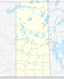
Key Lake Airport
Appearance
Key Lake Airport | |||||||||||
|---|---|---|---|---|---|---|---|---|---|---|---|
| Summary | |||||||||||
| Airport type | Public | ||||||||||
| Operator | Cameco Corp. | ||||||||||
| Location | Key Lake, Saskatchewan | ||||||||||
| Time zone | CST (UTC−06:00) | ||||||||||
| Elevation AMSL | 1,686 ft / 514 m | ||||||||||
| Coordinates | 57°15′23″N 105°37′03″W / 57.25639°N 105.61750°W | ||||||||||
| Map | |||||||||||
 | |||||||||||
| Runways | |||||||||||
| |||||||||||
Key Lake Airport, (IATA: YKJ, ICAO: CYKJ), is a regional airport near the Key Lake mine in Saskatchewan, Canada.
References
- ^ "Airline and Airport Code Search". IATA. Retrieved 28 April 2016.
- ^ Canada Flight Supplement. Effective 0901Z 16 July 2020 to 0901Z 10 September 2020.
- ^ Synoptic/Metstat Station Information Archived 2013-06-27 at the Wayback Machine
External links
- Past three hours METARs, SPECI and current TAFs for Key Lake Airport from Nav Canada as available.


