Jump to content

List of airports in Prince Edward Island

From Wikipedia, the free encyclopedia

This is an old revision of this page, as edited by CambridgeBayWeather (talk | contribs) at 00:55, 8 August 2020 (Updated). The present address (URL) is a permanent link to this revision, which may differ significantly from the current revision.

This is a list of airports in Prince Edward Island. It includes all Nav Canada certified and registered water and land airports, aerodromes and heliports in the Canadian province of Prince Edward Island.[1][2] Airports names in italics are part of the National Airports System.[3]

Prince Edward Island

List of airports and heliports

Charlottetown Airport
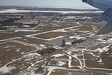
Summerside Airport

The list is sorted by the name of the community served, click the sort buttons in the table header to switch listing order.

Community   Airport name   ICAO   TC LID   IATA   Coordinates  
Cable Head Cable Head Airpark CCA3 46°26′36″N 062°35′29″W / 46.44333°N 62.59139°W / 46.44333; -62.59139 (Cable Head Airpark)
Charlottetown Charlottetown Airport CYYG YYG 46°17′21″N 063°06′55″W / 46.28917°N 63.11528°W / 46.28917; -63.11528 (Charlottetown Airport)
Charlottetown Charlottetown (Queen Elizabeth Hospital) Heliport CDV3 46°15′20″N 063°05′56″W / 46.25556°N 63.09889°W / 46.25556; -63.09889 (Charlottetown (Queen Elizabeth Hospital) Heliport)
Summerside Summerside Airport CYSU YSU 46°26′26″N 063°50′01″W / 46.44056°N 63.83361°W / 46.44056; -63.83361 (Summerside Airport)
Summerside Summerside (Prince County Hospital) Heliport CCH6 46°25′04″N 063°46′26″W / 46.41778°N 63.77389°W / 46.41778; -63.77389 (Summerside (Prince County Hospital) Heliport)

Defunct airports

Community   Airport name   ICAO   TC LID   IATA   Coordinates  
Grand River Grand River Airport CCA9 46°28′51″N 063°57′10″W / 46.48083°N 63.95278°W / 46.48083; -63.95278 (Grand River Airport)
Mount Pleasant RCAF Station Mount Pleasant 46°35′54″N 064°00′24″W / 46.59833°N 64.00667°W / 46.59833; -64.00667 (RCAF Station Mount Pleasant)
St. Eleanors CFB Summerside 46°26′35″N 063°49′49″W / 46.44306°N 63.83028°W / 46.44306; -63.83028 (CFB Summerside)
Sherwood RCAF Station Charlottetown 46°17′40″N 063°07′26″W / 46.29444°N 63.12389°W / 46.29444; -63.12389 (RCAF Station Charlottetown)

References

  1. ^ Canada Flight Supplement. Effective 0901Z 16 July 2020 to 0901Z 10 September 2020.
  2. ^ Nav Canada's Water Aerodrome Supplement. Effective 0901Z 26 March 2020 to 0901Z 22 April 2021.
  3. ^ National Airports System