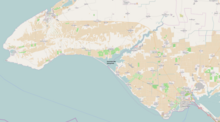
Donuzlav


Lake Donuzlav (Crimean Tatar: Doñuzlav/Донъузлав, Ukrainian: Донузлав, Russian: Донузлав) also referred to as Donuzlav Bay is the deepest lake of Crimea (27 m) and biggest in Chornomorske Raion (47 km²). In practice it is no longer a lake but rather a bay since 1961, when a sandy spit (200–400 m wide) separating it from the Black Sea was dug out with a 200-metre width channel. The lake is as salty as the sea near its mouth but bottom springs make the water much more sweet near the head.
Southern Naval Base (Ukraine) was located there.
Overview
Related to the Crimean crises 2014, on 5 March 2014, on the lake were sunk two vessels, the big anti-submarine ship of the project 1134B Ochakov (большой противолодочный корабль проекта 1134Б «Очаков») and rescue tugboat Shakhter (спасательное буксирное судно «Шахтер») belonging to the Russian Black Sea Fleet to prevent the access of the Ukrainian vessels to the Black Sea.[1][2][3][4]
Seven vessels of the Ukrainian fleet were blocked due to the sunk Russian vessels: Lutsk, Vinnystia, Chernihiv, Cherkasy, Henichesk, Kirovohrad and Kostiatyn Olshansky [5]
See also
References
![]() Media related to Donuzlav at Wikimedia Commons
Media related to Donuzlav at Wikimedia Commons
- ^ Defence Express 05.03.2014
- ^ "Large ASW Destroyer "Ochakov" - Project 1134B / Kara class". Flot.sevastopol.info. Retrieved 2014-04-23.
- ^ "Спасательное буксирное судно "Шахтер" Черноморского Флота". Flot.sevastopol.info. Retrieved 2014-04-23.
- ^ "В Крыму затоплен российский большой противолодочный корабль "Очаков" • Таймер". Timer.od.ua. Retrieved 2014-04-23.
- ^ "Военно-морская национализация". Hubs. 2013-07-18. Retrieved 2014-04-23.
45°20′N 33°00′E / 45.333°N 33.000°E
